Recent Damage
The storms your roofers are chasing right now.
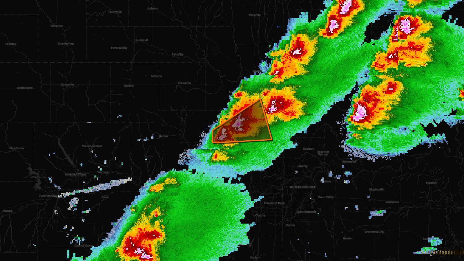
Every 10 minutes, we capture the peak moment of every active severe alert in the US — radar, polygon, Storm Score, and property count baked in. Here are the most damaging storms from the last 14 days.
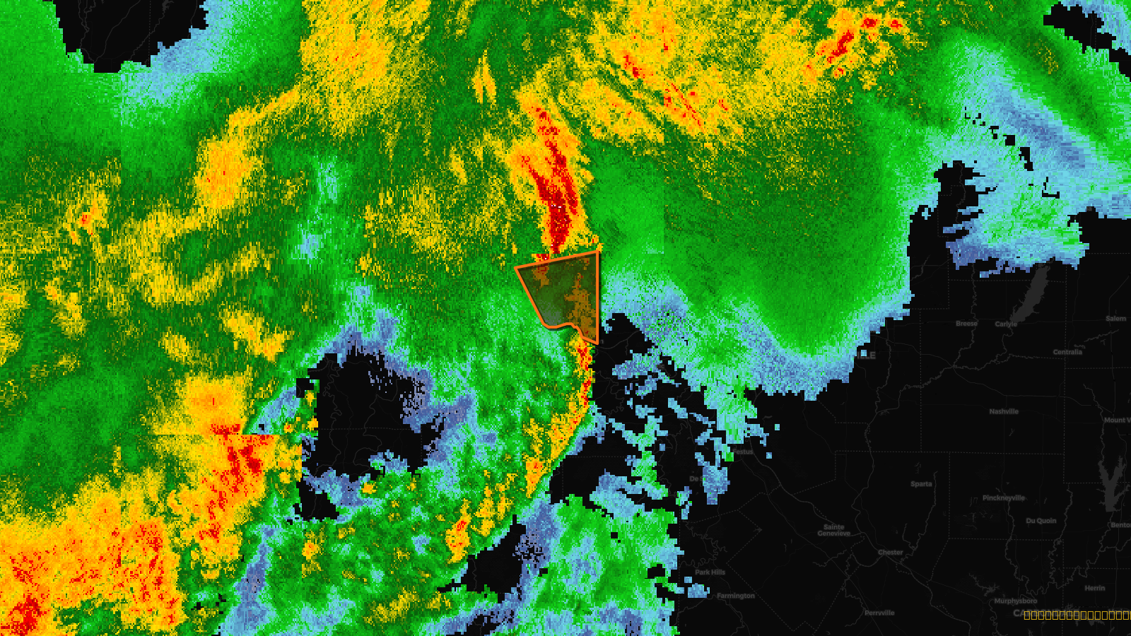
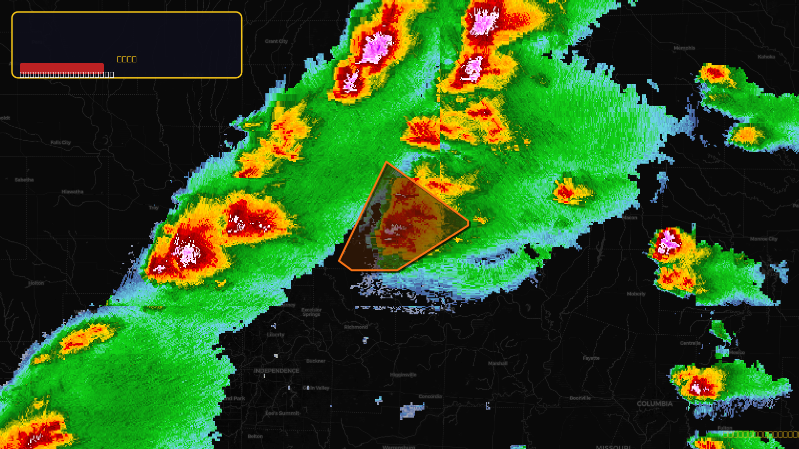
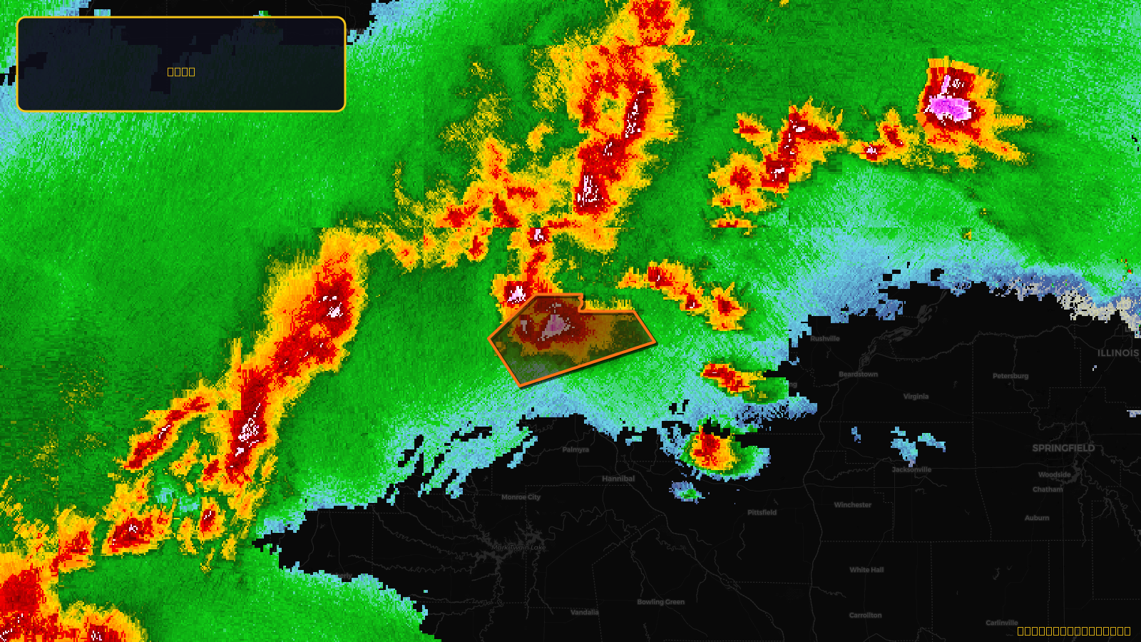
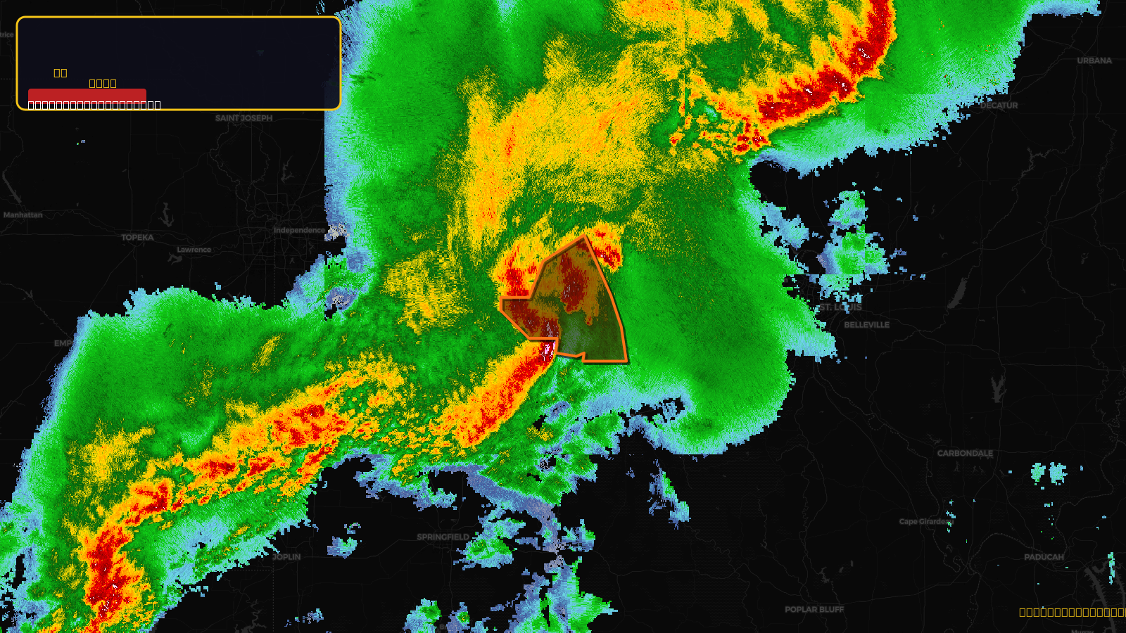
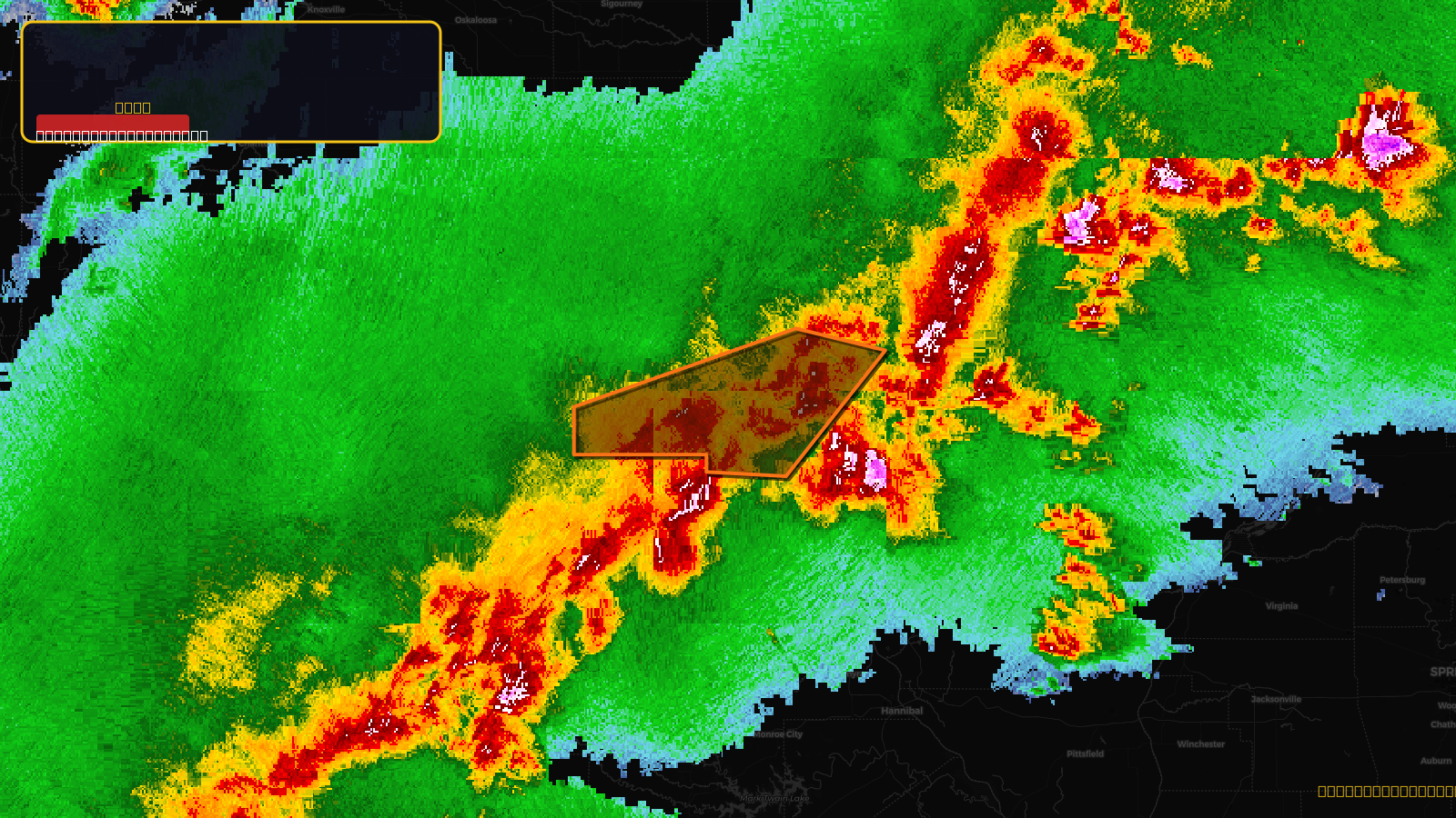
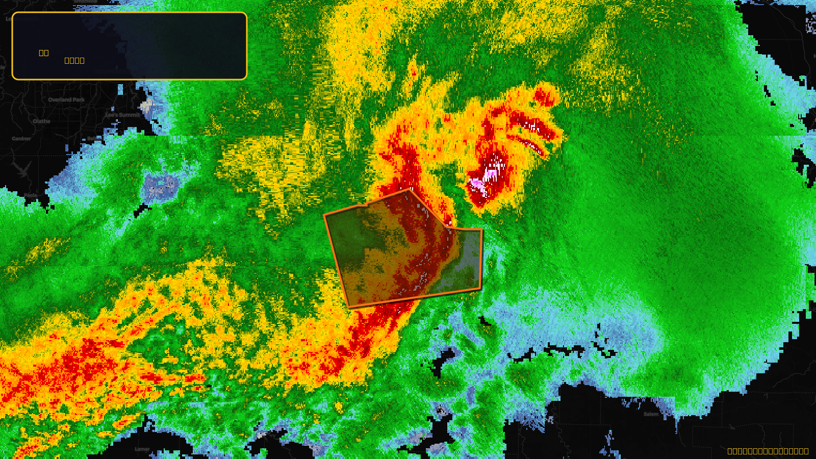
Very SevereTornado2d ago
Tornado Warning issued April 17 at 9:36PM CDT until April 17 at 10:15PM CDT by NWS St Louis MO
Missouri
Score
49
🏠 Res
4,897
🏢 Com
40
💰~$4.5M
✓ In storm zone
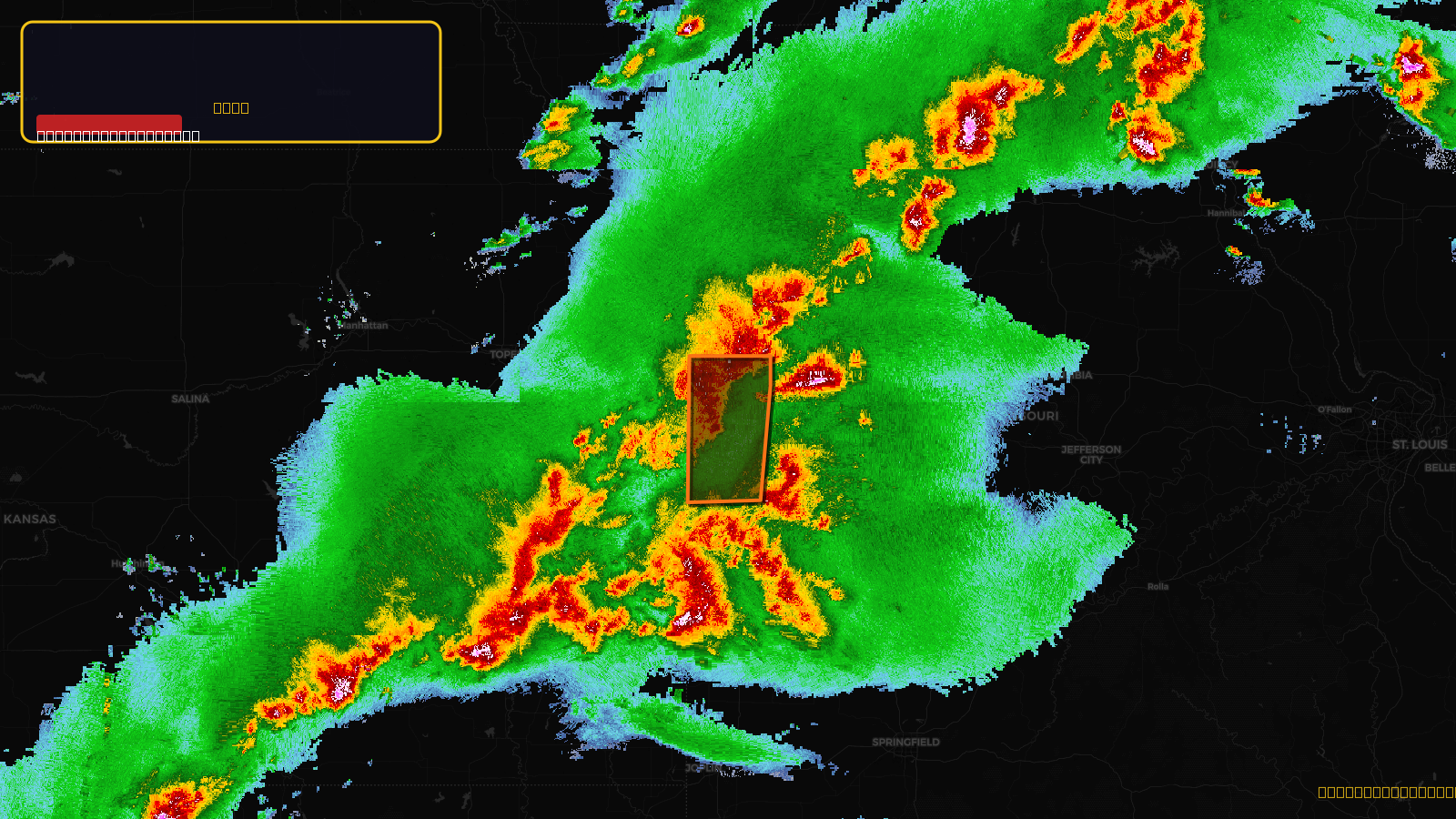
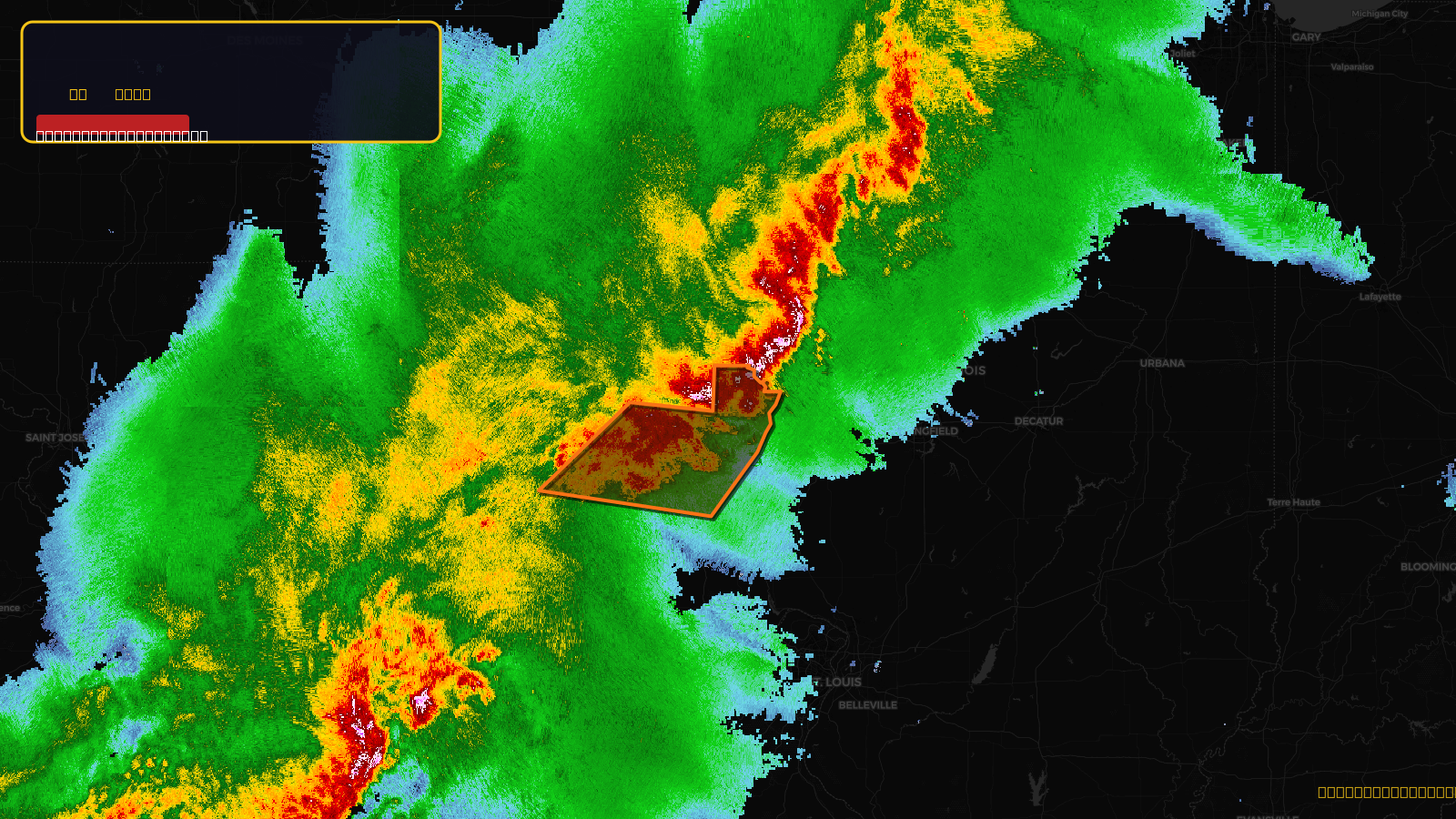
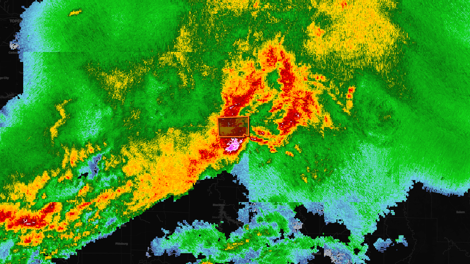
Very SevereThunderstorm2d ago
Severe Thunderstorm Warning issued April 17 at 4:58PM CDT until April 17 at 5:45PM CDT by NWS Kansas City/Pleasant Hill MO
Missouri
🧊1"Hail⚠ Destructive
Score
48
🏠 Res
7,961
🏢 Com
581
💰~$9.0M
✓ In storm zone

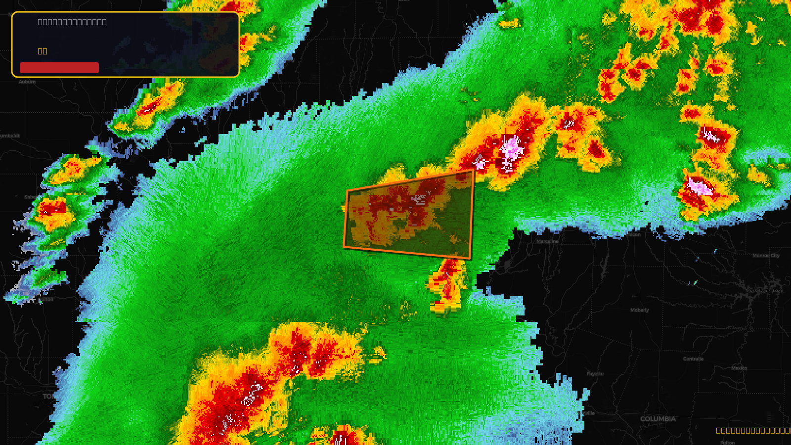
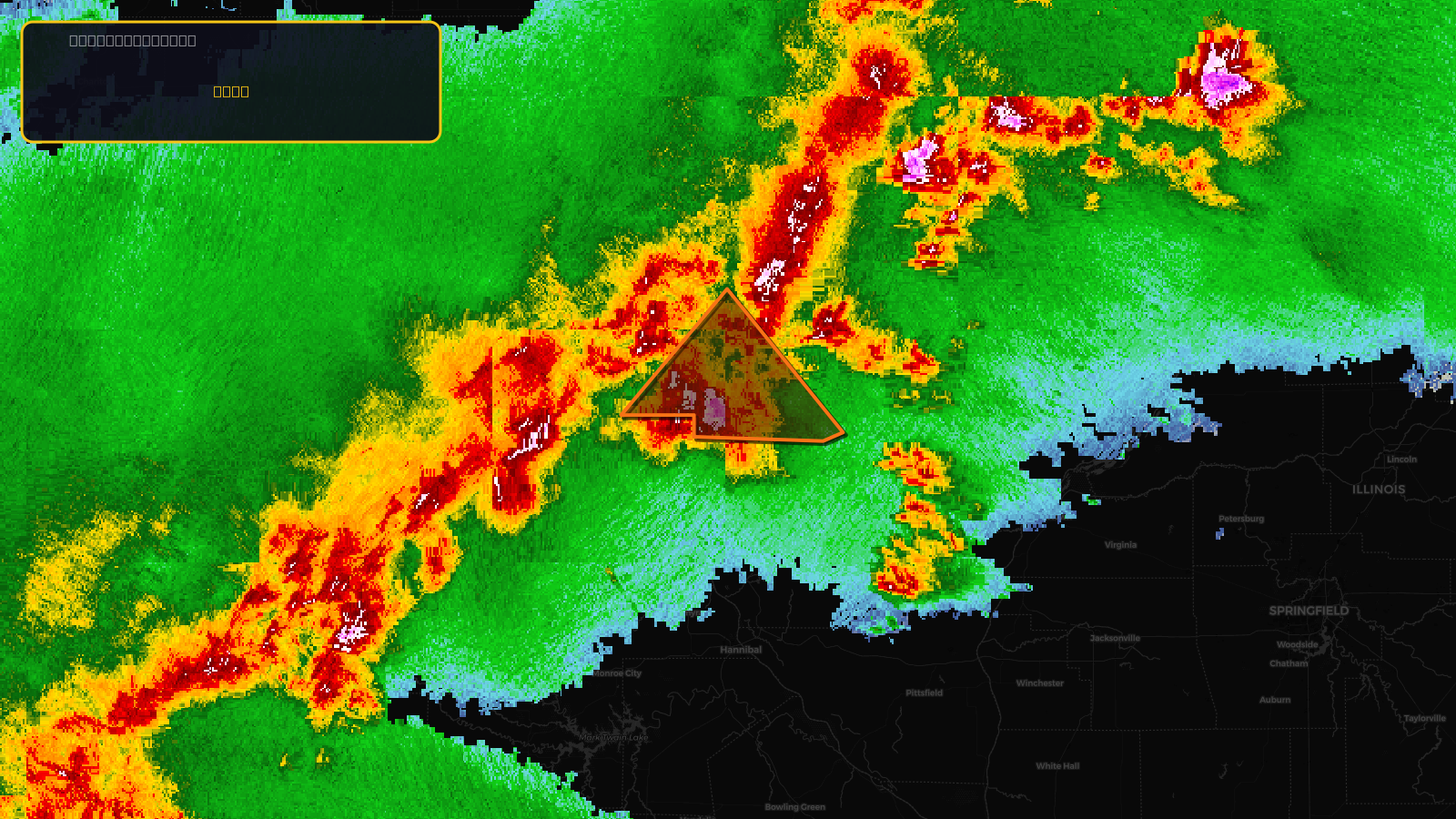
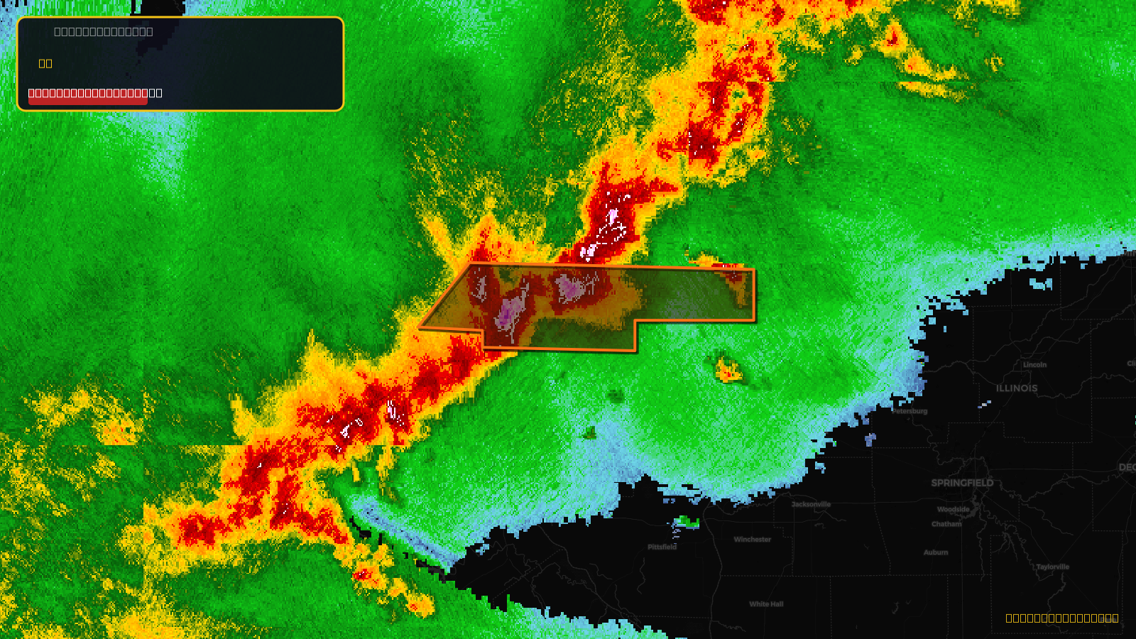
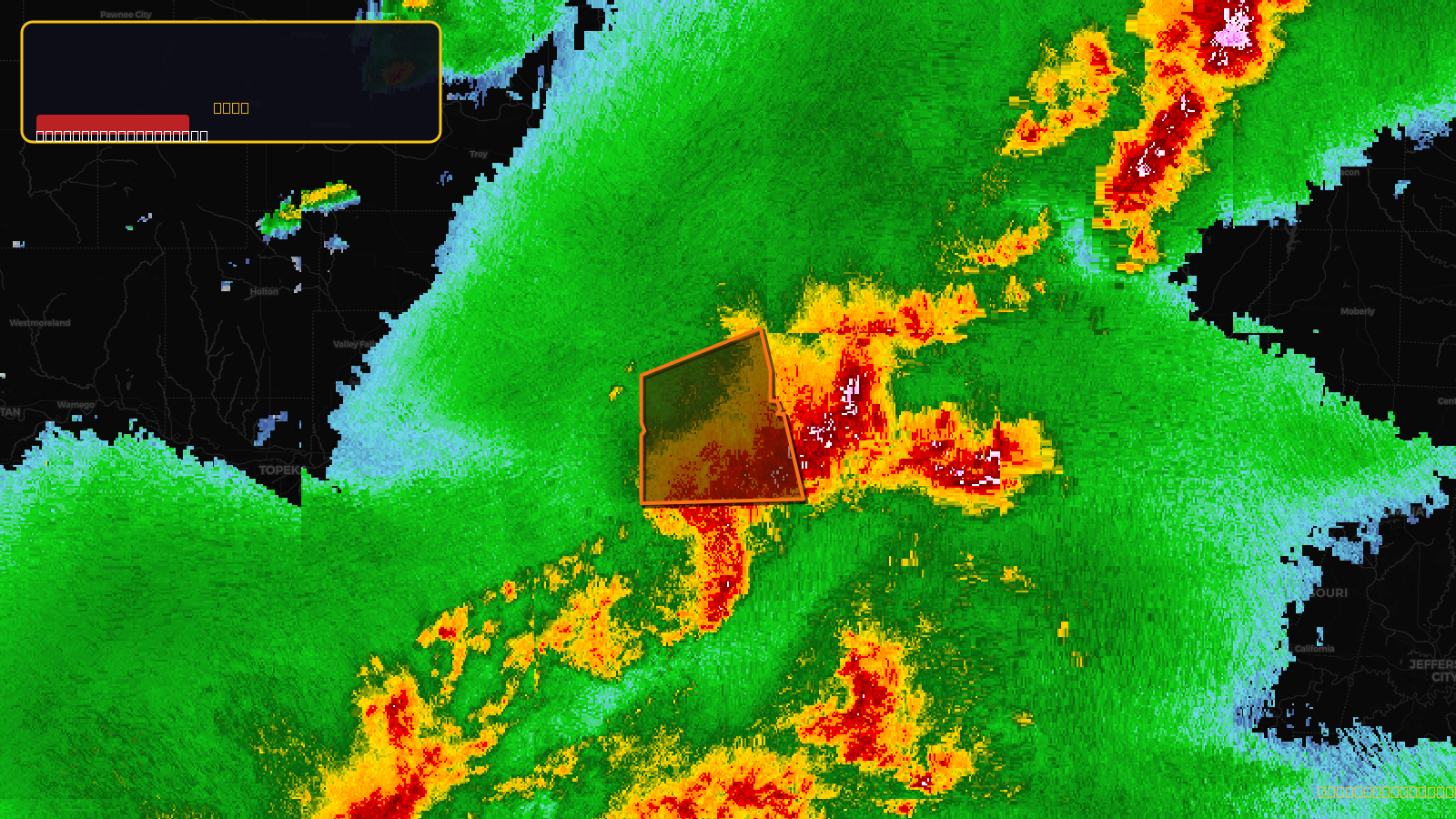
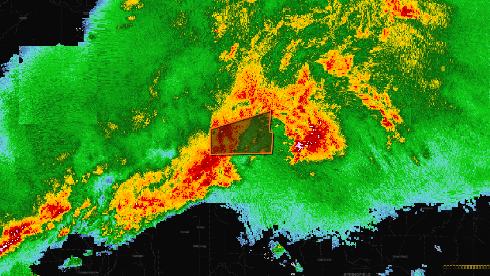
Very SevereThunderstorm2d ago
Severe Thunderstorm Warning issued April 17 at 3:07PM CDT until April 17 at 3:45PM CDT by NWS Kansas City/Pleasant Hill MO
Kansas, Missouri
🧊1.75"Hail⚠ Considerable
Score
52
🏠 Res
42,655
🏢 Com
2,676
💰~$47M
✓ In storm zone
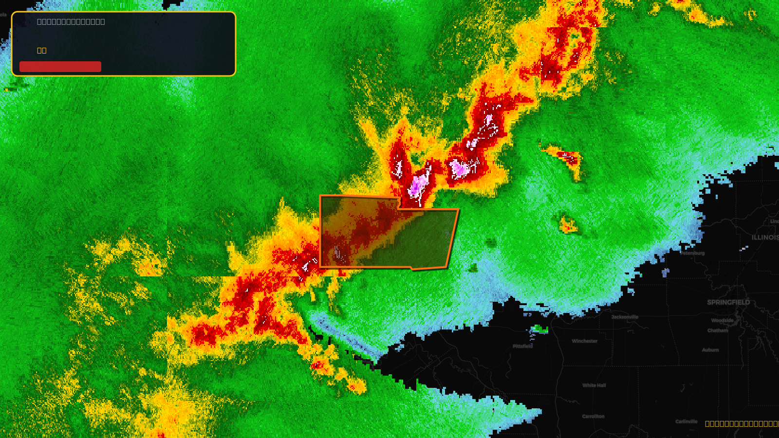
Very SevereThunderstorm2d ago
Severe Thunderstorm Warning issued April 17 at 3:11PM CDT until April 17 at 4:15PM CDT by NWS Kansas City/Pleasant Hill MO
Missouri
🧊1.75"Hail⚠ Considerable
Score
52
🏠 Res
9,820
🏢 Com
641
💰~$11M
✓ In storm zone
Very SevereThunderstorm2d ago
Severe Thunderstorm Warning issued April 17 at 3:56PM CDT until April 17 at 5:00PM CDT by NWS Kansas City/Pleasant Hill MO
Missouri
🧊1.75"Hail⚠ Considerable
Score
52
🏠 Res
7,972
🏢 Com
593
💰~$9.1M
✓ In storm zone
Very SevereThunderstorm2d ago
Severe Thunderstorm Warning issued April 17 at 3:09PM CDT until April 17 at 4:00PM CDT by NWS Kansas City/Pleasant Hill MO
Missouri
🧊1.75"Hail⚠ Considerable
Score
52
🏠 Res
5,496
🏢 Com
437
💰~$6.4M
✓ In storm zone
Very SevereThunderstorm2d ago
Severe Thunderstorm Warning issued April 17 at 3:33PM CDT until April 17 at 4:30PM CDT by NWS Kansas City/Pleasant Hill MO
Missouri
🧊1.75"Hail⚠ Considerable
Score
52
🏠 Res
2,780
🏢 Com
124
💰~$2.9M
✓ In storm zone
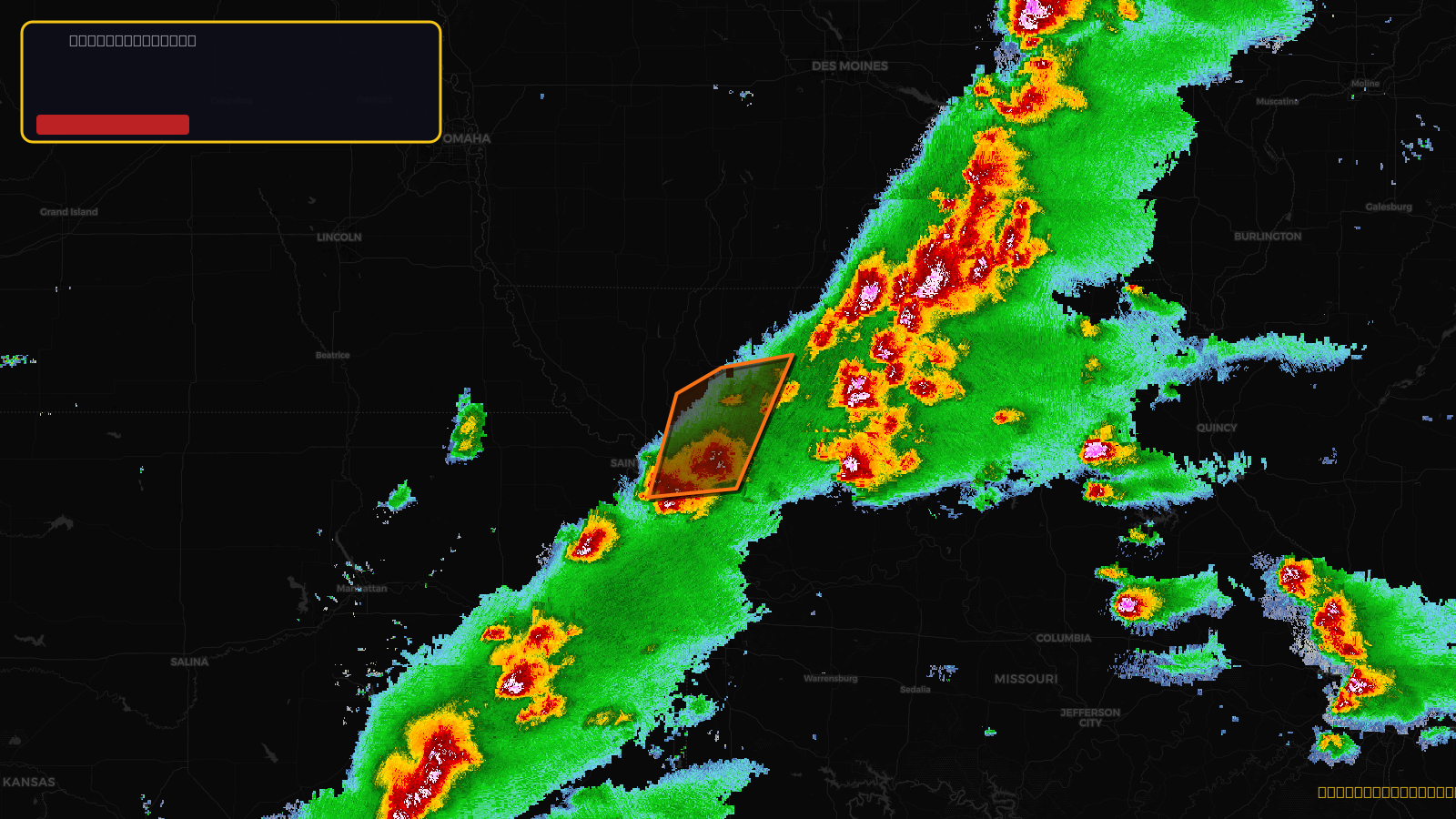
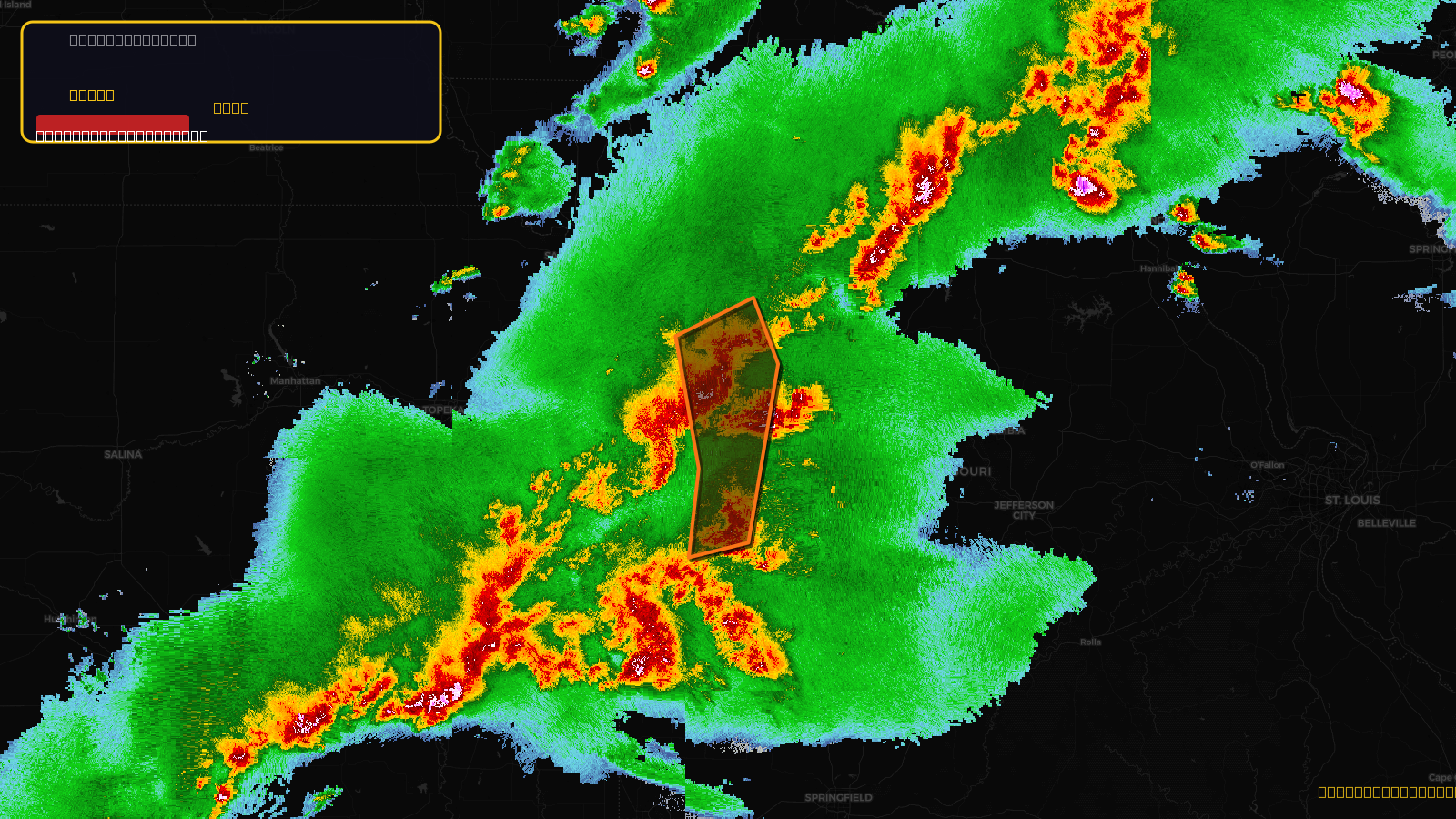
Very SevereThunderstorm2d ago
Severe Thunderstorm Warning issued April 17 at 5:02PM CDT until April 17 at 6:00PM CDT by NWS Kansas City/Pleasant Hill MO
Missouri
🧊0.88"Hail⚠ Destructive
Score
47
🏠 Res
184,941
🏢 Com
8,808
💰~$194M
✓ In storm zone
Very SevereThunderstorm2d ago
Severe Thunderstorm Warning issued April 17 at 4:35PM CDT until April 17 at 5:15PM CDT by NWS Kansas City/Pleasant Hill MO
Kansas, Missouri
🧊0.88"Hail⚠ Destructive
Score
47
🏠 Res
169,498
🏢 Com
6,640
💰~$173M
✓ In storm zone
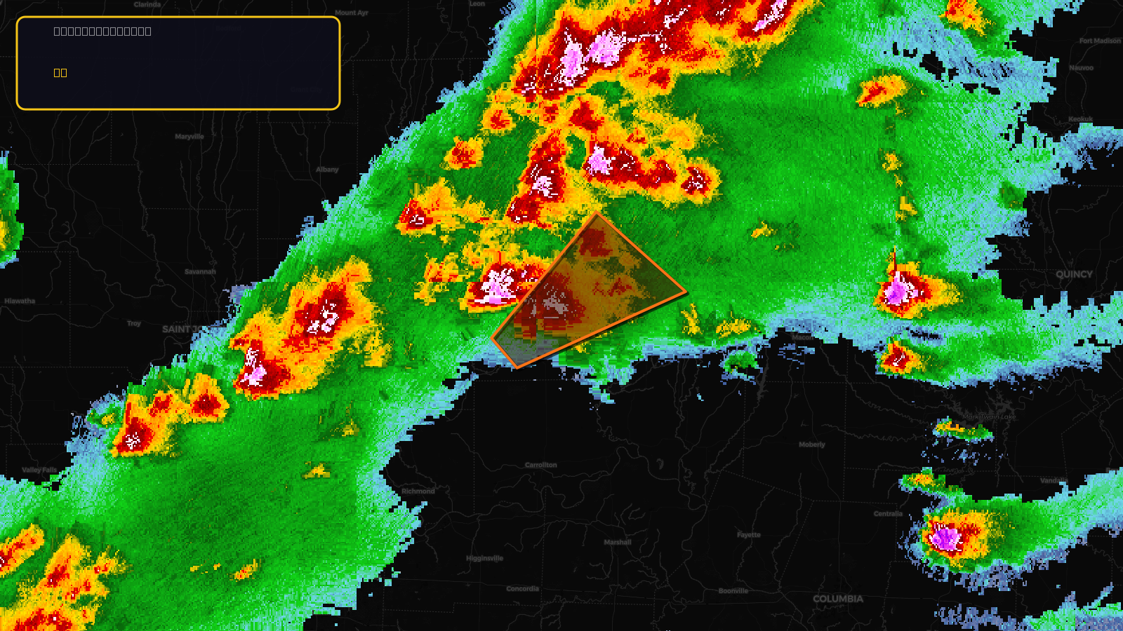
Very SevereTornado2d ago
Tornado Warning issued April 17 at 5:38PM CDT until April 17 at 6:30PM CDT by NWS St Louis MO
Illinois, Missouri
🧊1.75"Hail
Score
37
🏠 Res
1,950
🏢 Com
173
💰~$2.3M
✓ In storm zone
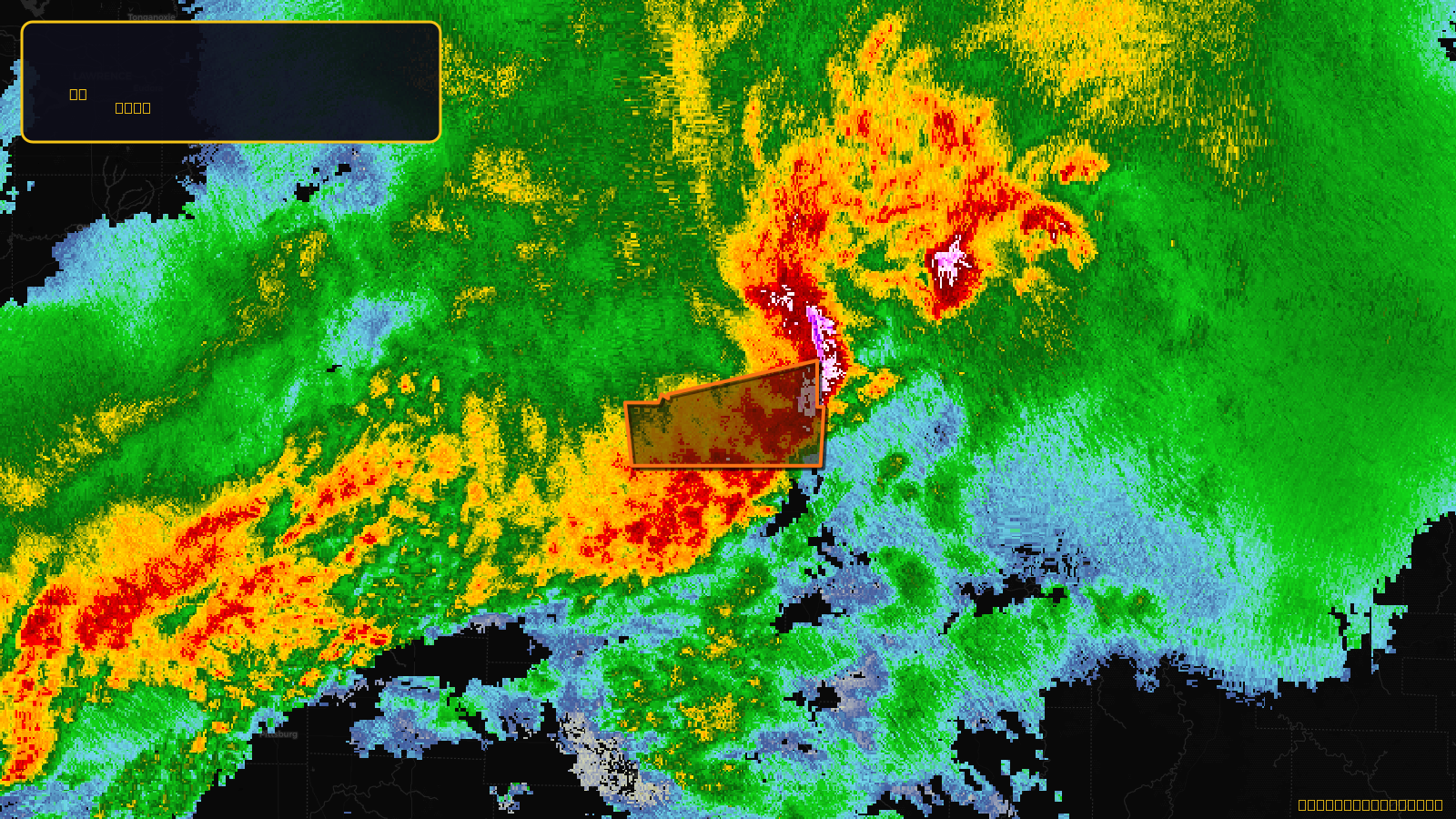
Very SevereTornado2d ago
Tornado Warning issued April 17 at 5:47PM CDT until April 17 at 6:30PM CDT by NWS Quad Cities IA IL
Illinois, Iowa, Missouri
🧊1.75"Hail
Score
36
🏠 Res
8,313
🏢 Com
897
💰~$10M
✓ In storm zone
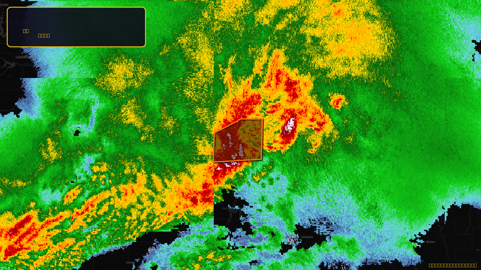
Very SevereTornado2d ago
Tornado Warning issued April 17 at 6:41PM CDT until April 17 at 7:30PM CDT by NWS Springfield MO
Missouri
🧊1.5"Hail
Score
32
🏠 Res
7,603
🏢 Com
274
💰~$7.7M
✓ In storm zone
Very SevereTornado2d ago
Tornado Warning issued April 17 at 6:19PM CDT until April 17 at 7:00PM CDT by NWS Springfield MO
Missouri
🧊1.5"Hail
Score
32
🏠 Res
2,450
🏢 Com
139
💰~$2.6M
✓ In storm zone
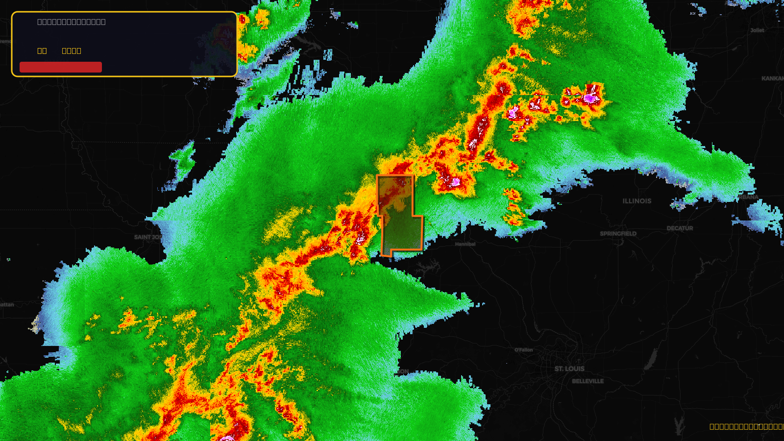
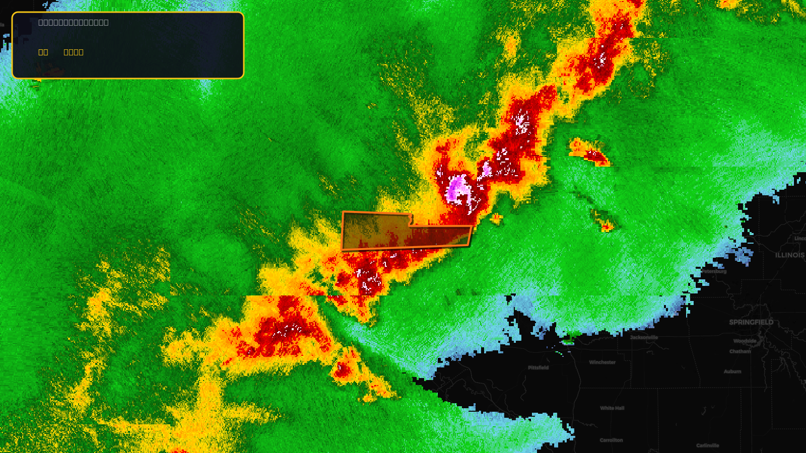
Very SevereThunderstorm2d ago
Severe Thunderstorm Warning issued April 17 at 7:57PM CDT until April 17 at 9:00PM CDT by NWS St Louis MO
Missouri
🧊1"Hail⚠ Considerable
Score
31
🏠 Res
73,288
🏢 Com
4,476
💰~$80M
✓ In storm zone
Very SevereThunderstorm2d ago
Severe Thunderstorm Warning issued April 17 at 7:21PM CDT until April 17 at 8:15PM CDT by NWS St Louis MO
Illinois, Missouri
🧊1"Hail⚠ Considerable
Score
31
🏠 Res
34,166
🏢 Com
2,783
💰~$40M
✓ In storm zone
Very SevereThunderstorm2d ago
Severe Thunderstorm Warning issued April 17 at 6:31PM CDT until April 17 at 7:30PM CDT by NWS Quad Cities IA IL
Illinois, Iowa, Missouri
🧊1"Hail⚠ Considerable
Score
31
🏠 Res
10,052
🏢 Com
1,119
💰~$13M
✓ In storm zone
Very SevereThunderstorm2d ago
Severe Thunderstorm Warning issued April 17 at 6:13PM CDT until April 17 at 7:00PM CDT by NWS St Louis MO
Illinois, Missouri
🧊1"Hail⚠ Considerable
Score
31
🏠 Res
2,936
🏢 Com
242
💰~$3.4M
✓ In storm zone
Very SevereThunderstorm2d ago
Severe Thunderstorm Warning issued April 17 at 5:55PM CDT until April 17 at 7:00PM CDT by NWS Quad Cities IA IL
Iowa, Missouri
🧊1"Hail⚠ Considerable
Score
31
🏠 Res
2,790
🏢 Com
59
💰~$2.7M
✓ In storm zone
Very SevereThunderstorm2d ago
Severe Thunderstorm Warning issued April 17 at 5:51PM CDT until April 17 at 6:45PM CDT by NWS St Louis MO
Missouri
🧊1"Hail⚠ Considerable
Score
31
🏠 Res
1,991
🏢 Com
75
💰~$2.0M
✓ In storm zone

Very SevereThunderstorm2d ago
Severe Thunderstorm Warning issued April 17 at 3:06PM CDT until April 17 at 3:45PM CDT by NWS St Louis MO
Missouri
🧊1.25"Hail✓ Obs
Score
25
🏠 Res
7,574
🏢 Com
179
💰~$7.3M
✓ In storm zone
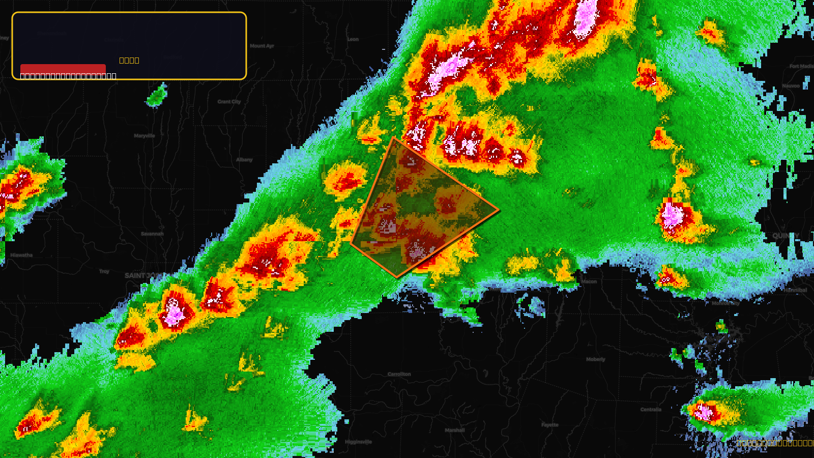
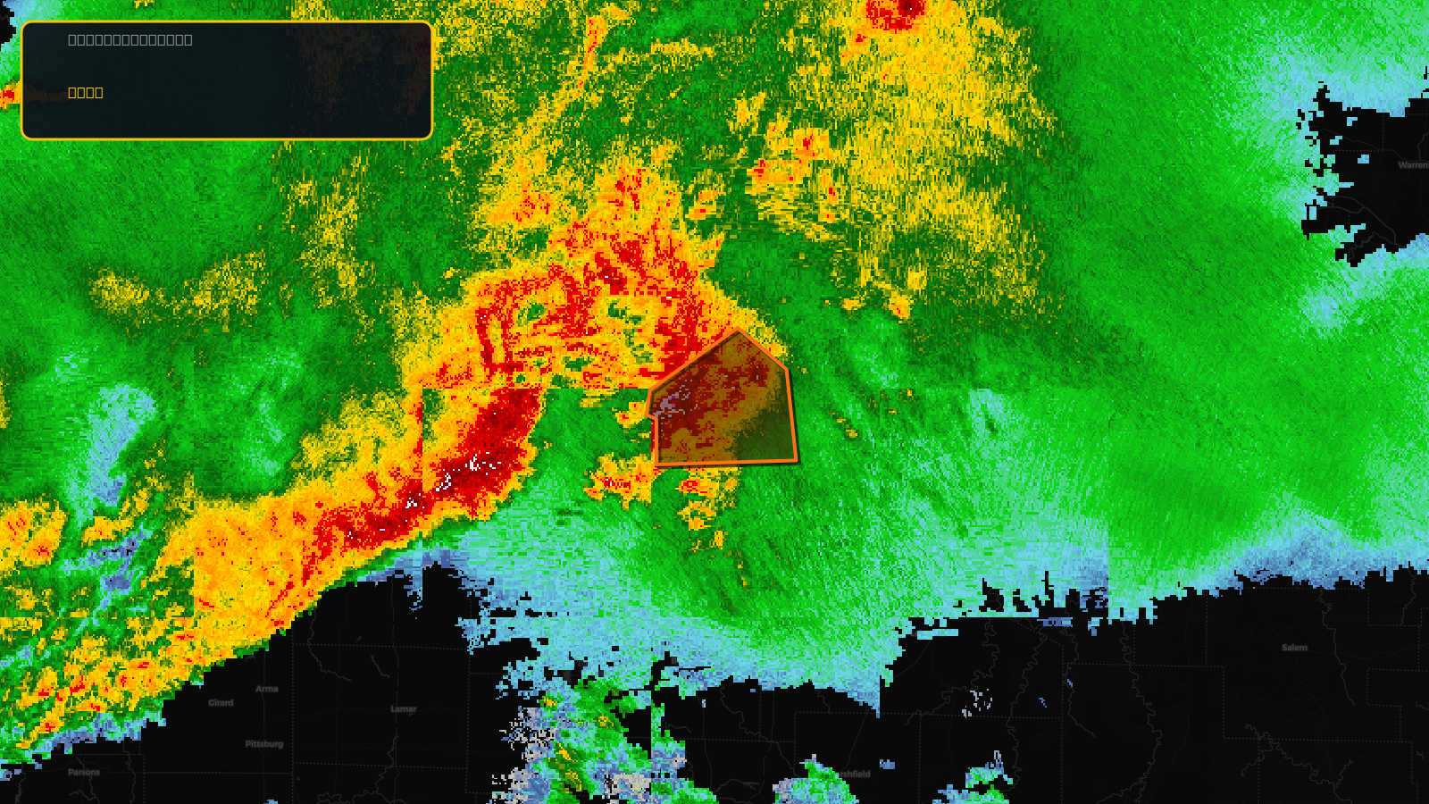
Very SevereThunderstorm2d ago
Severe Thunderstorm Warning issued April 17 at 5:25PM CDT until April 17 at 6:00PM CDT by NWS Kansas City/Pleasant Hill MO
Missouri
🧊0.88"Hail⚠ Considerable
Score
29
🏠 Res
98,725
🏢 Com
5,983
💰~$108M
✓ In storm zone
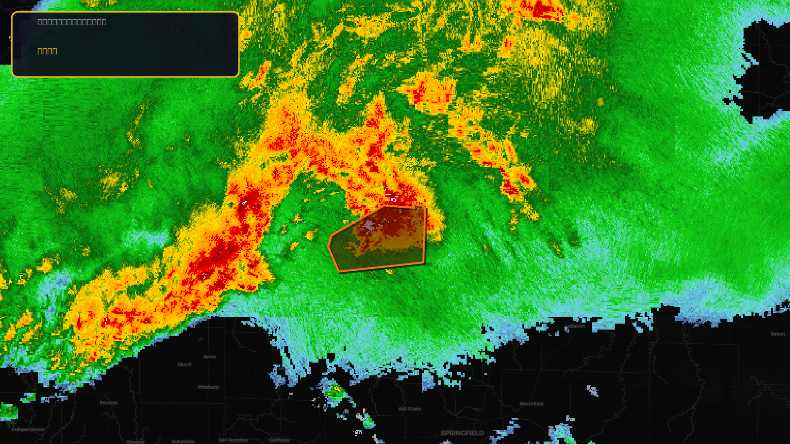
Very SevereThunderstorm2d ago
Severe Thunderstorm Warning issued April 17 at 5:11PM CDT until April 17 at 6:30PM CDT by NWS Kansas City/Pleasant Hill MO
Missouri
🧊0.88"Hail⚠ Considerable
Score
29
🏠 Res
41,650
🏢 Com
2,178
💰~$44M
✓ In storm zone
Very SevereTornado2d ago
Tornado Warning issued April 17 at 7:36PM CDT until April 17 at 8:15PM CDT by NWS Springfield MO
Missouri
🧊1"Hail
Score
28
🏠 Res
31,337
🏢 Com
1,390
💰~$32M
✓ In storm zone
Very SevereTornado2d ago
Tornado Warning issued April 17 at 6:23PM CDT until April 17 at 7:15PM CDT by NWS St Louis MO
Illinois, Missouri
🧊1"Hail
Score
28
🏠 Res
1,788
🏢 Com
155
💰~$2.1M
✓ In storm zone

Very SevereTornado2d ago
Tornado Warning issued April 17 at 5:58PM CDT until April 17 at 6:30PM CDT by NWS St Louis MO
Missouri
🧊1"Hail
Score
28
🏠 Res
625
🏢 Com
11
💰~$585K
✓ In storm zone
Very SevereTornado2d ago
Tornado Warning issued April 17 at 7:10PM CDT until April 17 at 7:45PM CDT by NWS Springfield MO
Missouri
🧊1"Hail
Score
26
🏠 Res
9,954
🏢 Com
456
💰~$10M
✓ In storm zone
Very SevereTornado2d ago
Tornado Warning issued April 17 at 7:16PM CDT until April 17 at 8:00PM CDT by NWS Springfield MO
Missouri
🧊1"Hail
Score
26
🏠 Res
6,050
🏢 Com
189
💰~$6.0M
✓ In storm zone

Very SevereTornado2d ago
Tornado Warning issued April 17 at 8:45PM CDT until April 17 at 9:30PM CDT by NWS St Louis MO
Missouri
🧊1"Hail
Score
26
🏠 Res
2,924
🏢 Com
1,968
💰~$9.5M
✓ In storm zone
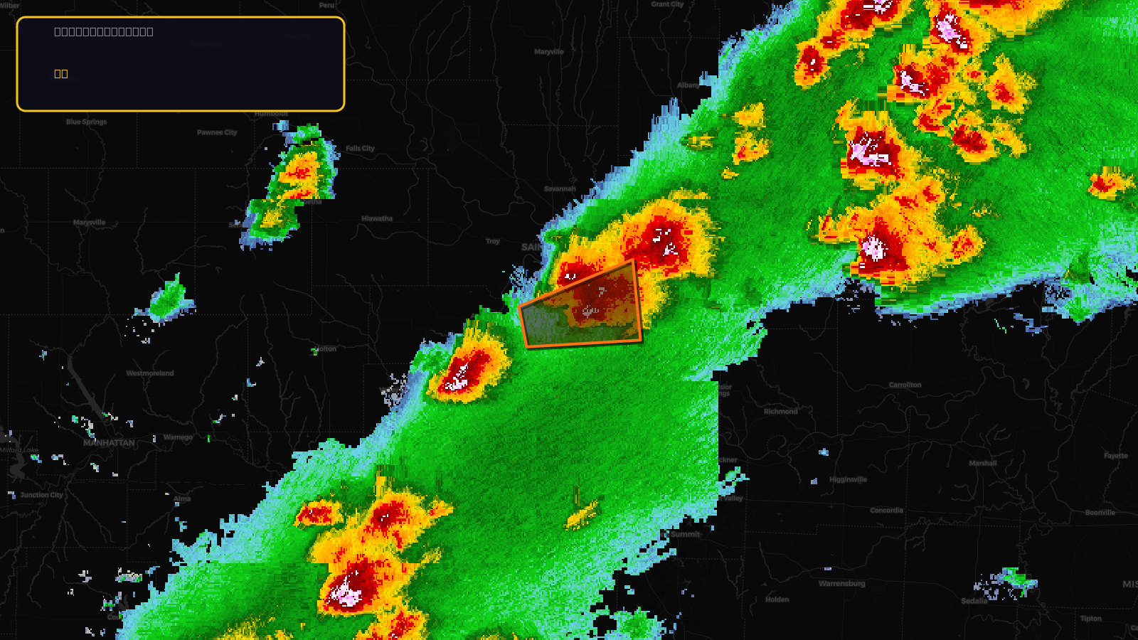
Very SevereTornado2d ago
Tornado Warning issued April 17 at 6:21PM CDT until April 17 at 6:45PM CDT by NWS Kansas City/Pleasant Hill MO
Missouri
Score
26
🏠 Res
2,695
🏢 Com
218
💰~$3.1M
✓ In storm zone
Very SevereTornado2d ago
Tornado Warning issued April 17 at 7:05PM CDT until April 17 at 7:30PM CDT by NWS Kansas City/Pleasant Hill MO
Missouri
Score
26
🏠 Res
1,612
🏢 Com
85
💰~$1.7M
✓ In storm zone
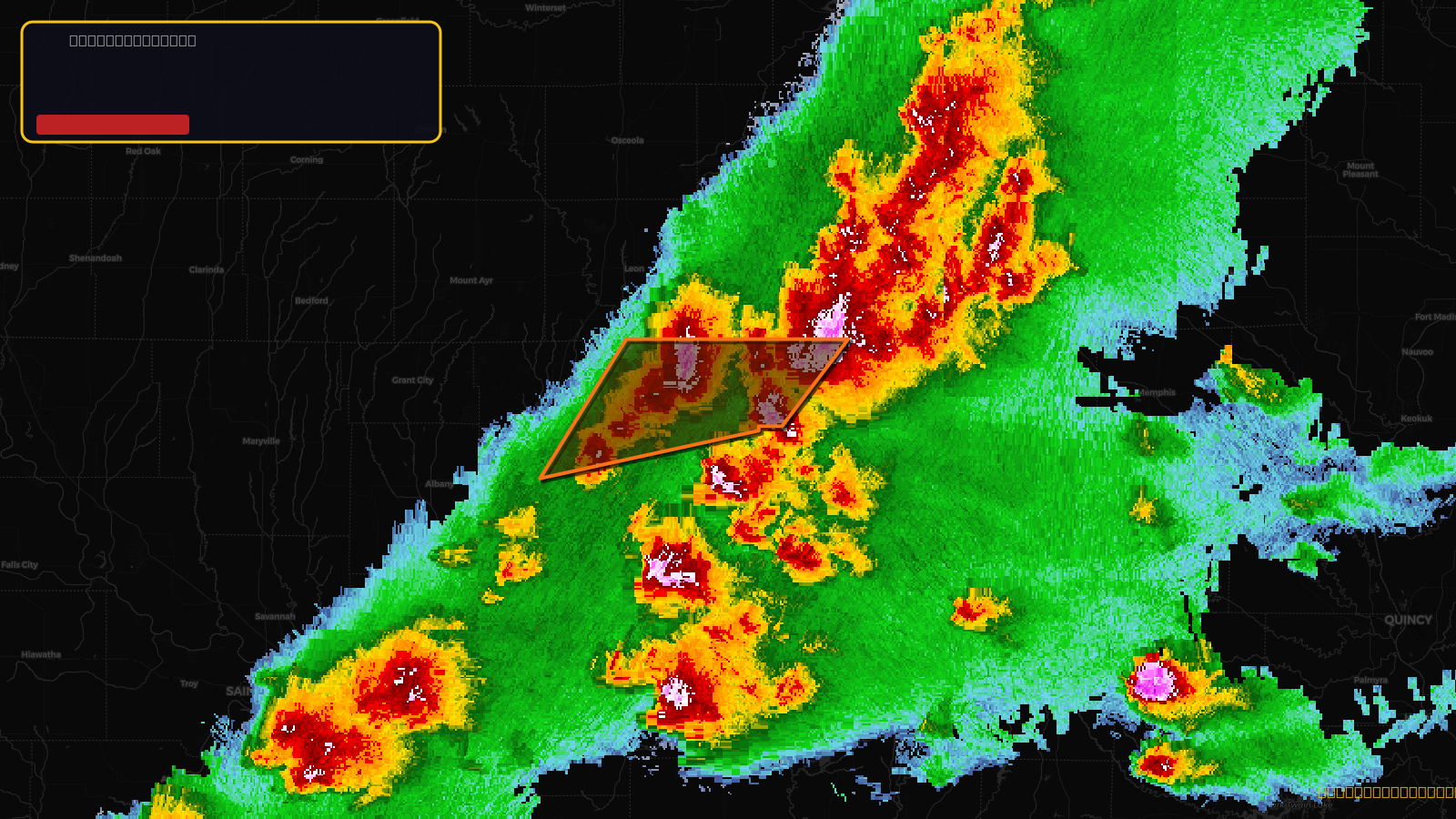
Very SevereTornado2d ago
Tornado Warning issued April 17 at 3:45PM CDT until April 17 at 4:30PM CDT by NWS Kansas City/Pleasant Hill MO
Missouri
🧊1"Hail
Score
30
🏠 Res
5,639
🏢 Com
454
💰~$6.6M
✓ In storm zone
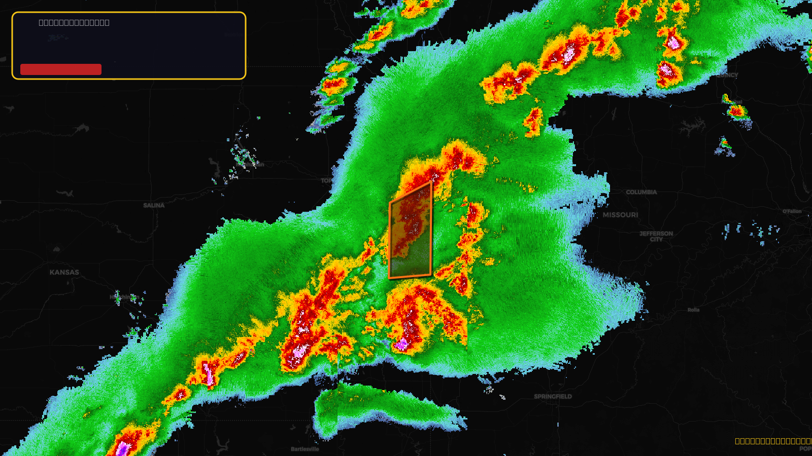
Very SevereTornado2d ago
Tornado Warning issued April 17 at 3:25PM CDT until April 17 at 4:00PM CDT by NWS Kansas City/Pleasant Hill MO
Missouri
🧊1"Hail
Score
30
🏠 Res
2,048
🏢 Com
70
💰~$2.0M
✓ In storm zone
Very SevereTornado2d ago
Tornado Warning issued April 17 at 2:57PM CDT until April 17 at 3:30PM CDT by NWS Kansas City/Pleasant Hill MO
Kansas, Missouri
Score
30
🏠 Res
10,092
🏢 Com
496
💰~$11M
✓ In storm zone
See a storm above? Get the lead list in minutes.
Every polygon here is a neighborhood of roofs. Upload the radar image, confirm the zone, pull the property list. No GIS team required.
Get early access →