Very SevereThunderstorm★ Peak frameCaptured 2d ago
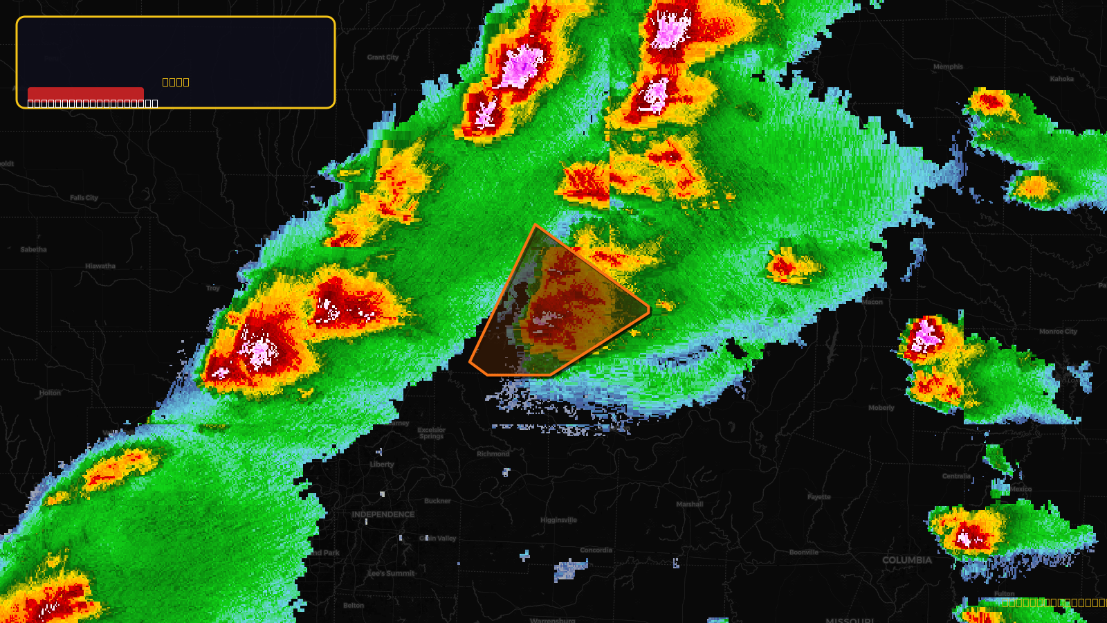
Severe Thunderstorm Warning issued April 17 at 3:09PM CDT until April 17 at 4:00PM CDT by NWS Kansas City/Pleasant Hill MO
Missouri
Pull this lead list →Pre-loads ~5,496 residential properties into Step 2 for zone selection.
✓Counts inside actual storm footprint· 15% of NWS polygon hit
Storm Score
52
🏠 Residential
5,496
🏢 Commercial
437
Total properties
5,933
Estimated roofing opportunity🔴 Zones 1 & 2
💰 ~$6.4M
Conservative estimate at 22% claim rate, scoped to the damage zone (core + inner — ~40% of the warning polygon): 🏠 ~2,198 residential · 🏢 ~175 commercial. Industry-low claim values ($10K residential / $40K commercial).
NWS intensity
🧊 1.75"Hail💨 60MPHRadar indicated⚠ ConsiderableIntensity Score 47/100
Issued
Apr 17, 8:09 PM UTC
Expires
Apr 17, 9:00 PM UTC
Event type
Severe Thunderstorm Warning
Affected areas (4)
Caldwell, MOCarroll, MODaviess, MOLivingston, MO
ID: urn:oid:2.49.0.1.840.0.717c78a41f6a577ea624406205b90f64063d08af.001.1Centroid: 39.714, -93.737