Very SevereThunderstorm★ Peak frameCaptured 2d ago
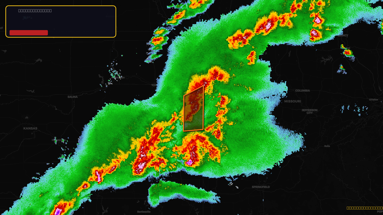
Severe Thunderstorm Warning issued April 17 at 4:35PM CDT until April 17 at 5:15PM CDT by NWS Kansas City/Pleasant Hill MO
Kansas, Missouri
Pull this lead list →Pre-loads ~169,498 residential properties into Step 2 for zone selection.
✓Counts inside actual storm footprint· 18.7% of NWS polygon hit
Storm Score
47
🏠 Residential
169,498
🏢 Commercial
6,640
Total properties
176,138
Estimated roofing opportunity🔴 Zones 1 & 2
💰 ~$173M
Conservative estimate at 22% claim rate, scoped to the damage zone (core + inner — ~40% of the warning polygon): 🏠 ~67,799 residential · 🏢 ~2,656 commercial. Industry-low claim values ($10K residential / $40K commercial).
NWS intensity
🧊 0.88"Hail💨 80MPHRadar indicated✓ Wind observed⚠ DestructiveIntensity Score 47/100
Issued
Apr 17, 9:35 PM UTC
Expires
Apr 17, 10:15 PM UTC
Event type
Severe Thunderstorm Warning
Affected areas (4)
Johnson, KSLinn, KSMiami, KSCass, MO
ID: urn:oid:2.49.0.1.840.0.7c86a0330ae7c0aa443d965eb9ef2293df942d57.001.1Centroid: 38.646, -94.884