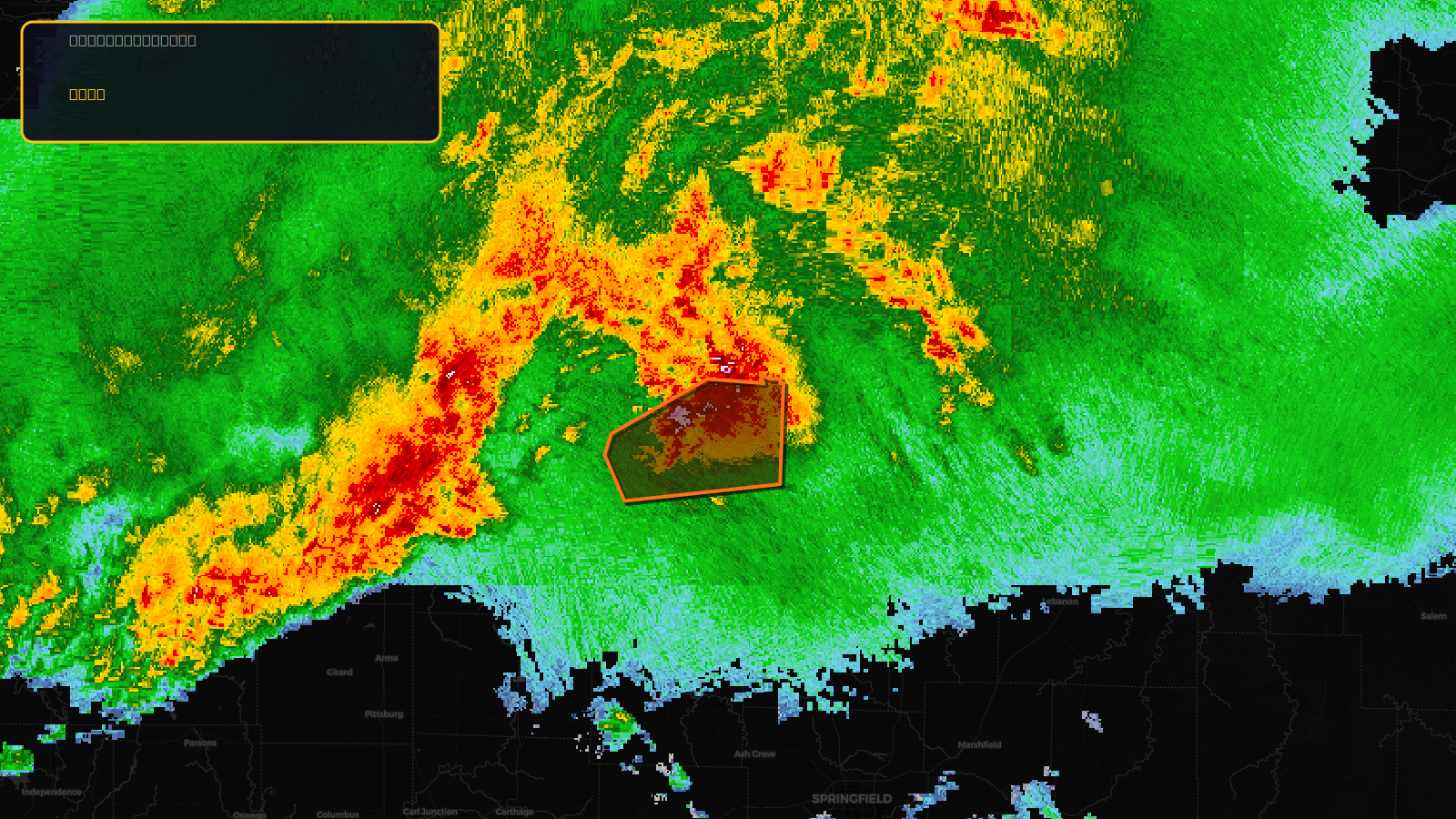
Very SevereTornado★ Peak frameCaptured 2d ago
Tornado Warning issued April 17 at 6:19PM CDT until April 17 at 7:00PM CDT by NWS Springfield MO
Missouri
Pull this lead list →Pre-loads ~2,450 residential properties into Step 2 for zone selection.
✓Counts inside actual storm footprint· 16.9% of NWS polygon hit
Storm Score
32
🏠 Residential
2,450
🏢 Commercial
139
Total properties
2,589
Estimated roofing opportunity🔴 Zones 1 & 2
💰 ~$2.6M
Conservative estimate at 22% claim rate, scoped to the damage zone (core + inner — ~40% of the warning polygon): 🏠 ~980 residential · 🏢 ~56 commercial. Industry-low claim values ($10K residential / $40K commercial).
NWS intensity
🧊 1.5"HailIntensity Score 32/100
Issued
Apr 17, 11:19 PM UTC
Expires
Apr 18, 12:00 AM UTC
Event type
Tornado Warning
Affected areas (1)
St. Clair, MO
ID: urn:oid:2.49.0.1.840.0.df38ae95d131517ac5bfad4596f7098eb6aba455.001.1Centroid: 38.137, -93.667