Very SevereThunderstorm★ Peak frameCaptured 2d ago
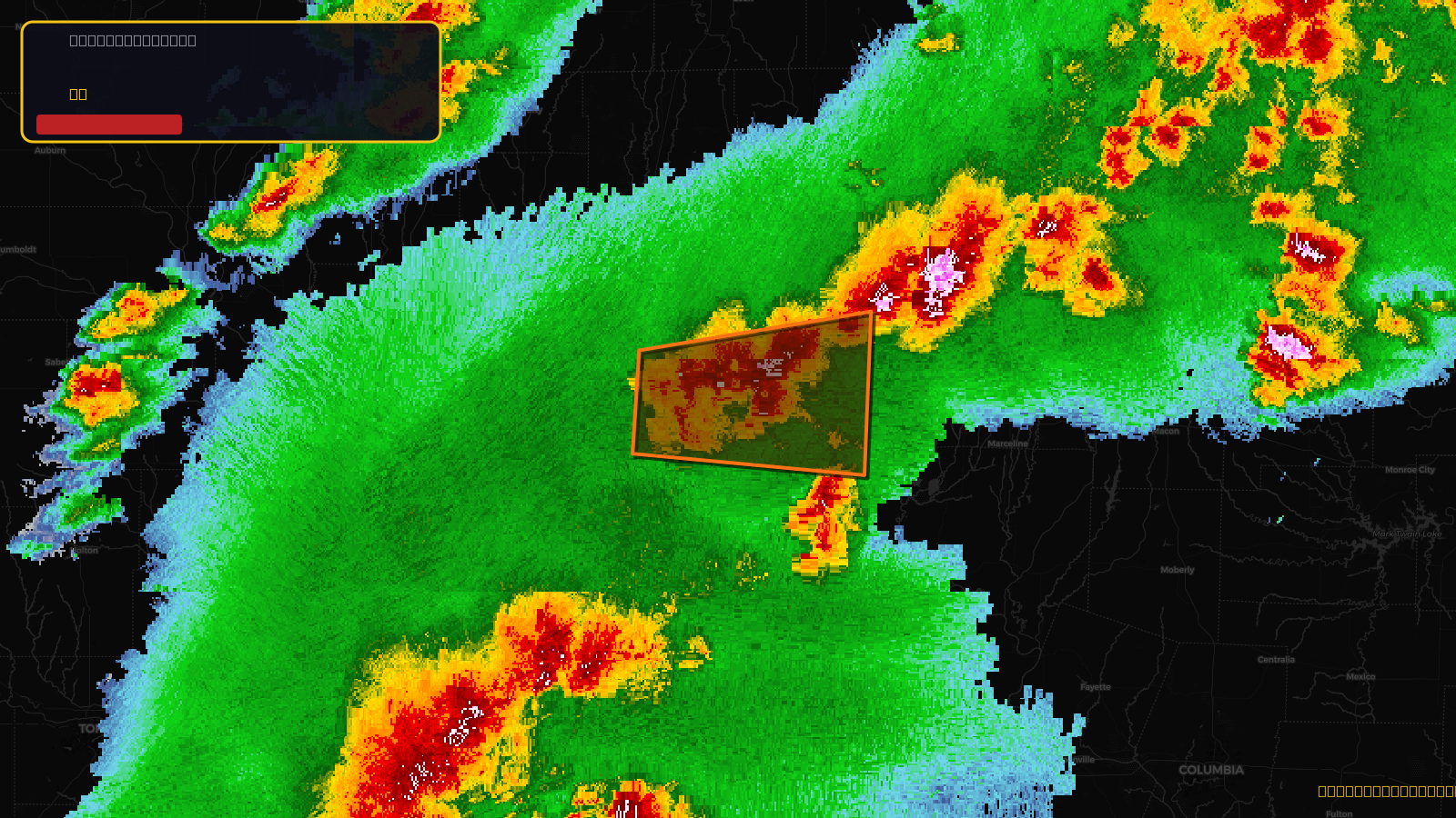
Severe Thunderstorm Warning issued April 17 at 4:58PM CDT until April 17 at 5:45PM CDT by NWS Kansas City/Pleasant Hill MO
Missouri
Pull this lead list →Pre-loads ~7,961 residential properties into Step 2 for zone selection.
✓Counts inside actual storm footprint· 13.7% of NWS polygon hit
Storm Score
48
🏠 Residential
7,961
🏢 Commercial
581
Total properties
8,542
Estimated roofing opportunity🔴 Zones 1 & 2
💰 ~$9.0M
Conservative estimate at 22% claim rate, scoped to the damage zone (core + inner — ~40% of the warning polygon): 🏠 ~3,184 residential · 🏢 ~232 commercial. Industry-low claim values ($10K residential / $40K commercial).
NWS intensity
🧊 1"Hail💨 80MPHRadar indicated✓ Wind observed⚠ DestructiveIntensity Score 48/100
Issued
Apr 17, 9:58 PM UTC
Expires
Apr 17, 10:45 PM UTC
Event type
Severe Thunderstorm Warning
Affected areas (4)
Caldwell, MODaviess, MOGrundy, MOLivingston, MO
ID: urn:oid:2.49.0.1.840.0.567359445c3fba27335d4692bcf0e6d2a263454b.001.1Centroid: 39.794, -93.792