Very SevereThunderstorm★ Peak frameCaptured 2d ago
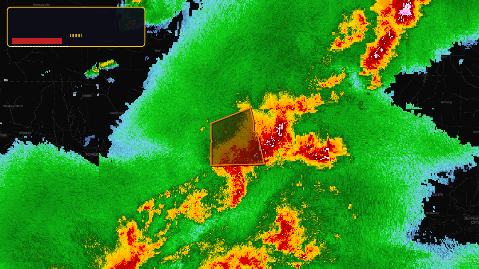
Severe Thunderstorm Warning issued April 17 at 5:25PM CDT until April 17 at 6:00PM CDT by NWS Kansas City/Pleasant Hill MO
Missouri
Pull this lead list →Pre-loads ~98,725 residential properties into Step 2 for zone selection.
✓Counts inside actual storm footprint· 18.4% of NWS polygon hit
Storm Score
29
🏠 Residential
98,725
🏢 Commercial
5,983
Total properties
104,708
Estimated roofing opportunity🔴 Zones 1 & 2
💰 ~$108M
Conservative estimate at 22% claim rate, scoped to the damage zone (core + inner — ~40% of the warning polygon): 🏠 ~39,490 residential · 🏢 ~2,393 commercial. Industry-low claim values ($10K residential / $40K commercial).
NWS intensity
🧊 0.88"Hail💨 70MPHRadar indicated✓ Wind observed⚠ ConsiderableIntensity Score 29/100
Issued
Apr 17, 10:25 PM UTC
Expires
Apr 17, 11:00 PM UTC
Event type
Severe Thunderstorm Warning
Affected areas (2)
Clay, MOJackson, MO
ID: urn:oid:2.49.0.1.840.0.317779fb5b680849a3ba8aee6738239eeee463dc.001.1Centroid: 39.190, -94.338