Very SevereThunderstorm★ Peak frameCaptured 2d ago
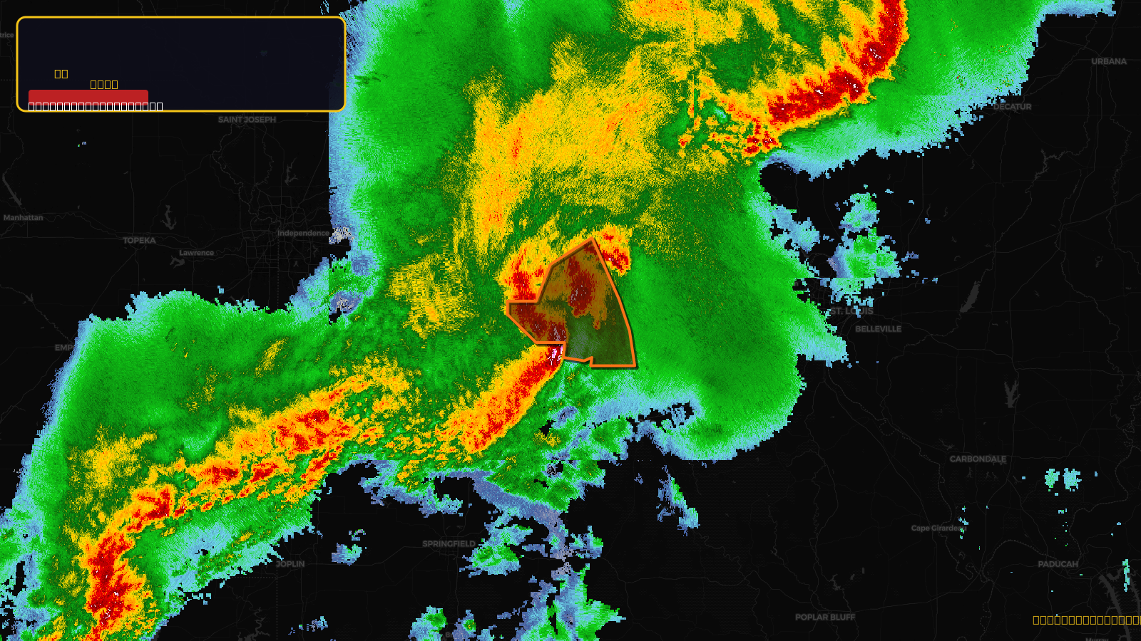
Severe Thunderstorm Warning issued April 17 at 7:57PM CDT until April 17 at 9:00PM CDT by NWS St Louis MO
Missouri
Pull this lead list →Pre-loads ~73,288 residential properties into Step 2 for zone selection.
✓Counts inside actual storm footprint· 14.1% of NWS polygon hit
Storm Score
31
🏠 Residential
73,288
🏢 Commercial
4,476
Total properties
77,764
Estimated roofing opportunity🔴 Zones 1 & 2
💰 ~$80M
Conservative estimate at 22% claim rate, scoped to the damage zone (core + inner — ~40% of the warning polygon): 🏠 ~29,315 residential · 🏢 ~1,790 commercial. Industry-low claim values ($10K residential / $40K commercial).
NWS intensity
🧊 1"Hail💨 70MPHRadar indicated⚠ ConsiderableIntensity Score 31/100
Issued
Apr 18, 12:57 AM UTC
Expires
Apr 18, 2:00 AM UTC
Event type
Severe Thunderstorm Warning
Affected areas (5)
Boone, MOCallaway, MOCole, MOMoniteau, MOOsage, MO
ID: urn:oid:2.49.0.1.840.0.868d791226d873197b97faebff8e1b353c7ee662.001.1Centroid: 38.563, -92.355