Very SevereThunderstorm★ Peak frameCaptured 2d ago
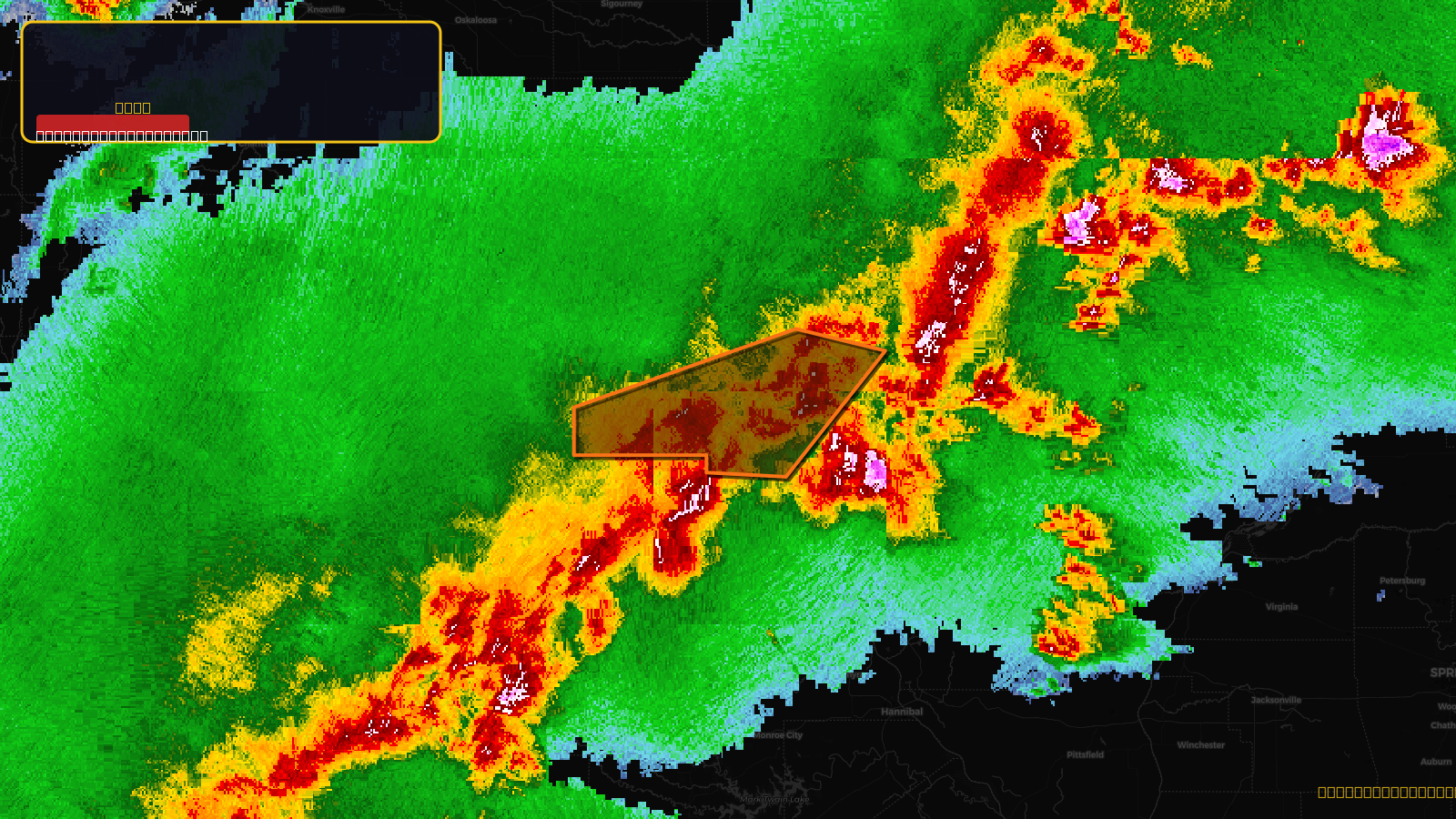
Severe Thunderstorm Warning issued April 17 at 5:55PM CDT until April 17 at 7:00PM CDT by NWS Quad Cities IA IL
Iowa, Missouri
Pull this lead list →Pre-loads ~2,790 residential properties into Step 2 for zone selection.
✓Counts inside actual storm footprint· 20.6% of NWS polygon hit
Storm Score
31
🏠 Residential
2,790
🏢 Commercial
59
Total properties
2,849
Estimated roofing opportunity🔴 Zones 1 & 2
💰 ~$2.7M
Conservative estimate at 22% claim rate, scoped to the damage zone (core + inner — ~40% of the warning polygon): 🏠 ~1,116 residential · 🏢 ~24 commercial. Industry-low claim values ($10K residential / $40K commercial).
NWS intensity
🧊 1"Hail💨 70MPHRadar indicated⚠ ConsiderableIntensity Score 31/100
Issued
Apr 17, 10:55 PM UTC
Expires
Apr 18, 12:00 AM UTC
Event type
Severe Thunderstorm Warning
Affected areas (3)
Lee, IAClark, MOScotland, MO
ID: urn:oid:2.49.0.1.840.0.f0817ef4c443e5b0c6fb617dbc1e10ee6d74fa49.001.1Centroid: 40.405, -91.885