Very SevereTornado★ Peak frameCaptured 2d ago
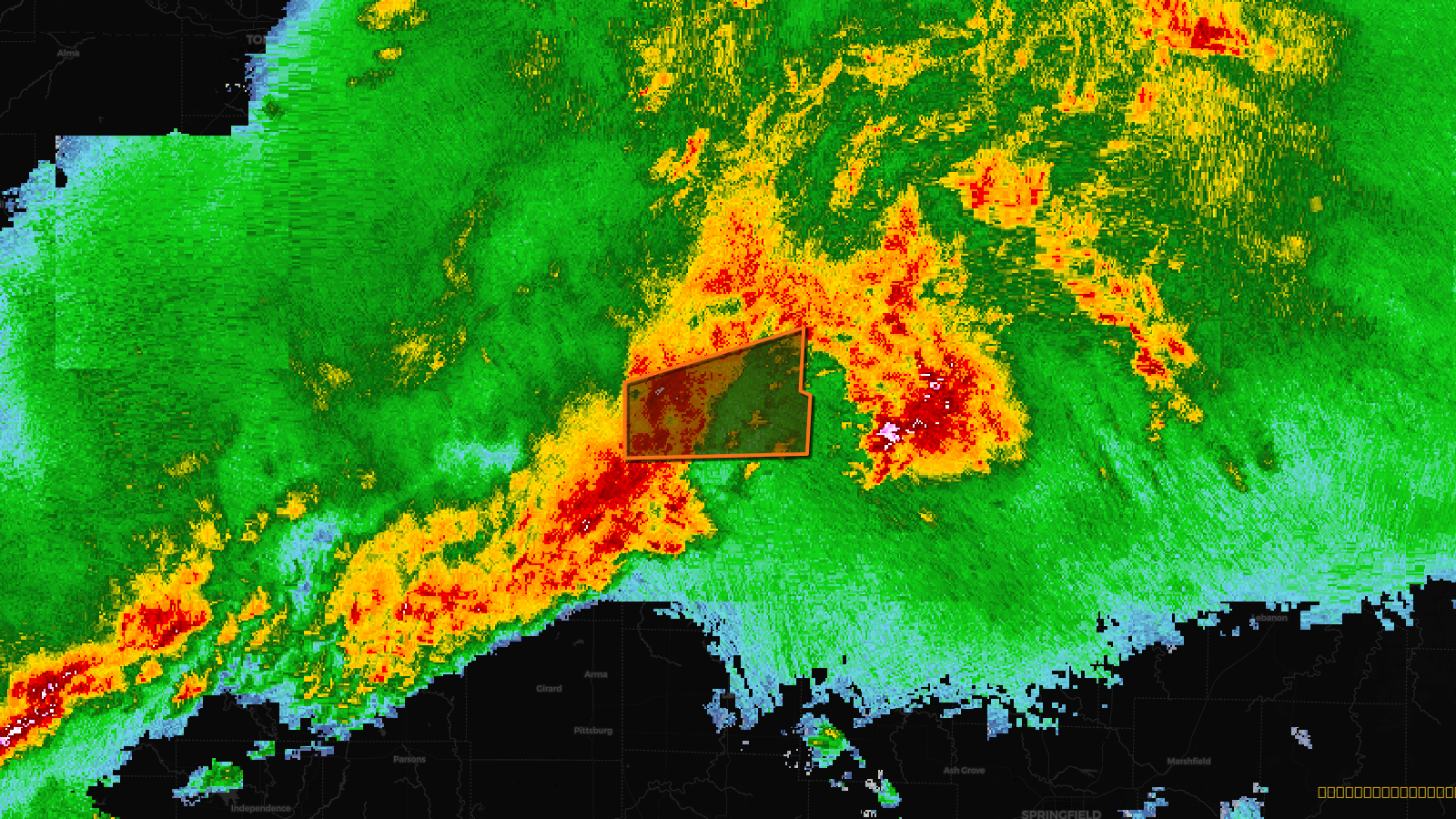
Tornado Warning issued April 17 at 6:21PM CDT until April 17 at 6:45PM CDT by NWS Kansas City/Pleasant Hill MO
Missouri
Pull this lead list →Pre-loads ~2,695 residential properties into Step 2 for zone selection.
✓Counts inside actual storm footprint· 15.9% of NWS polygon hit
Storm Score
26
🏠 Residential
2,695
🏢 Commercial
218
Total properties
2,913
Estimated roofing opportunity🔴 Zones 1 & 2
💰 ~$3.1M
Conservative estimate at 22% claim rate, scoped to the damage zone (core + inner — ~40% of the warning polygon): 🏠 ~1,078 residential · 🏢 ~87 commercial. Industry-low claim values ($10K residential / $40K commercial).
Issued
Apr 17, 11:21 PM UTC
Expires
Apr 17, 11:45 PM UTC
Event type
Tornado Warning
Affected areas (1)
Bates, MO
ID: urn:oid:2.49.0.1.840.0.0423f6d2834e39e261560fc4c037b300b2aa99dc.001.1Centroid: 38.176, -94.299