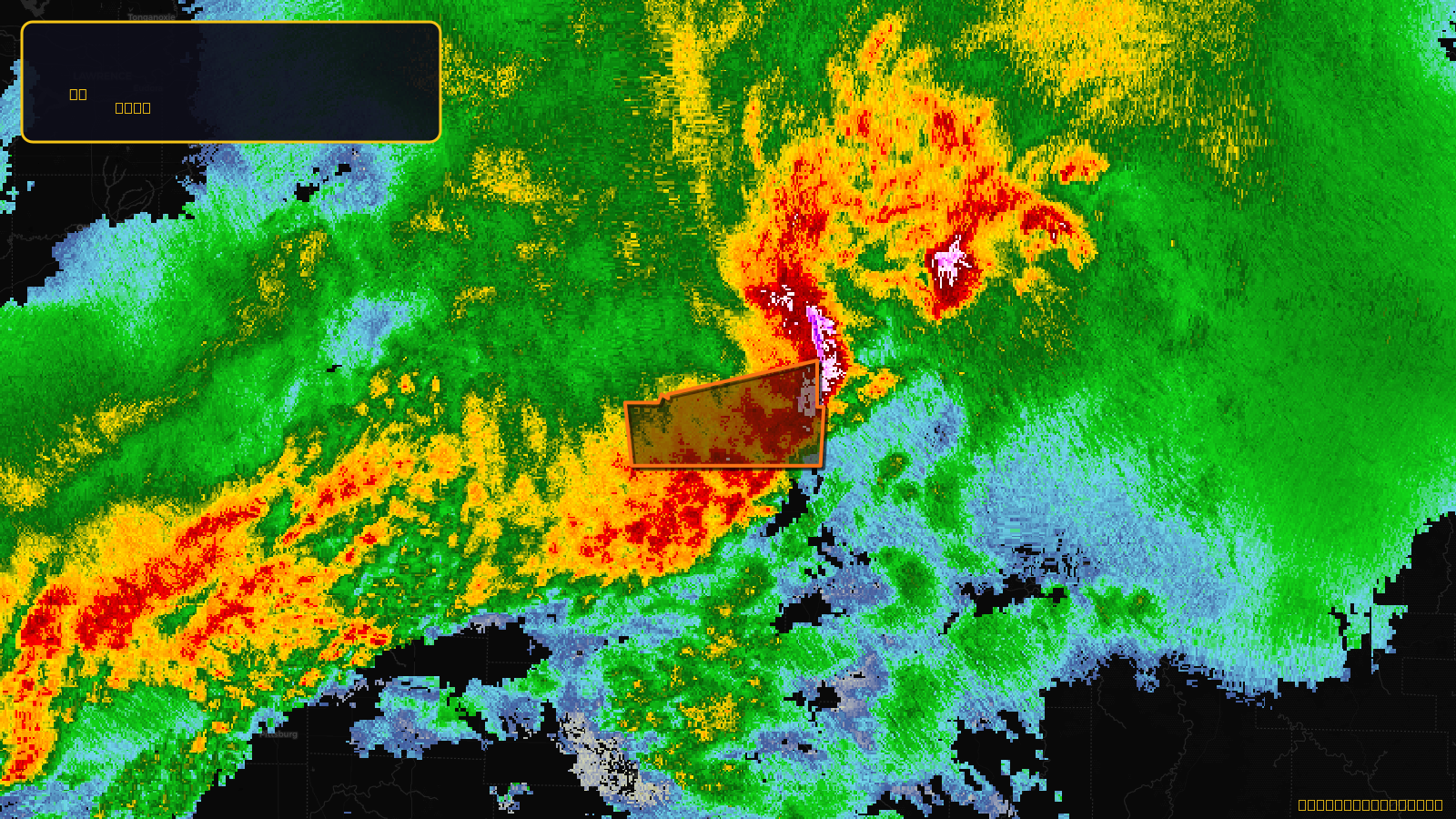
Very SevereTornado★ Peak frameCaptured 2d ago
Tornado Warning issued April 17 at 7:16PM CDT until April 17 at 8:00PM CDT by NWS Springfield MO
Missouri
Pull this lead list →Pre-loads ~6,050 residential properties into Step 2 for zone selection.
✓Counts inside actual storm footprint· 24.3% of NWS polygon hit
Storm Score
26
🏠 Residential
6,050
🏢 Commercial
189
Total properties
6,239
Estimated roofing opportunity🔴 Zones 1 & 2
💰 ~$6.0M
Conservative estimate at 22% claim rate, scoped to the damage zone (core + inner — ~40% of the warning polygon): 🏠 ~2,420 residential · 🏢 ~76 commercial. Industry-low claim values ($10K residential / $40K commercial).
NWS intensity
🧊 1"HailIntensity Score 26/100
Issued
Apr 18, 12:16 AM UTC
Expires
Apr 18, 1:00 AM UTC
Event type
Tornado Warning
Affected areas (3)
Benton, MOHickory, MOSt. Clair, MO
ID: urn:oid:2.49.0.1.840.0.d536032113e78fd2907edb2c7b7c8b25e3229680.001.1Centroid: 38.184, -93.349