Very SevereTornado★ Peak frameCaptured 2d ago
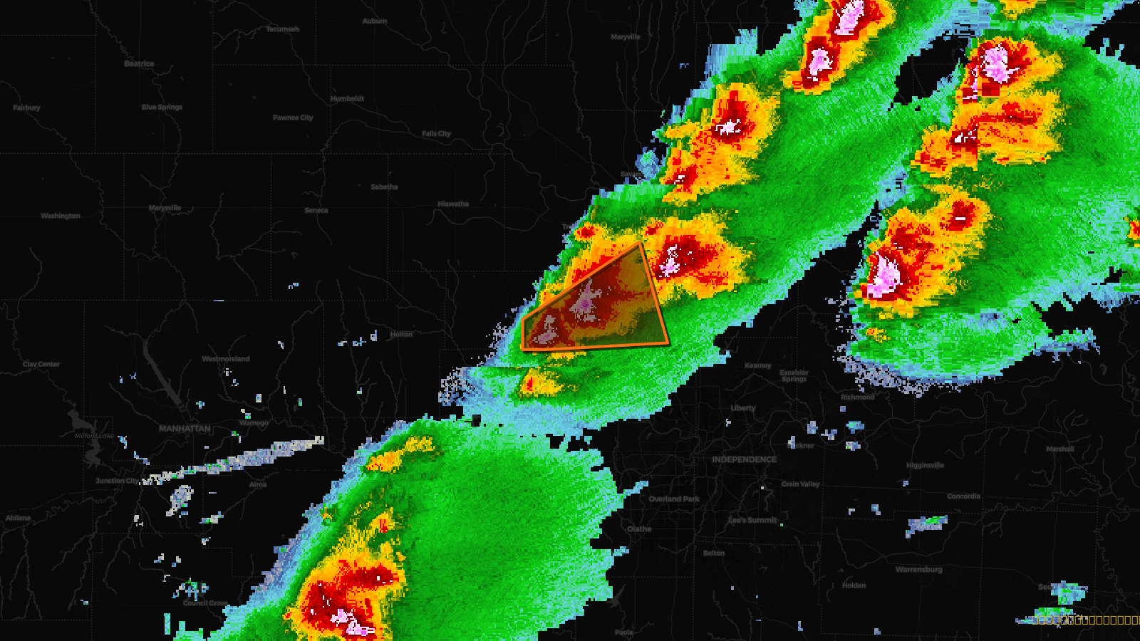
Tornado Warning issued April 17 at 2:57PM CDT until April 17 at 3:30PM CDT by NWS Kansas City/Pleasant Hill MO
Kansas, Missouri
Pull this lead list →Pre-loads ~10,092 residential properties into Step 2 for zone selection.
✓Counts inside actual storm footprint· 19.9% of NWS polygon hit
Storm Score
30
🏠 Residential
10,092
🏢 Commercial
496
Total properties
10,588
Estimated roofing opportunity🔴 Zones 1 & 2
💰 ~$11M
Conservative estimate at 22% claim rate, scoped to the damage zone (core + inner — ~40% of the warning polygon): 🏠 ~4,037 residential · 🏢 ~198 commercial. Industry-low claim values ($10K residential / $40K commercial).
Issued
Apr 17, 7:57 PM UTC
Expires
Apr 17, 8:30 PM UTC
Event type
Tornado Warning
Affected areas (3)
Atchison, KSBuchanan, MOPlatte, MO
ID: urn:oid:2.49.0.1.840.0.52bd07a1cbe2bc261f9246d115a2d1efb4c7b9be.001.1Centroid: 39.507, -95.087