Very SevereThunderstorm★ Peak frameCaptured 2d ago
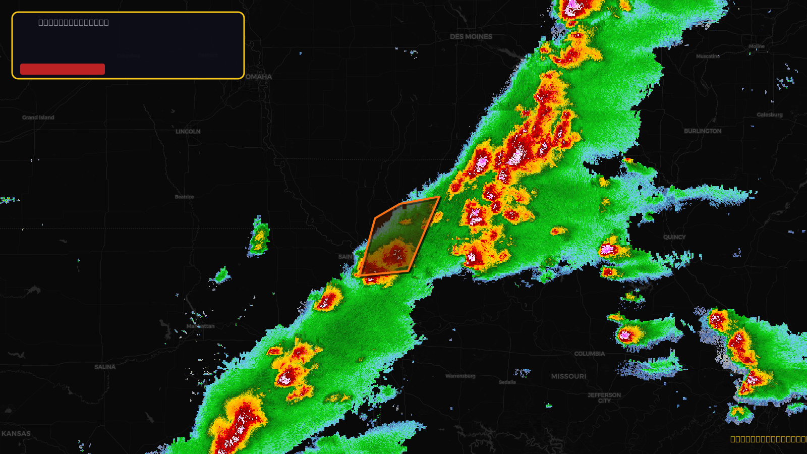
Severe Thunderstorm Warning issued April 17 at 3:11PM CDT until April 17 at 4:15PM CDT by NWS Kansas City/Pleasant Hill MO
Missouri
Pull this lead list →Pre-loads ~9,820 residential properties into Step 2 for zone selection.
✓Counts inside actual storm footprint· 10.4% of NWS polygon hit
Storm Score
52
🏠 Residential
9,820
🏢 Commercial
641
Total properties
10,461
Estimated roofing opportunity🔴 Zones 1 & 2
💰 ~$11M
Conservative estimate at 22% claim rate, scoped to the damage zone (core + inner — ~40% of the warning polygon): 🏠 ~3,928 residential · 🏢 ~256 commercial. Industry-low claim values ($10K residential / $40K commercial).
NWS intensity
🧊 1.75"Hail💨 60MPHRadar indicated⚠ ConsiderableIntensity Score 47/100
Issued
Apr 17, 8:11 PM UTC
Expires
Apr 17, 9:15 PM UTC
Event type
Severe Thunderstorm Warning
Affected areas (7)
Andrew, MOBuchanan, MOClinton, MODaviess, MODeKalb, MOGentry, MOHarrison, MO
ID: urn:oid:2.49.0.1.840.0.ecfd964e7435d489f79992ea271ca98a649ed979.001.1Centroid: 40.017, -94.360