Very SevereTornado★ Peak frameCaptured 2d ago
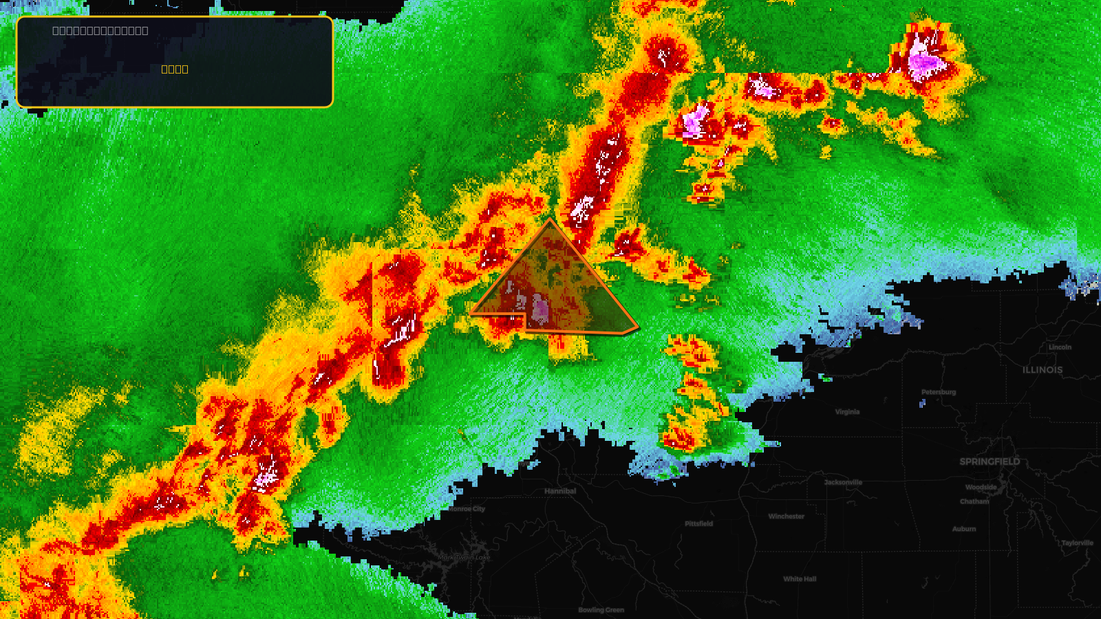
Tornado Warning issued April 17 at 5:47PM CDT until April 17 at 6:30PM CDT by NWS Quad Cities IA IL
Illinois, Iowa, Missouri
Pull this lead list →Pre-loads ~8,313 residential properties into Step 2 for zone selection.
✓Counts inside actual storm footprint· 17.1% of NWS polygon hit
Storm Score
36
🏠 Residential
8,313
🏢 Commercial
897
Total properties
9,210
Estimated roofing opportunity🔴 Zones 1 & 2
💰 ~$10M
Conservative estimate at 22% claim rate, scoped to the damage zone (core + inner — ~40% of the warning polygon): 🏠 ~3,325 residential · 🏢 ~359 commercial. Industry-low claim values ($10K residential / $40K commercial).
NWS intensity
🧊 1.75"HailIntensity Score 36/100
Issued
Apr 17, 10:47 PM UTC
Expires
Apr 17, 11:30 PM UTC
Event type
Tornado Warning
Affected areas (3)
Hancock, ILLee, IAClark, MO
ID: urn:oid:2.49.0.1.840.0.6d94d432c03baba92b815240233977a0f206819c.001.1Centroid: 40.263, -91.397