Very SevereThunderstorm★ Peak frameCaptured 2d ago
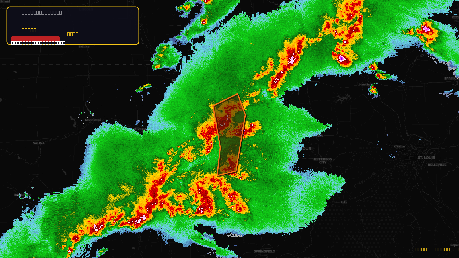
Severe Thunderstorm Warning issued April 17 at 5:11PM CDT until April 17 at 6:30PM CDT by NWS Kansas City/Pleasant Hill MO
Missouri
Pull this lead list →Pre-loads ~41,650 residential properties into Step 2 for zone selection.
✓Counts inside actual storm footprint· 14.8% of NWS polygon hit
Storm Score
29
🏠 Residential
41,650
🏢 Commercial
2,178
Total properties
43,828
Estimated roofing opportunity🔴 Zones 1 & 2
💰 ~$44M
Conservative estimate at 22% claim rate, scoped to the damage zone (core + inner — ~40% of the warning polygon): 🏠 ~16,660 residential · 🏢 ~871 commercial. Industry-low claim values ($10K residential / $40K commercial).
NWS intensity
🧊 0.88"Hail💨 70MPHRadar indicated✓ Wind observed⚠ ConsiderableIntensity Score 29/100
Issued
Apr 17, 10:11 PM UTC
Expires
Apr 17, 11:30 PM UTC
Event type
Severe Thunderstorm Warning
Affected areas (10)
Bates, MOCaldwell, MOCarroll, MOCass, MOClay, MOHenry, MOJackson, MOJohnson, MOLafayette, MORay, MO
ID: urn:oid:2.49.0.1.840.0.fa0d8b26945ef053236cdd32624a89cd6fdcfb8d.001.1Centroid: 39.047, -93.963