Very SevereTornado★ Peak frameCaptured 2d ago
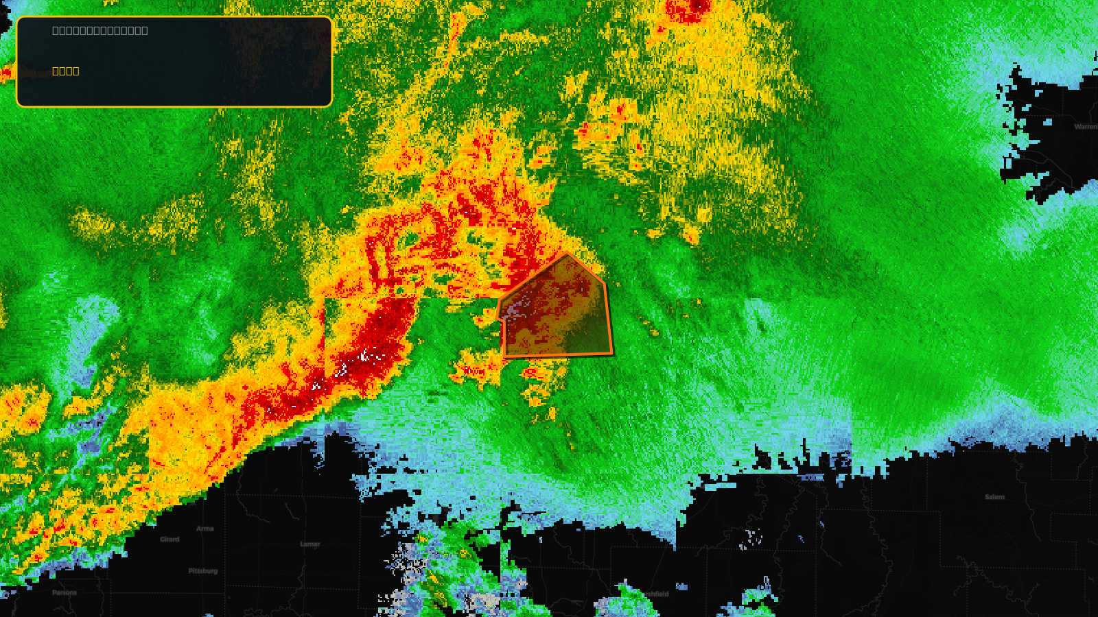
Tornado Warning issued April 17 at 6:41PM CDT until April 17 at 7:30PM CDT by NWS Springfield MO
Missouri
Pull this lead list →Pre-loads ~7,603 residential properties into Step 2 for zone selection.
✓Counts inside actual storm footprint· 21.2% of NWS polygon hit
Storm Score
32
🏠 Residential
7,603
🏢 Commercial
274
Total properties
7,877
Estimated roofing opportunity🔴 Zones 1 & 2
💰 ~$7.7M
Conservative estimate at 22% claim rate, scoped to the damage zone (core + inner — ~40% of the warning polygon): 🏠 ~3,041 residential · 🏢 ~110 commercial. Industry-low claim values ($10K residential / $40K commercial).
NWS intensity
🧊 1.5"HailIntensity Score 32/100
Issued
Apr 17, 11:41 PM UTC
Expires
Apr 18, 12:30 AM UTC
Event type
Tornado Warning
Affected areas (1)
Benton, MO
ID: urn:oid:2.49.0.1.840.0.628429684da13481d6aac988b88c0e9209c09f9c.001.1Centroid: 38.241, -93.321