Very SevereTornado★ Peak frameCaptured 2d ago
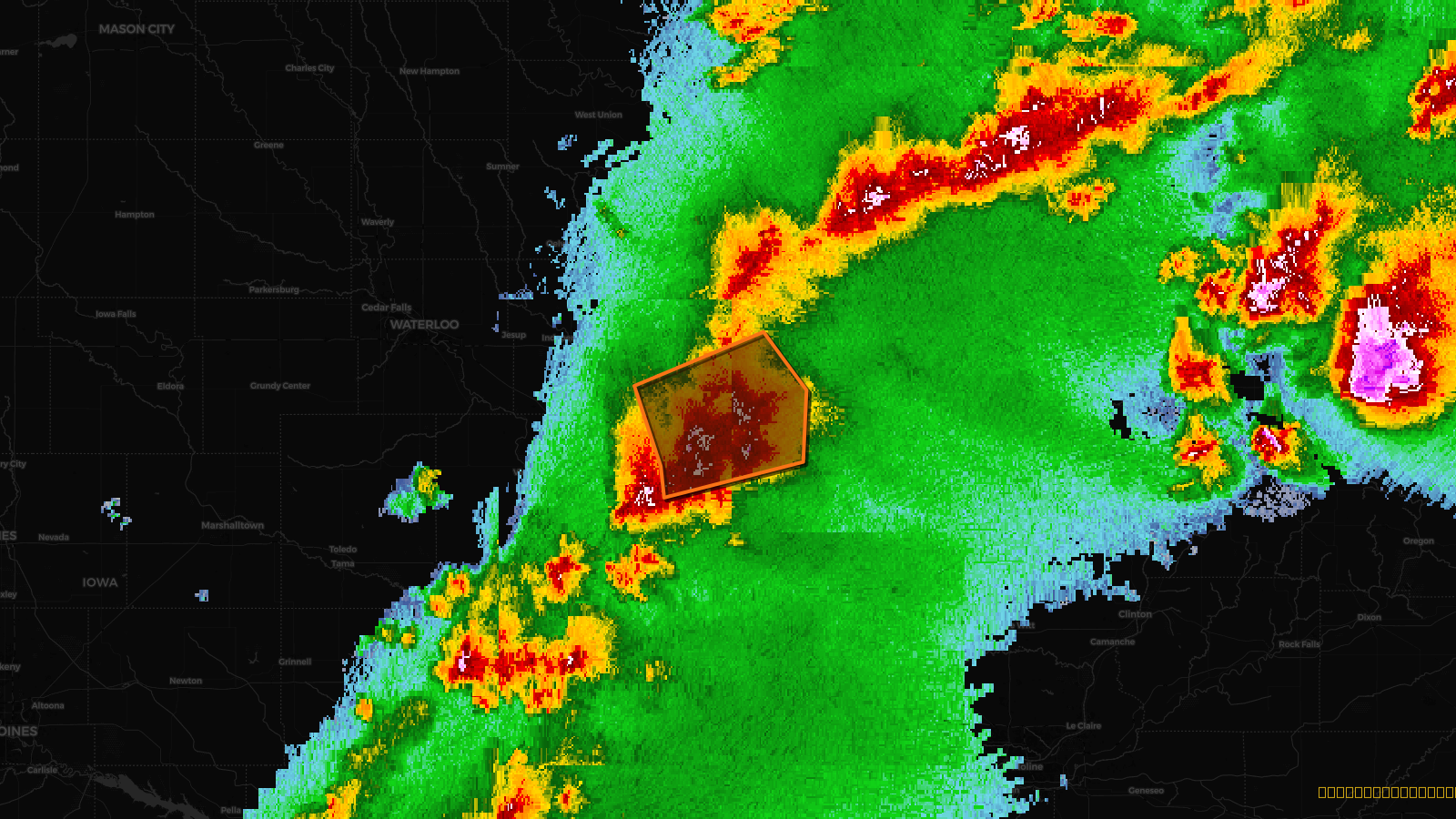
Tornado Warning issued April 17 at 4:18PM CDT until April 17 at 5:00PM CDT by NWS Quad Cities IA IL
Iowa
Pull this lead list →Pre-loads ~4,511 residential properties into Step 2 for zone selection.
✓Counts inside actual storm footprint· 20.7% of NWS polygon hit
Storm Score
30
🏠 Residential
4,511
🏢 Commercial
389
Total properties
4,900
Estimated roofing opportunity🔴 Zones 1 & 2
💰 ~$5.3M
Conservative estimate at 22% claim rate, scoped to the damage zone (core + inner — ~40% of the warning polygon): 🏠 ~1,804 residential · 🏢 ~156 commercial. Industry-low claim values ($10K residential / $40K commercial).
Issued
Apr 17, 9:18 PM UTC
Expires
Apr 17, 10:00 PM UTC
Event type
Tornado Warning
Affected areas (4)
Buchanan, IADelaware, IAJones, IALinn, IA
ID: urn:oid:2.49.0.1.840.0.fa9a31b61e70bc9039b953307e54cd7a43402706.001.1Centroid: 42.307, -91.417