SevereThunderstorm★ Peak frameCaptured 2d ago
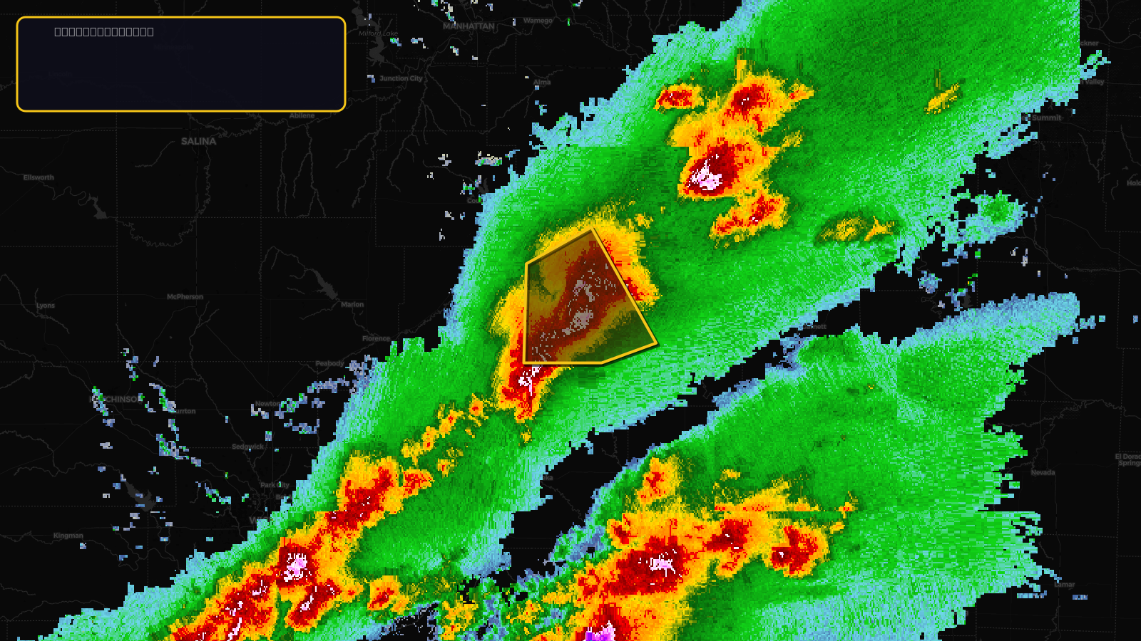
Severe Thunderstorm Warning issued April 17 at 3:23PM CDT until April 17 at 4:00PM CDT by NWS Topeka KS
Kansas
Pull this lead list →Pre-loads ~9,481 residential properties into Step 2 for zone selection.
✓Counts inside actual storm footprint· 19.5% of NWS polygon hit
Storm Score
20
🏠 Residential
9,481
🏢 Commercial
857
Total properties
10,338
Estimated roofing opportunity🔴 Zones 1 & 2
💰 ~$5.2M
Conservative estimate at 10% claim rate, scoped to the damage zone (core + inner — ~40% of the warning polygon): 🏠 ~3,792 residential · 🏢 ~343 commercial. Industry-low claim values ($10K residential / $40K commercial).
NWS intensity
🧊 1.25"Hail💨 60MPHRadar indicatedIntensity Score 25/100
Issued
Apr 17, 8:23 PM UTC
Expires
Apr 17, 9:00 PM UTC
Event type
Severe Thunderstorm Warning
Affected areas (2)
Coffey, KSLyon, KS
ID: urn:oid:2.49.0.1.840.0.f871d585852fc3efe5400665cc922abd8f0edc7f.001.1Centroid: 38.298, -96.180