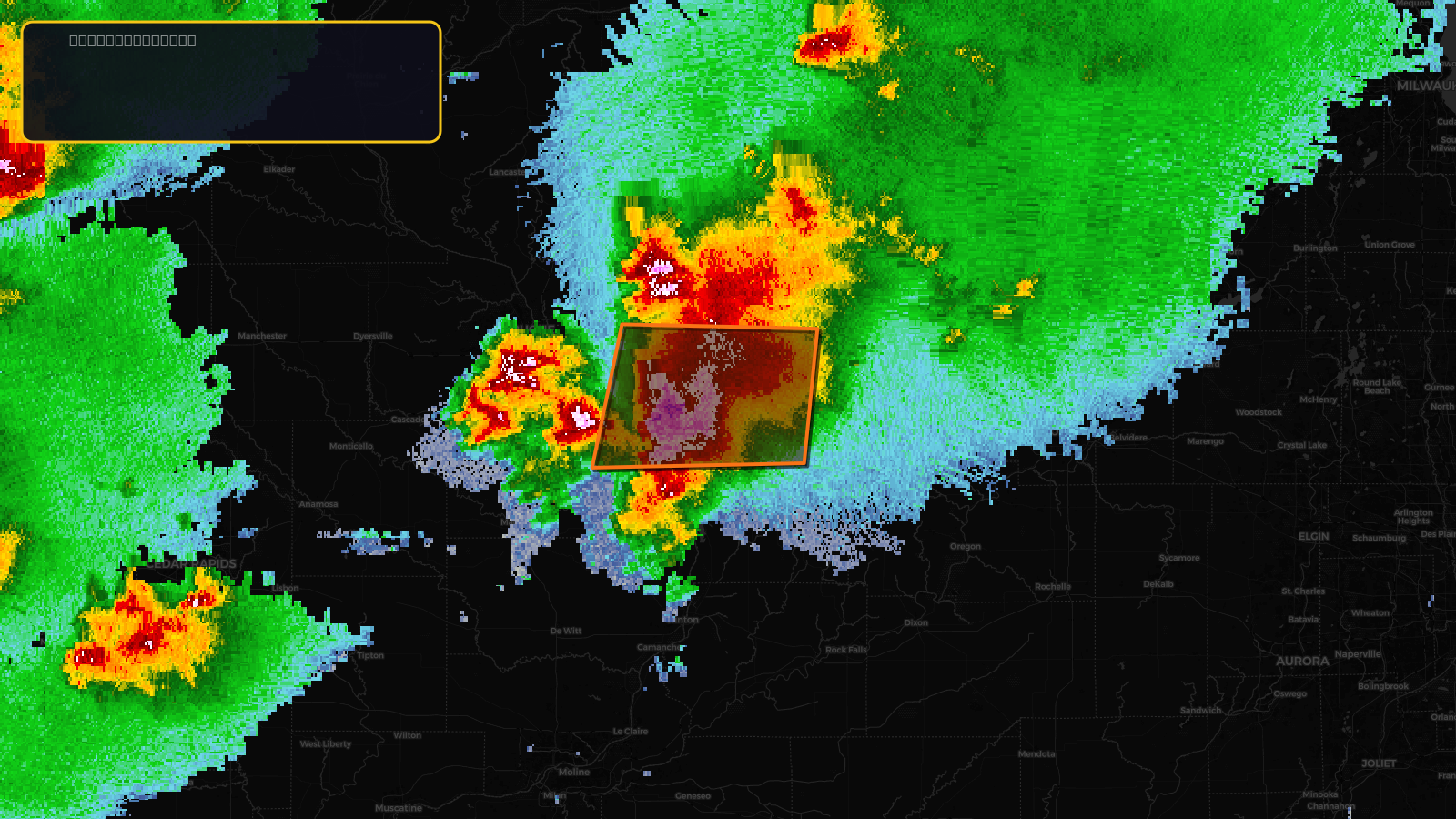
Very SevereTornado★ Peak frameCaptured 2d ago
Tornado Warning issued April 17 at 2:48PM CDT until April 17 at 3:30PM CDT by NWS Quad Cities IA IL
Illinois, Iowa
Pull this lead list →Pre-loads ~11,872 residential properties into Step 2 for zone selection.
✓Counts inside actual storm footprint· 21.2% of NWS polygon hit
Storm Score
30
🏠 Residential
11,872
🏢 Commercial
743
Total properties
12,615
Estimated roofing opportunity🔴 Zones 1 & 2
💰 ~$13M
Conservative estimate at 22% claim rate, scoped to the damage zone (core + inner — ~40% of the warning polygon): 🏠 ~4,749 residential · 🏢 ~297 commercial. Industry-low claim values ($10K residential / $40K commercial).
NWS intensity
🧊 1.75"HailIntensity Score 40/100
Issued
Apr 17, 7:48 PM UTC
Expires
Apr 17, 8:30 PM UTC
Event type
Tornado Warning
Affected areas (3)
Jo Daviess, ILStephenson, ILJackson, IA
ID: urn:oid:2.49.0.1.840.0.f163b74686190fb16cc22d32e1b0e52b5f868ef6.001.1Centroid: 42.320, -90.050