SevereThunderstorm★ Peak frameCaptured 2d ago
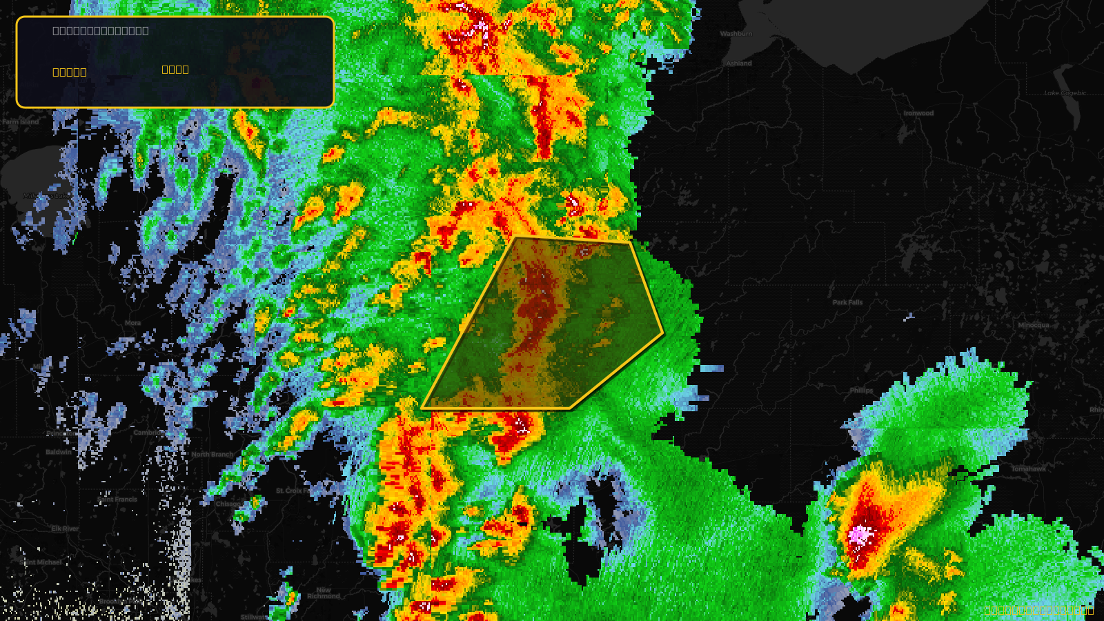
Severe Thunderstorm Warning issued April 17 at 2:53PM CDT until April 17 at 4:00PM CDT by NWS Duluth MN
Wisconsin
Pull this lead list →Pre-loads ~9,112 residential properties into Step 2 for zone selection.
✓Counts inside actual storm footprint· 7.9% of NWS polygon hit
Storm Score
20
🏠 Residential
9,112
🏢 Commercial
520
Total properties
9,632
Estimated roofing opportunity🔴 Zones 1 & 2
💰 ~$4.5M
Conservative estimate at 10% claim rate, scoped to the damage zone (core + inner — ~40% of the warning polygon): 🏠 ~3,645 residential · 🏢 ~208 commercial. Industry-low claim values ($10K residential / $40K commercial).
NWS intensity
🧊 1.25"Hail💨 60MPHRadar indicatedIntensity Score 25/100
Issued
Apr 17, 7:53 PM UTC
Expires
Apr 17, 9:00 PM UTC
Event type
Severe Thunderstorm Warning
Affected areas (3)
Burnett, WISawyer, WIWashburn, WI
ID: urn:oid:2.49.0.1.840.0.f1589846a6260279fd403f3b57050eb175176733.001.1Centroid: 45.912, -91.630