SevereThunderstorm★ Peak frameCaptured 2d ago
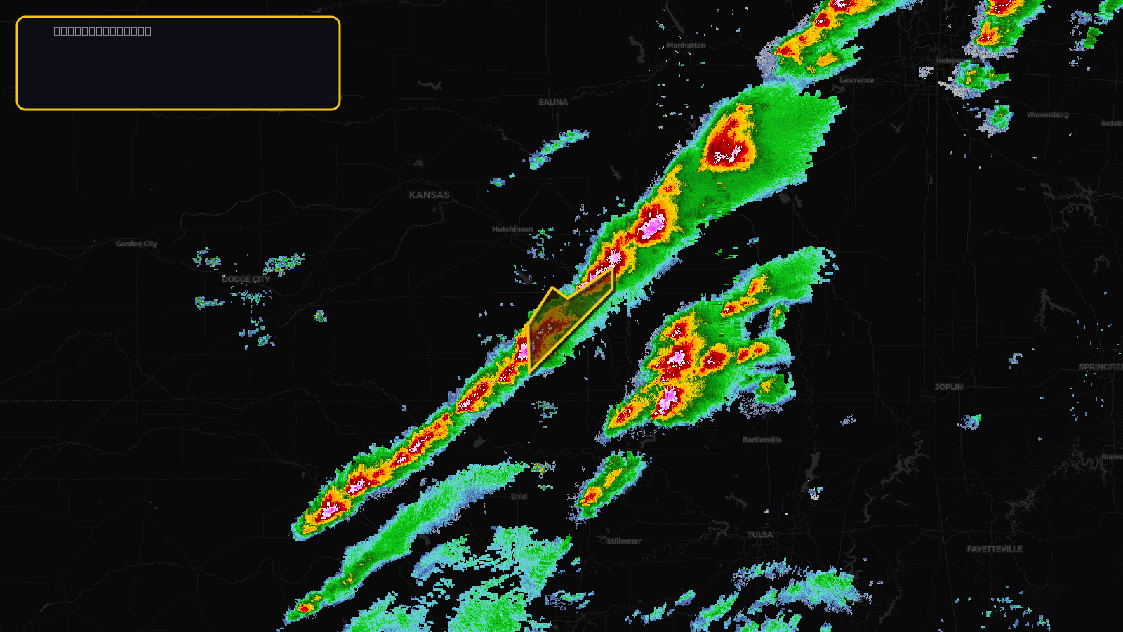
Severe Thunderstorm Warning issued April 17 at 2:22PM CDT until April 17 at 3:00PM CDT by NWS Wichita KS
Kansas
Pull this lead list →Pre-loads ~95,317 residential properties into Step 2 for zone selection.
✓Counts inside actual storm footprint· 12.3% of NWS polygon hit
Storm Score
13
🏠 Residential
95,317
🏢 Commercial
8,515
Total properties
103,832
Estimated roofing opportunity🔴 Zones 1 & 2
💰 ~$52M
Conservative estimate at 10% claim rate, scoped to the damage zone (core + inner — ~40% of the warning polygon): 🏠 ~38,127 residential · 🏢 ~3,406 commercial. Industry-low claim values ($10K residential / $40K commercial).
NWS intensity
🧊 1"Hail💨 60MPHRadar indicatedIntensity Score 13/100
Issued
Apr 17, 7:22 PM UTC
Expires
Apr 17, 8:00 PM UTC
Event type
Severe Thunderstorm Warning
Affected areas (2)
Sedgwick, KSSumner, KS
ID: urn:oid:2.49.0.1.840.0.eff6415541e34ab93d1de16e1adabf3bcb921562.001.1Centroid: 37.521, -97.547