Very SevereThunderstorm★ Peak frameCaptured 2d ago
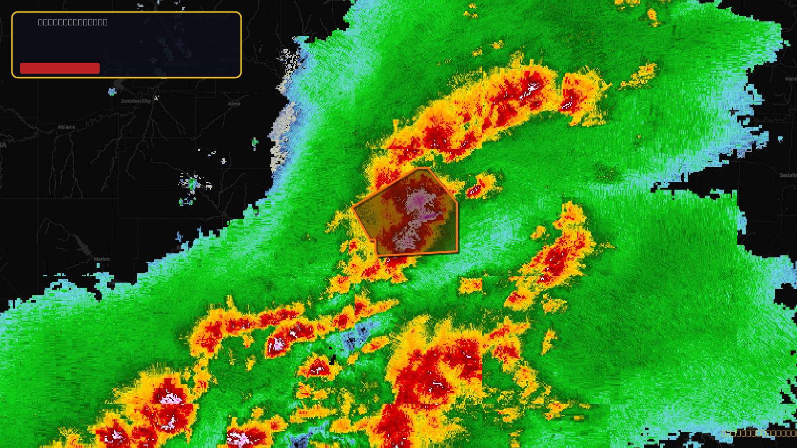
Severe Thunderstorm Warning issued April 17 at 4:22PM CDT until April 17 at 4:45PM CDT by NWS Topeka KS
Kansas
Pull this lead list →Pre-loads ~8,678 residential properties into Step 2 for zone selection.
✓Counts inside actual storm footprint· 20.7% of NWS polygon hit
Storm Score
64
🏠 Residential
8,678
🏢 Commercial
683
Total properties
9,361
Estimated roofing opportunity🔴 Zones 1 & 2
💰 ~$10M
Conservative estimate at 22% claim rate, scoped to the damage zone (core + inner — ~40% of the warning polygon): 🏠 ~3,471 residential · 🏢 ~273 commercial. Industry-low claim values ($10K residential / $40K commercial).
NWS intensity
🧊 0.88"Hail💨 80MPHRadar indicated⚠ DestructiveIntensity Score 33/100
Issued
Apr 17, 9:22 PM UTC
Expires
Apr 17, 9:45 PM UTC
Event type
Severe Thunderstorm Warning
Affected areas (3)
Anderson, KSFranklin, KSOsage, KS
ID: urn:oid:2.49.0.1.840.0.ef781d1a9fe92f4611683aacc5d74a0a9a494fb8.001.1Centroid: 38.498, -95.382