SevereThunderstorm★ Peak frameCaptured 2d ago
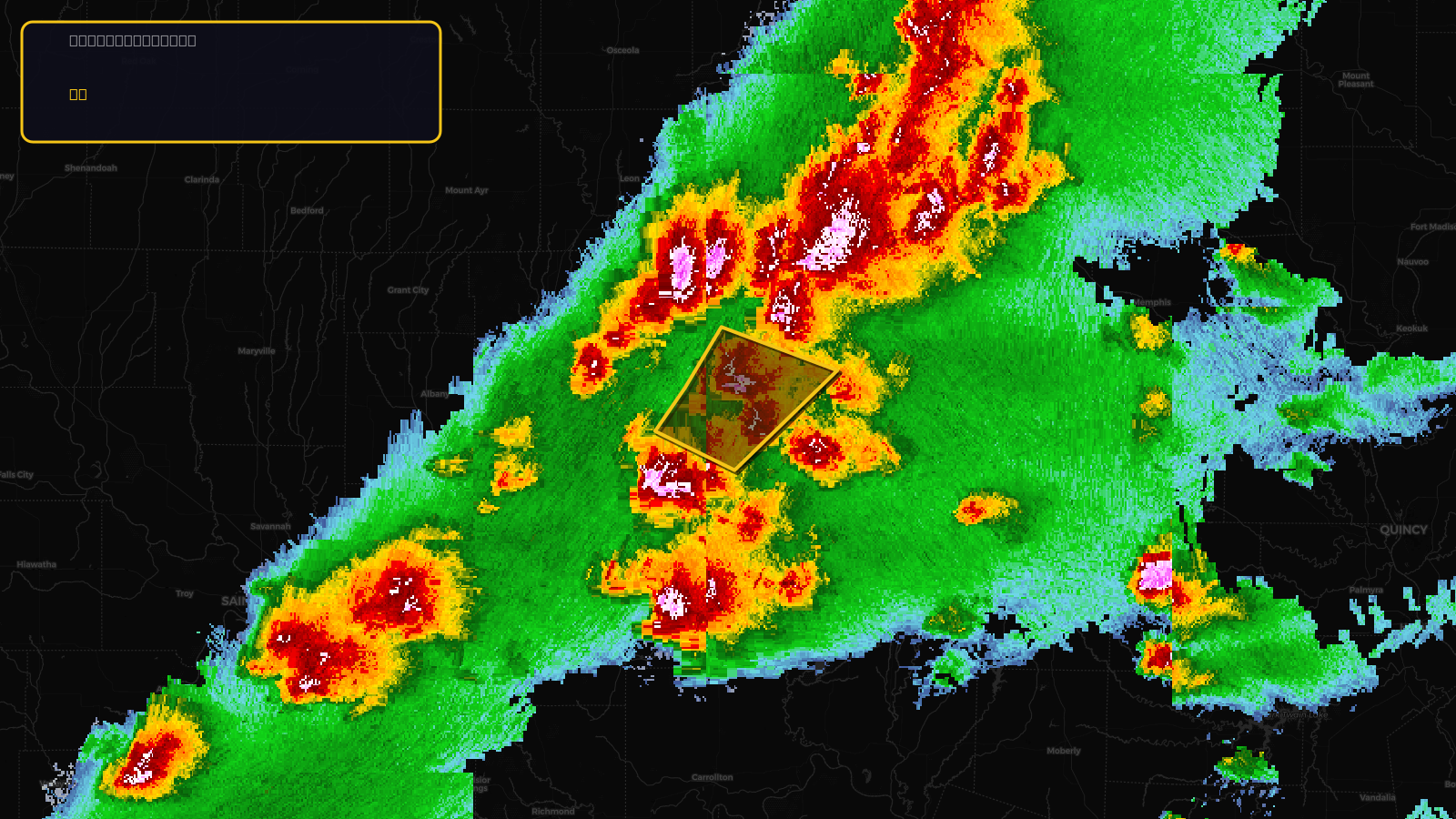
Severe Thunderstorm Warning issued April 17 at 3:33PM CDT until April 17 at 4:00PM CDT by NWS Kansas City/Pleasant Hill MO
Missouri
Pull this lead list →Pre-loads ~519 residential properties into Step 2 for zone selection.
✓Counts inside actual storm footprint· 17.5% of NWS polygon hit
Storm Score
13
🏠 Residential
519
🏢 Commercial
12
Total properties
531
Estimated roofing opportunity🔴 Zones 1 & 2
💰 ~$228K
Conservative estimate at 10% claim rate, scoped to the damage zone (core + inner — ~40% of the warning polygon): 🏠 ~208 residential · 🏢 ~5 commercial. Industry-low claim values ($10K residential / $40K commercial).
NWS intensity
🧊 1"Hail💨 60MPHRadar indicatedIntensity Score 13/100
Issued
Apr 17, 8:33 PM UTC
Expires
Apr 17, 9:00 PM UTC
Event type
Severe Thunderstorm Warning
Affected areas (3)
Grundy, MOMercer, MOSullivan, MO
ID: urn:oid:2.49.0.1.840.0.eb589687073d2e8f37f0fa632165523d5e26fd29.001.1Centroid: 40.210, -93.450