SevereThunderstorm★ Peak frameCaptured 2d ago
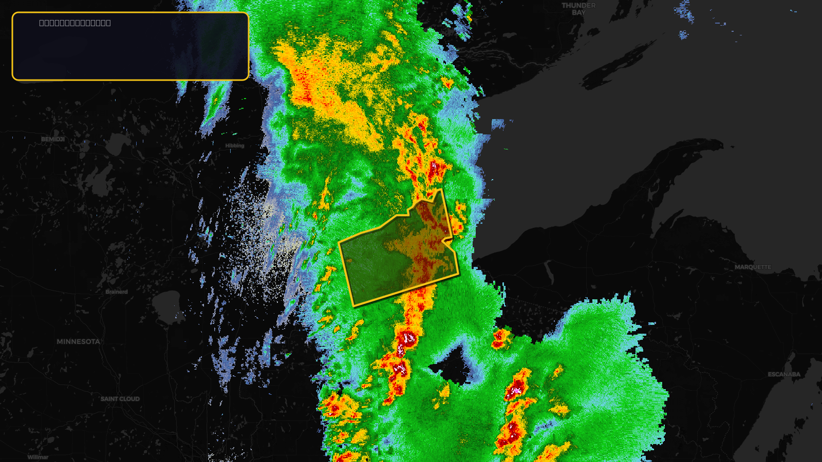
Severe Thunderstorm Warning issued April 17 at 3:27PM CDT until April 17 at 4:30PM CDT by NWS Duluth MN
Wisconsin
Pull this lead list →Pre-loads ~15,965 residential properties into Step 2 for zone selection.
✓Counts inside actual storm footprint· 6.2% of NWS polygon hit
Storm Score
10
🏠 Residential
15,965
🏢 Commercial
957
Total properties
16,922
Estimated roofing opportunity🔴 Zones 1 & 2
💰 ~$7.9M
Conservative estimate at 10% claim rate, scoped to the damage zone (core + inner — ~40% of the warning polygon): 🏠 ~6,386 residential · 🏢 ~383 commercial. Industry-low claim values ($10K residential / $40K commercial).
NWS intensity
🧊 0.88"Hail💨 60MPHRadar indicatedIntensity Score 10/100
Issued
Apr 17, 8:27 PM UTC
Expires
Apr 17, 9:30 PM UTC
Event type
Severe Thunderstorm Warning
Affected areas (3)
Ashland, WIBayfield, WIDouglas, WI
ID: urn:oid:2.49.0.1.840.0.e8e455f034c015dfd4151e908dfdb6273b84c772.001.1Centroid: 46.804, -91.054