SevereThunderstorm★ Peak frameCaptured 2d ago
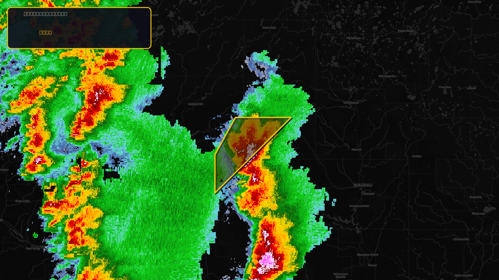
Severe Thunderstorm Warning issued April 17 at 2:36PM CDT until April 17 at 3:15PM CDT by NWS La Crosse WI
Wisconsin
Pull this lead list →Pre-loads ~1,523 residential properties into Step 2 for zone selection.
✓Counts inside actual storm footprint· 13.2% of NWS polygon hit
Storm Score
10
🏠 Residential
1,523
🏢 Commercial
78
Total properties
1,601
Estimated roofing opportunity🔴 Zones 1 & 2
💰 ~$733K
Conservative estimate at 10% claim rate, scoped to the damage zone (core + inner — ~40% of the warning polygon): 🏠 ~609 residential · 🏢 ~31 commercial. Industry-low claim values ($10K residential / $40K commercial).
NWS intensity
🧊 1"HailRadar indicatedIntensity Score 10/100
Issued
Apr 17, 7:36 PM UTC
Expires
Apr 17, 8:15 PM UTC
Event type
Severe Thunderstorm Warning
Affected areas (2)
Clark, WITaylor, WI
ID: urn:oid:2.49.0.1.840.0.e691b704dbe7676620f20e2fe6ed68daa8c2e05c.001.1Centroid: 45.240, -90.626