SevereThunderstorm★ Peak frameCaptured 2d ago
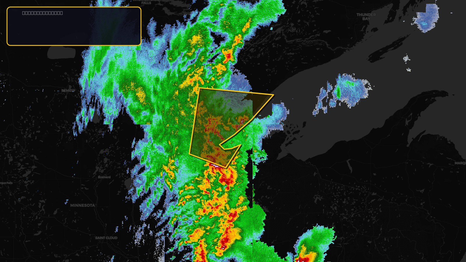
Severe Thunderstorm Warning issued April 17 at 2:44PM CDT until April 17 at 3:45PM CDT by NWS Duluth MN
Minnesota, Wisconsin
Pull this lead list →Pre-loads ~68,400 residential properties into Step 2 for zone selection.
✓Counts inside actual storm footprint· 3.2% of NWS polygon hit
Storm Score
13
🏠 Residential
68,400
🏢 Commercial
3,571
Total properties
71,971
Estimated roofing opportunity🔴 Zones 1 & 2
💰 ~$33M
Conservative estimate at 10% claim rate, scoped to the damage zone (core + inner — ~40% of the warning polygon): 🏠 ~27,360 residential · 🏢 ~1,428 commercial. Industry-low claim values ($10K residential / $40K commercial).
NWS intensity
🧊 1"Hail💨 60MPHRadar indicatedIntensity Score 13/100
Issued
Apr 17, 7:44 PM UTC
Expires
Apr 17, 8:45 PM UTC
Event type
Severe Thunderstorm Warning
Affected areas (4)
Carlton, MNLake, MNSt. Louis, MNDouglas, WI
ID: urn:oid:2.49.0.1.840.0.e3e950b8f1395d8fcc338555921cafd8e64f9243.001.1Centroid: 46.955, -91.775