Very SevereThunderstorm★ Peak frameCaptured 2d ago
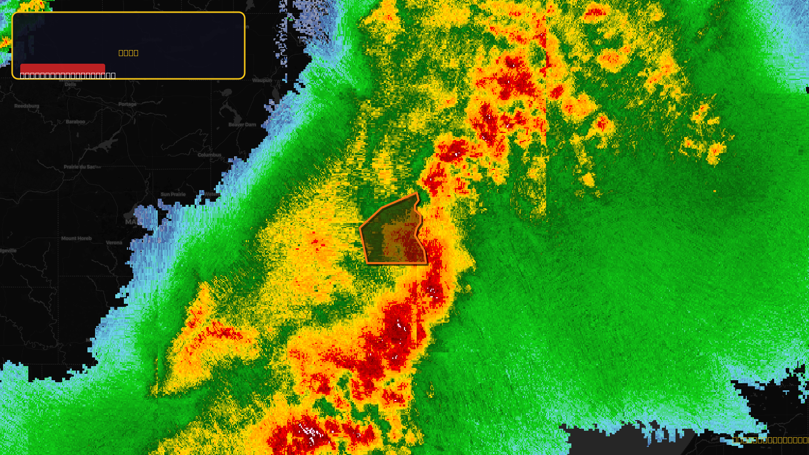
Severe Thunderstorm Warning issued April 17 at 8:12PM CDT until April 17 at 9:00PM CDT by NWS Milwaukee/Sullivan WI
Wisconsin
Pull this lead list →Pre-loads ~119,250 residential properties into Step 2 for zone selection.
✓Counts inside actual storm footprint· 13.6% of NWS polygon hit
Storm Score
29
🏠 Residential
119,250
🏢 Commercial
9,595
Total properties
128,845
Estimated roofing opportunity🔴 Zones 1 & 2
💰 ~$139M
Conservative estimate at 22% claim rate, scoped to the damage zone (core + inner — ~40% of the warning polygon): 🏠 ~47,700 residential · 🏢 ~3,838 commercial. Industry-low claim values ($10K residential / $40K commercial).
NWS intensity
🧊 0.88"Hail💨 70MPHRadar indicated⚠ ConsiderableIntensity Score 29/100
Issued
Apr 18, 1:12 AM UTC
Expires
Apr 18, 2:00 AM UTC
Event type
Severe Thunderstorm Warning
Affected areas (2)
Milwaukee, WIWaukesha, WI
ID: urn:oid:2.49.0.1.840.0.e3b8c6d39d3f05ca0c56d1b89e8178d1fa101170.001.1Centroid: 43.051, -87.956