SevereThunderstorm★ Peak frameCaptured 2d ago
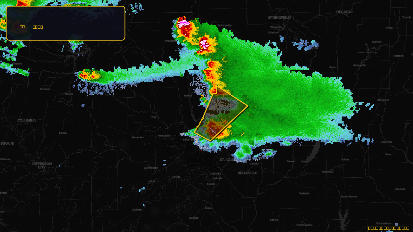
Severe Thunderstorm Warning issued April 17 at 4:11PM CDT until April 17 at 5:00PM CDT by NWS St Louis MO
Illinois, Missouri
Pull this lead list →Pre-loads ~14,606 residential properties into Step 2 for zone selection.
✓Counts inside actual storm footprint· 6.1% of NWS polygon hit
Storm Score
13
🏠 Residential
14,606
🏢 Commercial
486
Total properties
15,092
Estimated roofing opportunity🔴 Zones 1 & 2
💰 ~$6.6M
Conservative estimate at 10% claim rate, scoped to the damage zone (core + inner — ~40% of the warning polygon): 🏠 ~5,842 residential · 🏢 ~194 commercial. Industry-low claim values ($10K residential / $40K commercial).
NWS intensity
🧊 1"Hail💨 60MPHRadar indicatedIntensity Score 13/100
Issued
Apr 17, 9:11 PM UTC
Expires
Apr 17, 10:00 PM UTC
Event type
Severe Thunderstorm Warning
Affected areas (5)
Jersey, ILMacoupin, ILMadison, ILSt. Charles, MOSt. Louis, MO
ID: urn:oid:2.49.0.1.840.0.e1f621e4cc22056568f0c1feaba02476cde38ed9.001.1Centroid: 38.986, -90.419