Very SevereThunderstorm★ Peak frameCaptured 2d ago
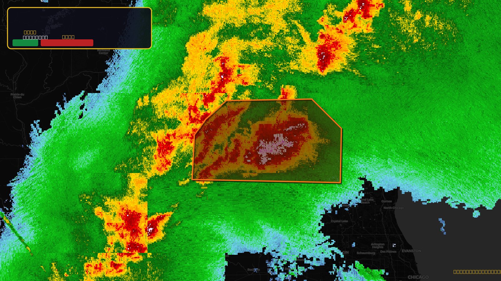
Severe Thunderstorm Warning issued April 17 at 5:25PM CDT until April 17 at 6:30PM CDT by NWS Milwaukee/Sullivan WI
Wisconsin
Pull this lead list →Pre-loads ~105,100 residential properties into Step 2 for zone selection.
✓Counts inside actual storm footprint· 15.9% of NWS polygon hit
Storm Score
40
🏠 Residential
105,100
🏢 Commercial
6,982
Total properties
112,082
Estimated roofing opportunity🔴 Zones 1 & 2
💰 ~$117M
Conservative estimate at 22% claim rate, scoped to the damage zone (core + inner — ~40% of the warning polygon): 🏠 ~42,040 residential · 🏢 ~2,793 commercial. Industry-low claim values ($10K residential / $40K commercial).
NWS intensity
🧊 1.5"Hail💨 70MPH✓ Observed (ground-truth)⚠ ConsiderableIntensity Score 40/100
Issued
Apr 17, 10:25 PM UTC
Expires
Apr 17, 11:30 PM UTC
Event type
Severe Thunderstorm Warning
Affected areas (6)
Dane, WIGreen, WIJefferson, WIRock, WIWalworth, WIWaukesha, WI
ID: urn:oid:2.49.0.1.840.0.df827f984df153a692bd315818f44386cd1015b1.001.1Centroid: 42.763, -89.098