SevereThunderstorm★ Peak frameCaptured 2d ago
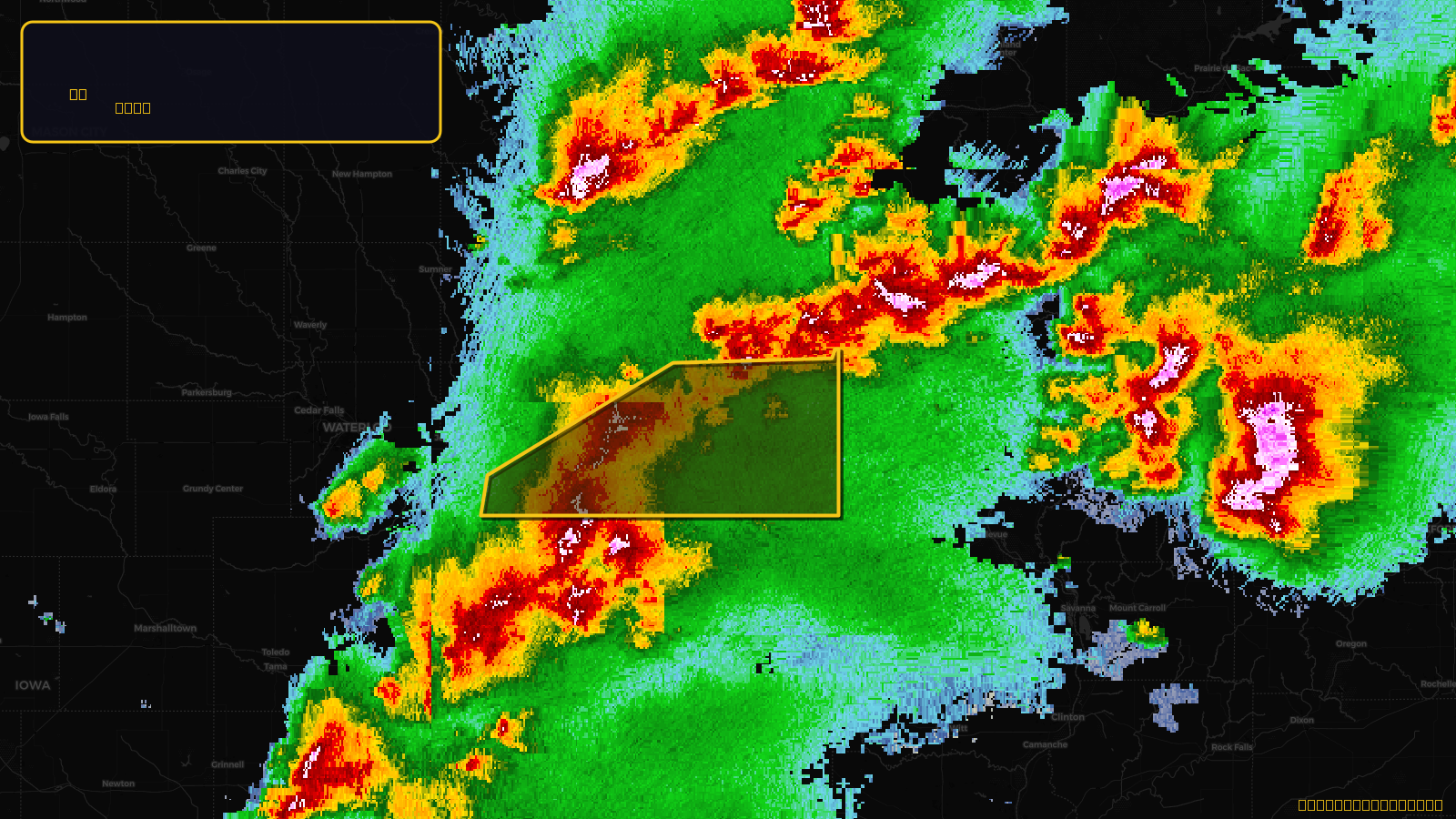
Severe Thunderstorm Warning issued April 17 at 4:00PM CDT until April 17 at 5:00PM CDT by NWS Quad Cities IA IL
Iowa
Pull this lead list →Pre-loads ~7,686 residential properties into Step 2 for zone selection.
✓Counts inside actual storm footprint· 8.5% of NWS polygon hit
Storm Score
13
🏠 Residential
7,686
🏢 Commercial
894
Total properties
8,580
Estimated roofing opportunity🔴 Zones 1 & 2
💰 ~$4.5M
Conservative estimate at 10% claim rate, scoped to the damage zone (core + inner — ~40% of the warning polygon): 🏠 ~3,074 residential · 🏢 ~358 commercial. Industry-low claim values ($10K residential / $40K commercial).
NWS intensity
🧊 1"Hail💨 60MPHRadar indicatedIntensity Score 13/100
Issued
Apr 17, 9:00 PM UTC
Expires
Apr 17, 10:00 PM UTC
Event type
Severe Thunderstorm Warning
Affected areas (3)
Buchanan, IADelaware, IADubuque, IA
ID: urn:oid:2.49.0.1.840.0.dd0f777361f50b65525ac26e2e165de59634ab2c.001.1Centroid: 42.536, -91.214