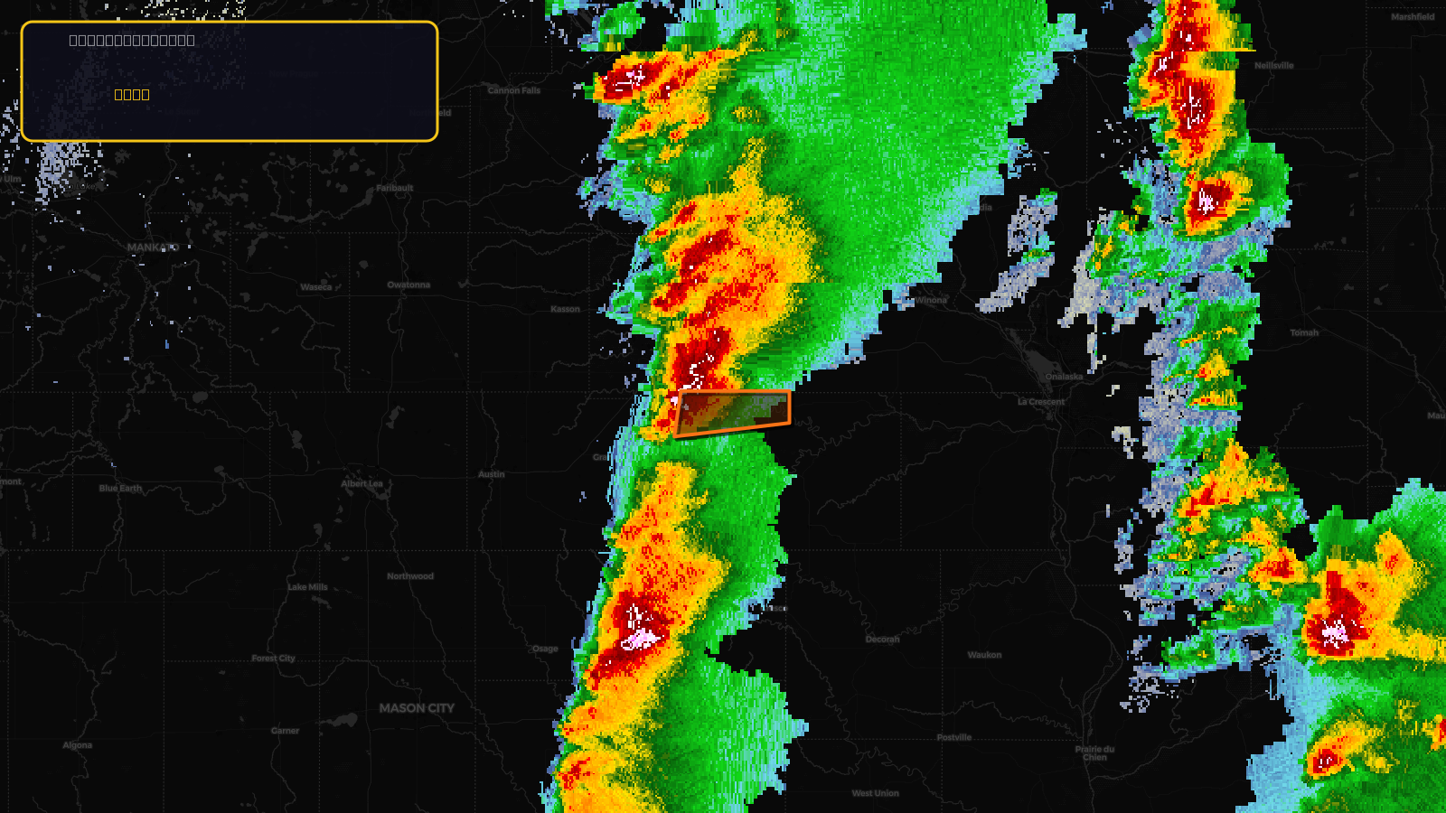
Very SevereTornado★ Peak frameCaptured 2d ago
Tornado Warning issued April 17 at 2:36PM CDT until April 17 at 3:00PM CDT by NWS La Crosse WI
Minnesota
Pull this lead list →Pre-loads ~92 residential properties into Step 2 for zone selection.
✓Counts inside actual storm footprint· 9.6% of NWS polygon hit
Storm Score
30
🏠 Residential
92
🏢 Commercial
0
Total properties
92
Estimated roofing opportunity🔴 Zones 1 & 2
💰 ~$81K
Conservative estimate at 22% claim rate, scoped to the damage zone (core + inner — ~40% of the warning polygon): 🏠 ~37 residential · 🏢 ~0 commercial. Industry-low claim values ($10K residential / $40K commercial).
NWS intensity
🧊 1"HailIntensity Score 10/100
Issued
Apr 17, 7:36 PM UTC
Expires
Apr 17, 8:00 PM UTC
Event type
Tornado Warning
Affected areas (1)
Fillmore, MN
ID: urn:oid:2.49.0.1.840.0.dc8cb4d187181263f6b8bef55b890409c6663bad.001.1Centroid: 43.816, -92.272