Very SevereThunderstorm★ Peak frameCaptured 2d ago
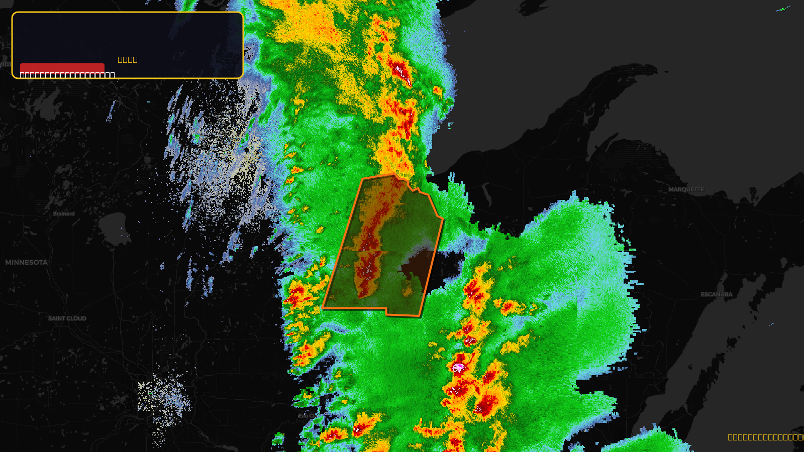
Severe Thunderstorm Warning issued April 17 at 4:14PM CDT until April 17 at 5:15PM CDT by NWS Duluth MN
Wisconsin
Pull this lead list →Pre-loads ~5,253 residential properties into Step 2 for zone selection.
✓Counts inside actual storm footprint· 5.8% of NWS polygon hit
Storm Score
44
🏠 Residential
5,253
🏢 Commercial
210
Total properties
5,463
Estimated roofing opportunity🔴 Zones 1 & 2
💰 ~$5.4M
Conservative estimate at 22% claim rate, scoped to the damage zone (core + inner — ~40% of the warning polygon): 🏠 ~2,101 residential · 🏢 ~84 commercial. Industry-low claim values ($10K residential / $40K commercial).
NWS intensity
🧊 0.88"Hail💨 70MPHRadar indicated⚠ ConsiderableIntensity Score 21/100
Issued
Apr 17, 9:14 PM UTC
Expires
Apr 17, 10:15 PM UTC
Event type
Severe Thunderstorm Warning
Affected areas (5)
Ashland, WIBayfield, WIIron, WIPrice, WISawyer, WI
ID: urn:oid:2.49.0.1.840.0.d51832622bc1cfd394016856501881418892630d.001.1Centroid: 46.264, -90.506