SevereTornado★ Peak frameCaptured 2d ago
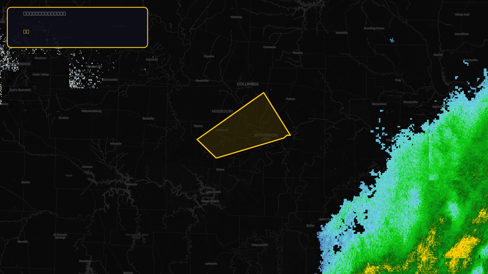
Tornado Warning issued April 17 at 7:42PM CDT until April 17 at 8:30PM CDT by NWS St Louis MO
Missouri
Pull this lead list →Pre-loads ~35,872 residential properties into Step 2 for zone selection.
⚠Counts inside NWS warning area· storm hadn’t entered polygon at capture
Storm Score
25
🏠 Residential
35,872
🏢 Commercial
2,409
Total properties
38,281
Estimated roofing opportunity🔴 Zones 1 & 2
💰 ~$18M
Conservative estimate at 10% claim rate, scoped to the damage zone (core + inner — ~40% of the warning polygon): 🏠 ~14,349 residential · 🏢 ~964 commercial. Industry-low claim values ($10K residential / $40K commercial).
NWS intensity
🧊 1"HailIntensity Score 25/100
Issued
Apr 18, 12:42 AM UTC
Expires
Apr 18, 1:30 AM UTC
Event type
Tornado Warning
Affected areas (4)
Boone, MOCallaway, MOCole, MOMoniteau, MO
ID: urn:oid:2.49.0.1.840.0.d3bd88db09f493b18232818eb6a1efc8e410b297.001.1Centroid: 38.578, -92.367