SevereThunderstorm★ Peak frameCaptured 2d ago
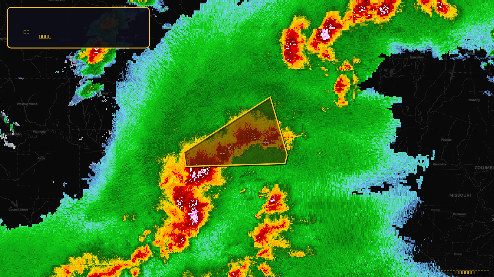
Severe Thunderstorm Warning issued April 17 at 4:44PM CDT until April 17 at 5:30PM CDT by NWS Kansas City/Pleasant Hill MO
Kansas, Missouri
Pull this lead list →Pre-loads ~287,412 residential properties into Step 2 for zone selection.
✓Counts inside actual storm footprint· 19.6% of NWS polygon hit
Storm Score
11
🏠 Residential
287,412
🏢 Commercial
20,209
Total properties
307,621
Estimated roofing opportunity🔴 Zones 1 & 2
💰 ~$147M
Conservative estimate at 10% claim rate, scoped to the damage zone (core + inner — ~40% of the warning polygon): 🏠 ~114,965 residential · 🏢 ~8,084 commercial. Industry-low claim values ($10K residential / $40K commercial).
NWS intensity
🧊 1"Hail💨 60MPHRadar indicatedIntensity Score 11/100
Issued
Apr 17, 9:44 PM UTC
Expires
Apr 17, 10:30 PM UTC
Event type
Severe Thunderstorm Warning
Affected areas (7)
Johnson, KSLeavenworth, KSWyandotte, KSClay, MOJackson, MOPlatte, MORay, MO
ID: urn:oid:2.49.0.1.840.0.cf07c346ad978a015c3e896517893aa21593280d.001.1Centroid: 39.153, -94.457