SevereThunderstorm★ Peak frameCaptured 2d ago
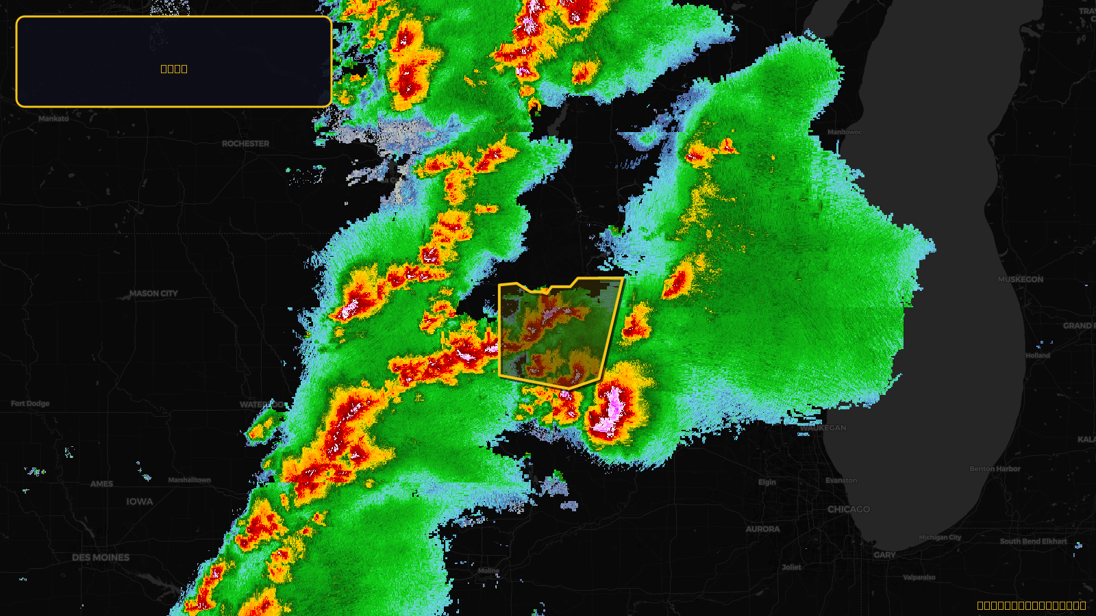
Severe Thunderstorm Warning issued April 17 at 4:07PM CDT until April 17 at 4:45PM CDT by NWS Milwaukee/Sullivan WI
Wisconsin
Pull this lead list →Pre-loads ~10,276 residential properties into Step 2 for zone selection.
✓Counts inside actual storm footprint· 7.8% of NWS polygon hit
Storm Score
20
🏠 Residential
10,276
🏢 Commercial
970
Total properties
11,246
Estimated roofing opportunity🔴 Zones 1 & 2
💰 ~$5.7M
Conservative estimate at 10% claim rate, scoped to the damage zone (core + inner — ~40% of the warning polygon): 🏠 ~4,110 residential · 🏢 ~388 commercial. Industry-low claim values ($10K residential / $40K commercial).
NWS intensity
🧊 1.25"Hail💨 60MPHRadar indicatedIntensity Score 25/100
Issued
Apr 17, 9:07 PM UTC
Expires
Apr 17, 9:45 PM UTC
Event type
Severe Thunderstorm Warning
Affected areas (4)
Dane, WIGreen, WIIowa, WILafayette, WI
ID: urn:oid:2.49.0.1.840.0.ced240ec3560a6b65590a249382f3330f04adb24.001.1Centroid: 43.065, -90.039