SevereThunderstorm★ Peak frameCaptured 2d ago
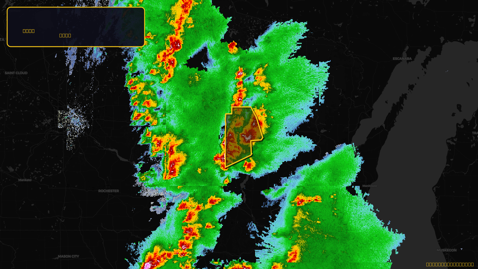
Severe Thunderstorm Warning issued April 17 at 2:53PM CDT until April 17 at 4:15PM CDT by NWS Green Bay WI
Wisconsin
Pull this lead list →Pre-loads ~21,437 residential properties into Step 2 for zone selection.
✓Counts inside actual storm footprint· 13.8% of NWS polygon hit
Storm Score
20
🏠 Residential
21,437
🏢 Commercial
1,771
Total properties
23,208
Estimated roofing opportunity🔴 Zones 1 & 2
💰 ~$11M
Conservative estimate at 10% claim rate, scoped to the damage zone (core + inner — ~40% of the warning polygon): 🏠 ~8,575 residential · 🏢 ~708 commercial. Industry-low claim values ($10K residential / $40K commercial).
NWS intensity
🧊 1.5"Hail💨 60MPHRadar indicatedIntensity Score 34/100
Issued
Apr 17, 7:53 PM UTC
Expires
Apr 17, 9:15 PM UTC
Event type
Severe Thunderstorm Warning
Affected areas (2)
Marathon, WIWood, WI
ID: urn:oid:2.49.0.1.840.0.ccf571a6efcf0ad676ef4f4fd3c59fab0637c849.001.1Centroid: 44.761, -90.067