SevereThunderstorm★ Peak frameCaptured 2d ago
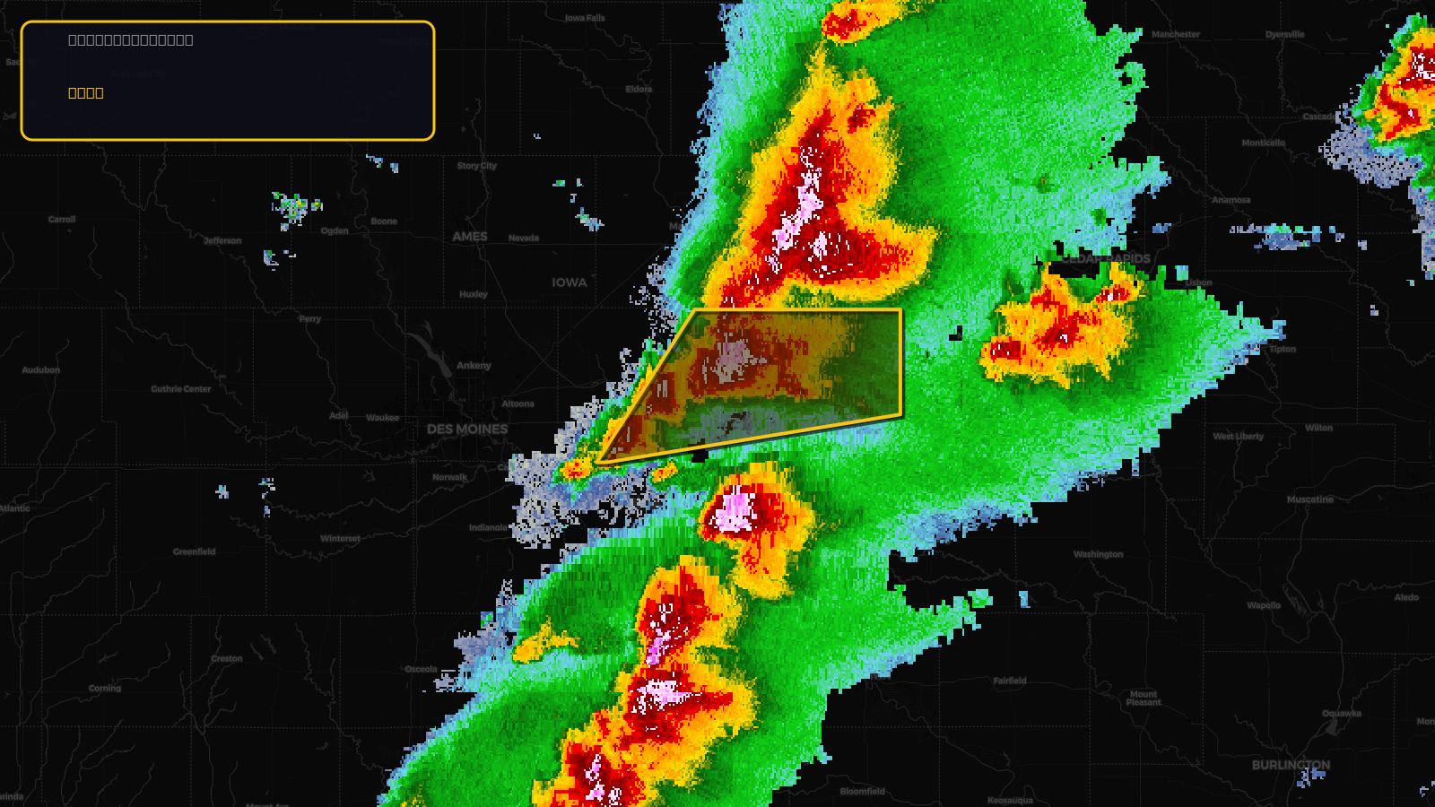
Severe Thunderstorm Warning issued April 17 at 3:15PM CDT until April 17 at 4:00PM CDT by NWS Des Moines IA
Iowa
Pull this lead list →Pre-loads ~11,251 residential properties into Step 2 for zone selection.
✓Counts inside actual storm footprint· 12.1% of NWS polygon hit
Storm Score
20
🏠 Residential
11,251
🏢 Commercial
1,085
Total properties
12,336
Estimated roofing opportunity🔴 Zones 1 & 2
💰 ~$6.2M
Conservative estimate at 10% claim rate, scoped to the damage zone (core + inner — ~40% of the warning polygon): 🏠 ~4,500 residential · 🏢 ~434 commercial. Industry-low claim values ($10K residential / $40K commercial).
NWS intensity
🧊 1.5"Hail💨 60MPHRadar indicatedIntensity Score 34/100
Issued
Apr 17, 8:15 PM UTC
Expires
Apr 17, 9:00 PM UTC
Event type
Severe Thunderstorm Warning
Affected areas (2)
Jasper, IAPoweshiek, IA
ID: urn:oid:2.49.0.1.840.0.c8f2ced7e9b79556ea5fa3940a2eae07aa01abd2.001.1Centroid: 41.645, -92.860