SevereThunderstorm★ Peak frameCaptured 2d ago
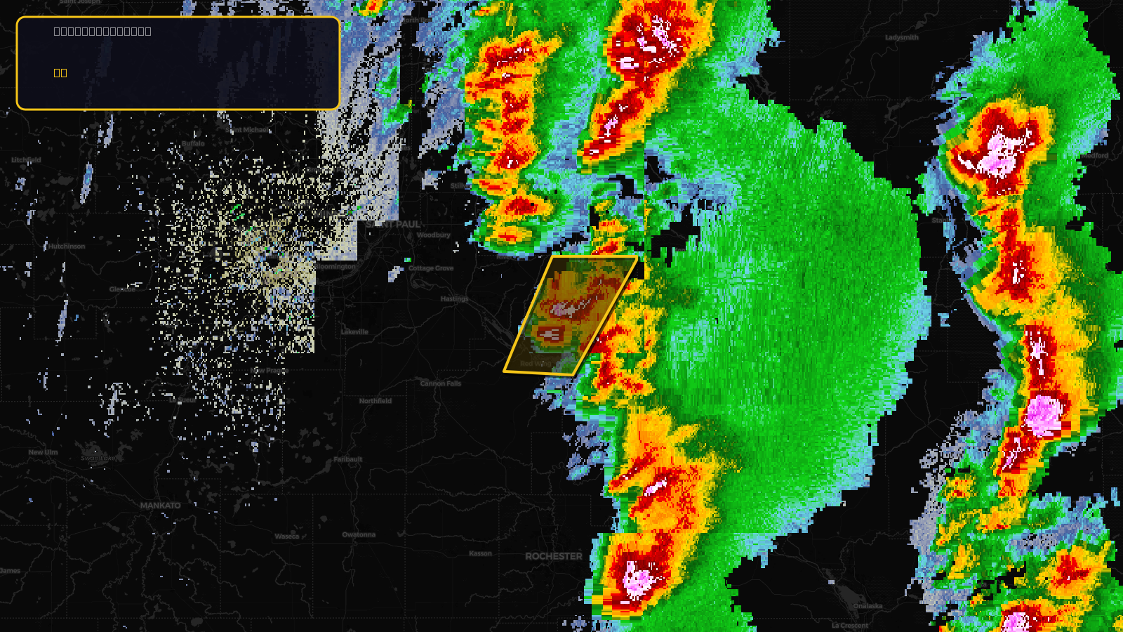
Severe Thunderstorm Warning issued April 17 at 2:42PM CDT until April 17 at 3:15PM CDT by NWS Twin Cities/Chanhassen MN
Minnesota, Wisconsin
Pull this lead list →Pre-loads ~2,811 residential properties into Step 2 for zone selection.
✓Counts inside actual storm footprint· 11.4% of NWS polygon hit
Storm Score
10
🏠 Residential
2,811
🏢 Commercial
208
Total properties
3,019
Estimated roofing opportunity🔴 Zones 1 & 2
💰 ~$1.5M
Conservative estimate at 10% claim rate, scoped to the damage zone (core + inner — ~40% of the warning polygon): 🏠 ~1,124 residential · 🏢 ~83 commercial. Industry-low claim values ($10K residential / $40K commercial).
NWS intensity
🧊 1"HailRadar indicatedIntensity Score 10/100
Issued
Apr 17, 7:42 PM UTC
Expires
Apr 17, 8:15 PM UTC
Event type
Severe Thunderstorm Warning
Affected areas (2)
Goodhue, MNPierce, WI
ID: urn:oid:2.49.0.1.840.0.c7ec680dba9397f018995bd9f8511f159eaaedac.001.1Centroid: 44.694, -92.434