SevereThunderstorm★ Peak frameCaptured 2d ago
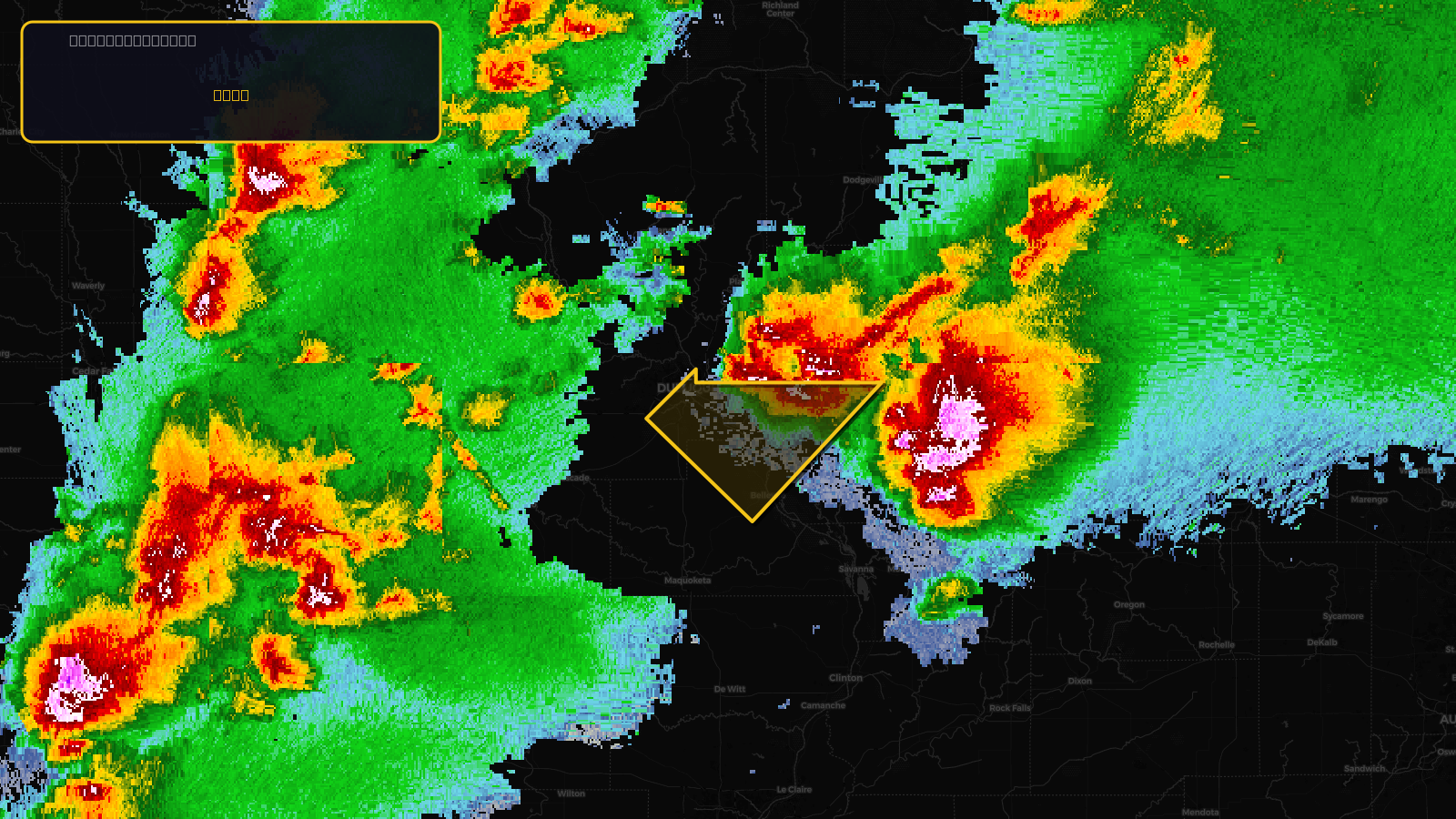
Severe Thunderstorm Warning issued April 17 at 3:25PM CDT until April 17 at 4:00PM CDT by NWS Quad Cities IA IL
Illinois, Iowa
Pull this lead list →Pre-loads ~413 residential properties into Step 2 for zone selection.
✓Counts inside actual storm footprint· 6.5% of NWS polygon hit
Storm Score
20
🏠 Residential
413
🏢 Commercial
48
Total properties
461
Estimated roofing opportunity🔴 Zones 1 & 2
💰 ~$241K
Conservative estimate at 10% claim rate, scoped to the damage zone (core + inner — ~40% of the warning polygon): 🏠 ~165 residential · 🏢 ~19 commercial. Industry-low claim values ($10K residential / $40K commercial).
NWS intensity
🧊 1.25"Hail💨 60MPHRadar indicatedIntensity Score 25/100
Issued
Apr 17, 8:25 PM UTC
Expires
Apr 17, 9:00 PM UTC
Event type
Severe Thunderstorm Warning
Affected areas (3)
Jo Daviess, ILDubuque, IAJackson, IA
ID: urn:oid:2.49.0.1.840.0.c44ce784efc98966a102160a619d92ecbf231b23.001.1Centroid: 42.450, -90.543