SevereThunderstorm★ Peak frameCaptured 2d ago
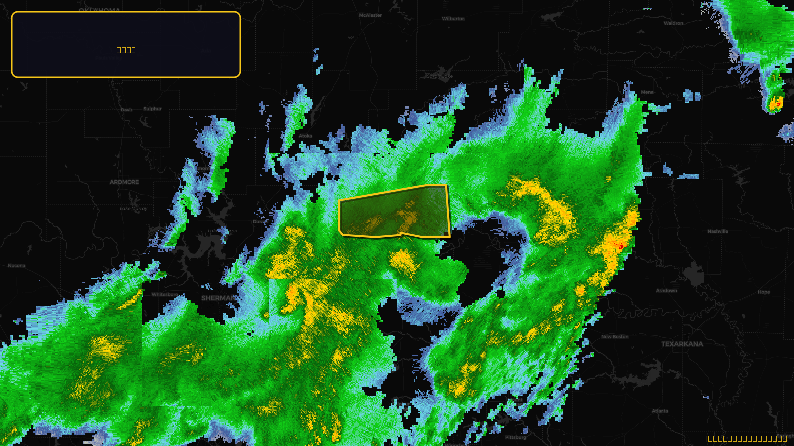
Severe Thunderstorm Warning issued April 18 at 4:42AM CDT until April 18 at 5:30AM CDT by NWS Tulsa OK
Oklahoma
Pull this lead list →Pre-loads ~3,970 residential properties into Step 2 for zone selection.
⚠Counts inside NWS warning area· storm hadn’t entered polygon at capture
Storm Score
15
🏠 Residential
3,970
🏢 Commercial
182
Total properties
4,152
Estimated roofing opportunity🔴 Zones 1 & 2
💰 ~$1.9M
Conservative estimate at 10% claim rate, scoped to the damage zone (core + inner — ~40% of the warning polygon): 🏠 ~1,588 residential · 🏢 ~73 commercial. Industry-low claim values ($10K residential / $40K commercial).
NWS intensity
🧊 1.25"Hail💨 60MPHRadar indicatedIntensity Score 15/100
Issued
Apr 18, 9:42 AM UTC
Expires
Apr 18, 10:30 AM UTC
Event type
Severe Thunderstorm Warning
Affected areas (1)
Choctaw, OK
ID: urn:oid:2.49.0.1.840.0.c02f5243ff4006d65bfe3d2e81cc8262c32cf36e.001.1Centroid: 33.985, -95.621