SevereThunderstorm★ Peak frameCaptured 2d ago
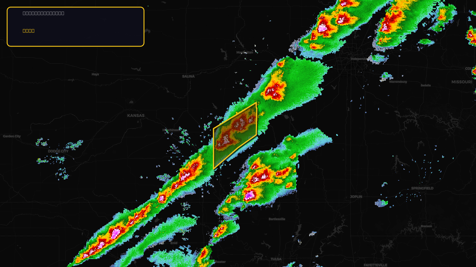
Severe Thunderstorm Warning issued April 17 at 2:55PM CDT until April 17 at 4:00PM CDT by NWS Wichita KS
Kansas
Pull this lead list →Pre-loads ~2,169 residential properties into Step 2 for zone selection.
✓Counts inside actual storm footprint· 12% of NWS polygon hit
Storm Score
20
🏠 Residential
2,169
🏢 Commercial
156
Total properties
2,325
Estimated roofing opportunity🔴 Zones 1 & 2
💰 ~$1.1M
Conservative estimate at 10% claim rate, scoped to the damage zone (core + inner — ~40% of the warning polygon): 🏠 ~868 residential · 🏢 ~62 commercial. Industry-low claim values ($10K residential / $40K commercial).
NWS intensity
🧊 1.5"Hail💨 60MPHRadar indicatedIntensity Score 34/100
Issued
Apr 17, 7:55 PM UTC
Expires
Apr 17, 9:00 PM UTC
Event type
Severe Thunderstorm Warning
Affected areas (4)
Butler, KSChase, KSGreenwood, KSMarion, KS
ID: urn:oid:2.49.0.1.840.0.be54e343649a5fef1a6dff64e1a05b98e8292148.001.1Centroid: 38.009, -96.698