WatchThunderstorm★ Peak frameCaptured 1d ago
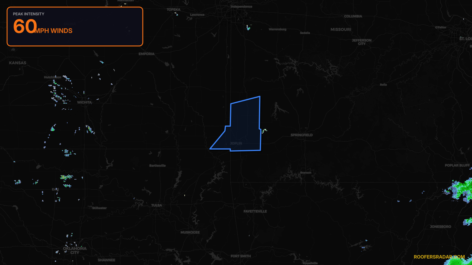
Severe Thunderstorm Warning issued April 17 at 9:22PM CDT until April 17 at 10:00PM CDT by NWS Springfield MO
Kansas, Missouri
Pull this lead list →Pre-loads ~68,925 residential properties into Step 2 for zone selection.
⚠Counts inside NWS warning area· storm hadn’t entered polygon at capture
Storm Score
9
🏠 Residential
68,925
🏢 Commercial
2,199
Total properties
71,124
NWS intensity
💨 60MPHIntensity Score 9/100
Issued
Apr 18, 2:22 AM UTC
Expires
Apr 18, 3:00 AM UTC
Event type
Severe Thunderstorm Warning
Affected areas (5)
Cherokee, KSBarton, MOJasper, MONewton, MOVernon, MO
ID: urn:oid:2.49.0.1.840.0.bdaf621b7e830528b01ee7b00beeb6ff2dc6634b.001.1Centroid: 37.245, -94.513