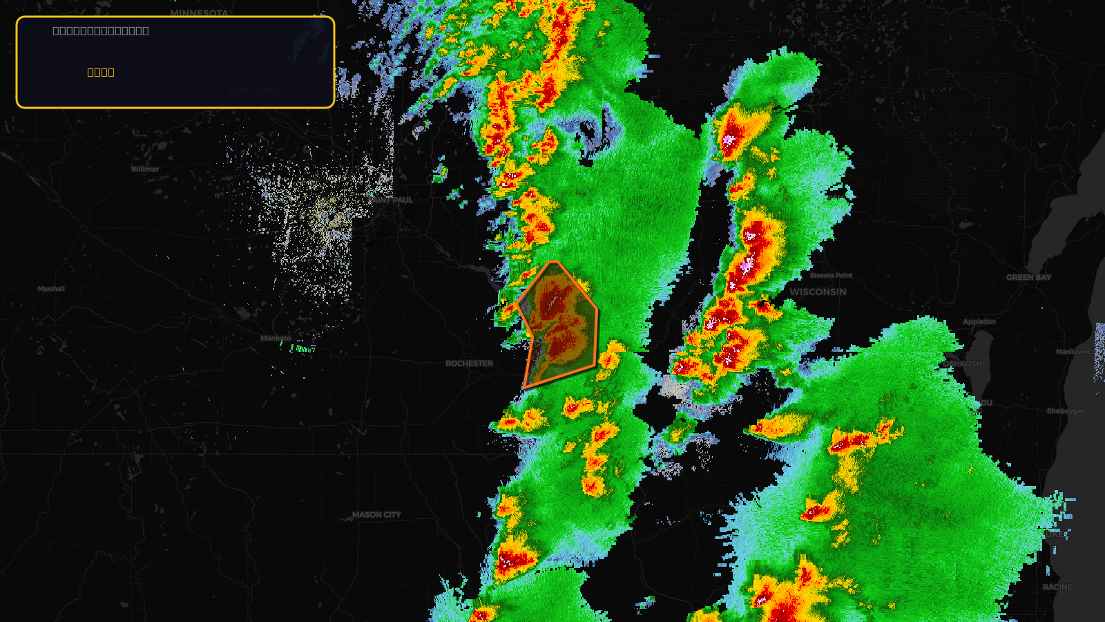
Very SevereTornado★ Peak frameCaptured 2d ago
Tornado Warning issued April 17 at 3:07PM CDT until April 17 at 3:45PM CDT by NWS La Crosse WI
Minnesota, Wisconsin
Pull this lead list →Pre-loads ~7,872 residential properties into Step 2 for zone selection.
✓Counts inside actual storm footprint· 14.6% of NWS polygon hit
Storm Score
30
🏠 Residential
7,872
🏢 Commercial
777
Total properties
8,649
Estimated roofing opportunity🔴 Zones 1 & 2
💰 ~$9.7M
Conservative estimate at 22% claim rate, scoped to the damage zone (core + inner — ~40% of the warning polygon): 🏠 ~3,149 residential · 🏢 ~311 commercial. Industry-low claim values ($10K residential / $40K commercial).
NWS intensity
🧊 1"HailIntensity Score 10/100
Issued
Apr 17, 8:07 PM UTC
Expires
Apr 17, 8:45 PM UTC
Event type
Tornado Warning
Affected areas (4)
Wabasha, MNWinona, MNBuffalo, WITrempealeau, WI
ID: urn:oid:2.49.0.1.840.0.b8f62c9e65f3e20565a80746fa8a85d09737b39d.001.1Centroid: 44.319, -91.803