Very SevereThunderstorm★ Peak frameCaptured 2d ago
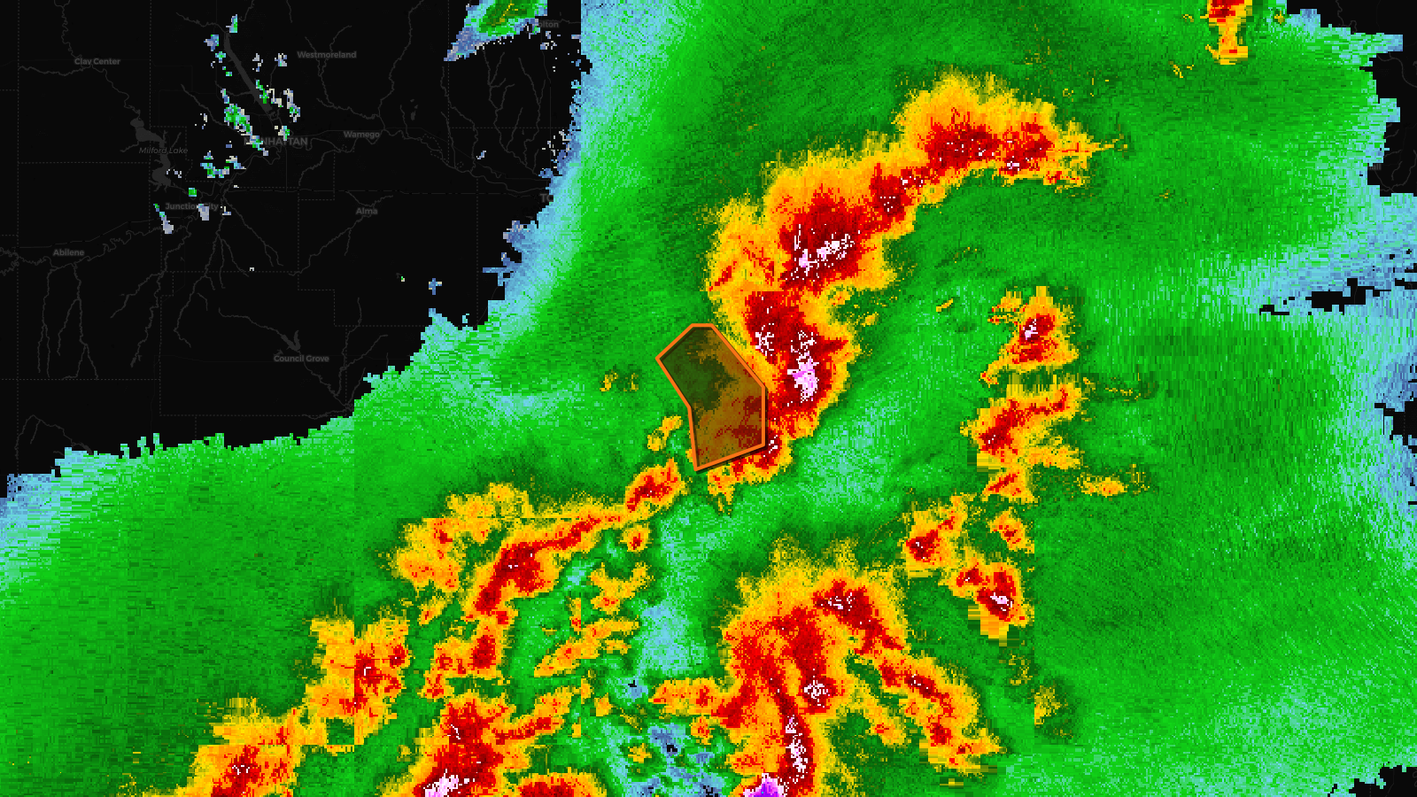
Severe Thunderstorm Warning issued April 17 at 4:44PM CDT until April 17 at 4:45PM CDT by NWS Topeka KS
Kansas
Pull this lead list →Pre-loads ~788 residential properties into Step 2 for zone selection.
✓Counts inside actual storm footprint· 9% of NWS polygon hit
Storm Score
26
🏠 Residential
788
🏢 Commercial
19
Total properties
807
Estimated roofing opportunity🔴 Zones 1 & 2
💰 ~$763K
Conservative estimate at 22% claim rate, scoped to the damage zone (core + inner — ~40% of the warning polygon): 🏠 ~315 residential · 🏢 ~8 commercial. Industry-low claim values ($10K residential / $40K commercial).
Issued
Apr 17, 9:44 PM UTC
Expires
Apr 17, 9:54 PM UTC
Event type
Severe Thunderstorm Warning
Affected areas (1)
Franklin, KS
ID: urn:oid:2.49.0.1.840.0.a91d0432150463e529b7f8561da7d73702017fb0.001.1Centroid: 38.563, -95.230