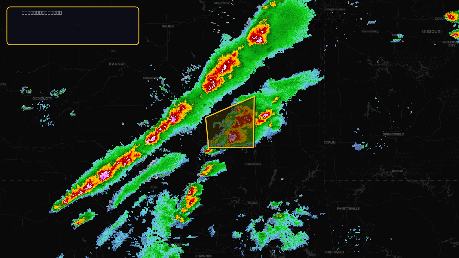
SevereThunderstorm★ Peak frameCaptured 2d ago
Severe Thunderstorm Warning issued April 17 at 2:46PM CDT until April 17 at 3:45PM CDT by NWS Wichita KS
Kansas
Pull this lead list →Pre-loads ~2,629 residential properties into Step 2 for zone selection.
✓Counts inside actual storm footprint· 7.6% of NWS polygon hit
Storm Score
20
🏠 Residential
2,629
🏢 Commercial
288
Total properties
2,917
Estimated roofing opportunity🔴 Zones 1 & 2
💰 ~$1.5M
Conservative estimate at 10% claim rate, scoped to the damage zone (core + inner — ~40% of the warning polygon): 🏠 ~1,052 residential · 🏢 ~115 commercial. Industry-low claim values ($10K residential / $40K commercial).
NWS intensity
🧊 1.25"Hail💨 60MPHRadar indicatedIntensity Score 25/100
Issued
Apr 17, 7:46 PM UTC
Expires
Apr 17, 8:45 PM UTC
Event type
Severe Thunderstorm Warning
Affected areas (5)
Butler, KSChautauqua, KSCowley, KSElk, KSGreenwood, KS
ID: urn:oid:2.49.0.1.840.0.a0ca969a78ce419d880d082d60259ceb38de4888.001.1Centroid: 37.285, -96.432