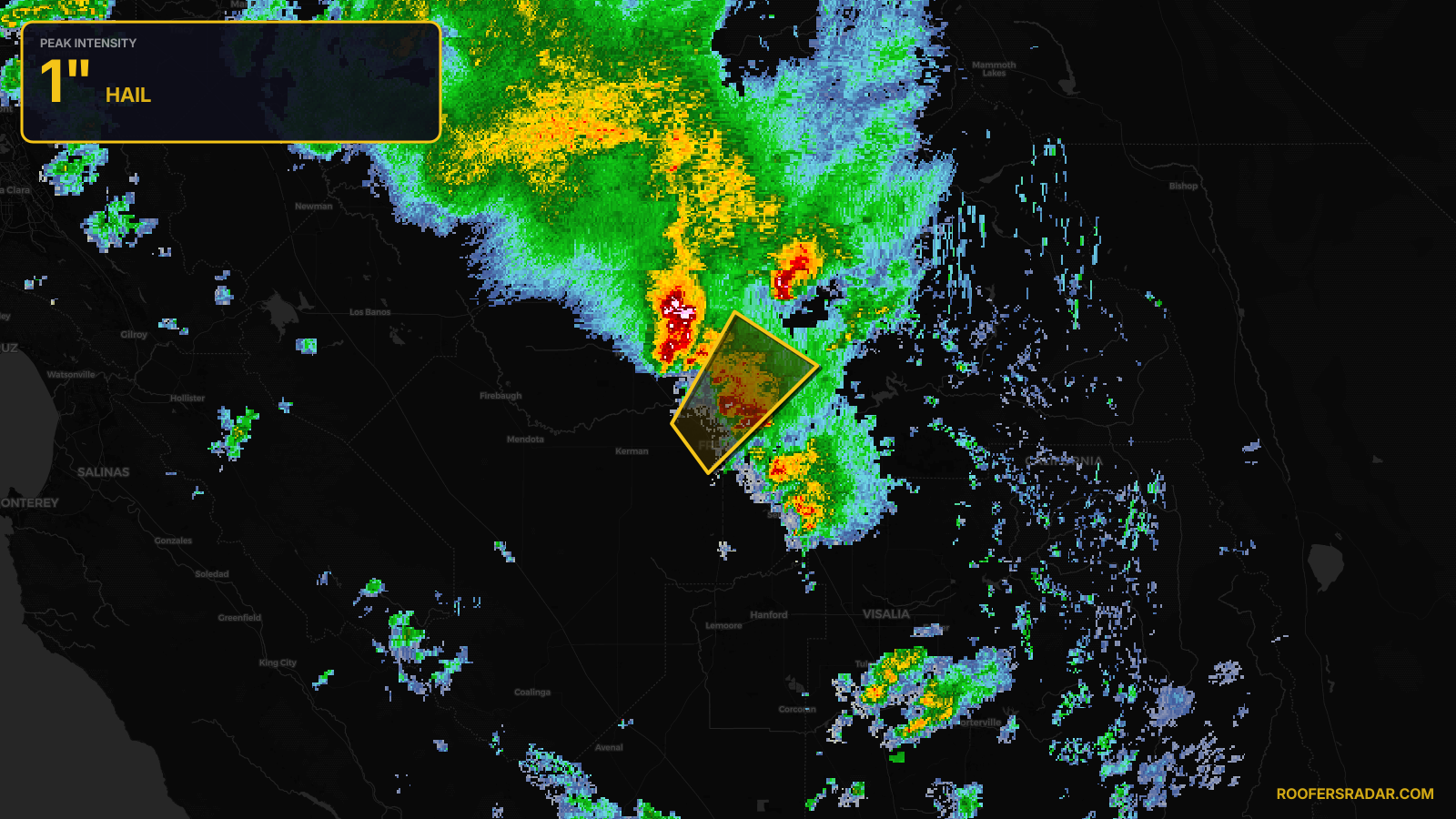
SevereThunderstorm★ Peak frameCaptured 11h ago
Severe Thunderstorm Warning issued April 21 at 4:30PM PDT until April 21 at 5:00PM PDT by NWS Hanford CA
California
Pull this lead list →Pre-loads ~112,432 residential properties into Step 2 for zone selection.
✓Counts inside actual storm footprint· 5.6% of NWS polygon hit
Storm Score
11
🏠 Residential
112,432
🏢 Commercial
5,859
Total properties
118,291
Estimated roofing opportunity🔴 Zones 1 & 2
💰 ~$54M
Conservative estimate at 10% claim rate, scoped to the damage zone (core + inner — ~40% of the warning polygon): 🏠 ~44,973 residential · 🏢 ~2,344 commercial. Industry-low claim values ($10K residential / $40K commercial).
NWS intensity
🧊 1"Hail💨 60MPHRadar indicatedIntensity Score 11/100
Issued
Apr 21, 11:30 PM UTC
Expires
Apr 22, 12:00 AM UTC
Event type
Severe Thunderstorm Warning
Affected areas (2)
Fresno, CAMadera, CA
ID: urn:oid:2.49.0.1.840.0.9ad55baf5effaf3181f1bf5d1afe585e47e11414.001.1Centroid: 36.824, -119.770