SevereThunderstorm★ Peak frameCaptured 2d ago
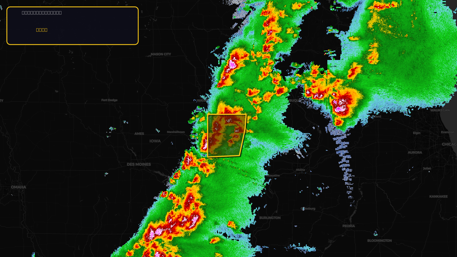
Severe Thunderstorm Warning issued April 17 at 3:29PM CDT until April 17 at 4:45PM CDT by NWS Quad Cities IA IL
Iowa
Pull this lead list →Pre-loads ~52,493 residential properties into Step 2 for zone selection.
✓Counts inside actual storm footprint· 15.8% of NWS polygon hit
Storm Score
13
🏠 Residential
52,493
🏢 Commercial
3,118
Total properties
55,611
Estimated roofing opportunity🔴 Zones 1 & 2
💰 ~$26M
Conservative estimate at 10% claim rate, scoped to the damage zone (core + inner — ~40% of the warning polygon): 🏠 ~20,997 residential · 🏢 ~1,247 commercial. Industry-low claim values ($10K residential / $40K commercial).
NWS intensity
🧊 1"Hail💨 60MPHRadar indicatedIntensity Score 13/100
Issued
Apr 17, 8:29 PM UTC
Expires
Apr 17, 9:45 PM UTC
Event type
Severe Thunderstorm Warning
Affected areas (5)
Benton, IABuchanan, IAIowa, IAJohnson, IALinn, IA
ID: urn:oid:2.49.0.1.840.0.95dfa9cb20ca8614c54663f7251323cdc1c36be2.001.1Centroid: 42.097, -91.899