SevereThunderstorm★ Peak frameCaptured 10h ago
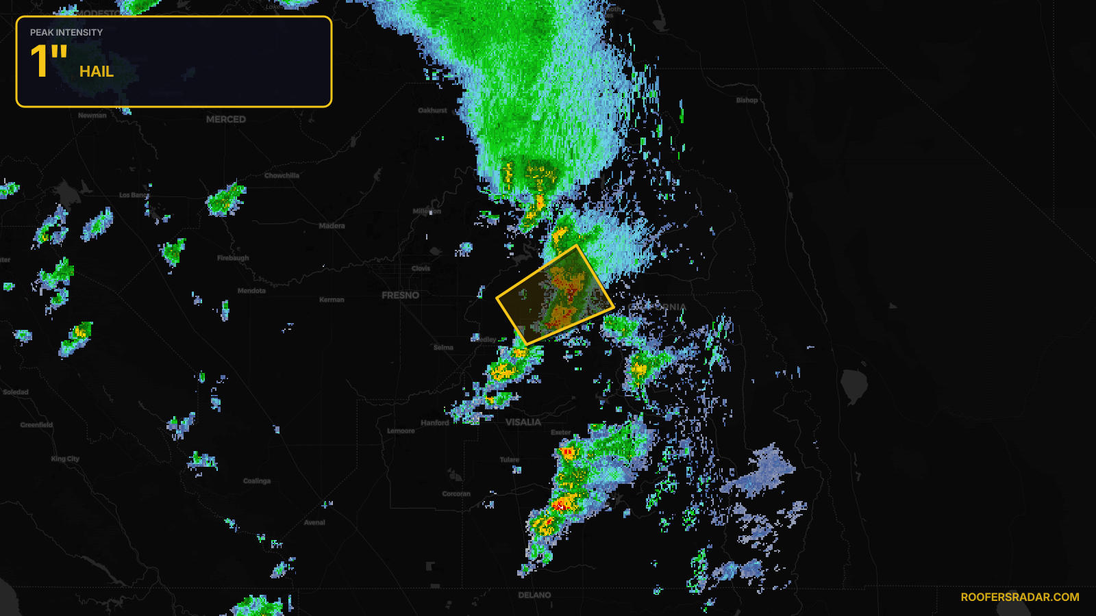
Severe Thunderstorm Warning issued April 21 at 5:39PM PDT until April 21 at 6:15PM PDT by NWS Hanford CA
California
Pull this lead list →Pre-loads ~997 residential properties into Step 2 for zone selection.
✓Counts inside actual storm footprint· 1.7% of NWS polygon hit
Storm Score
11
🏠 Residential
997
🏢 Commercial
13
Total properties
1,010
Estimated roofing opportunity🔴 Zones 1 & 2
💰 ~$419K
Conservative estimate at 10% claim rate, scoped to the damage zone (core + inner — ~40% of the warning polygon): 🏠 ~399 residential · 🏢 ~5 commercial. Industry-low claim values ($10K residential / $40K commercial).
NWS intensity
🧊 1"Hail💨 60MPHRadar indicatedIntensity Score 11/100
Issued
Apr 22, 12:39 AM UTC
Expires
Apr 22, 1:15 AM UTC
Event type
Severe Thunderstorm Warning
Affected areas (2)
Fresno, CATulare, CA
ID: urn:oid:2.49.0.1.840.0.90c925b2d5933b51dd950f1d192b592e34f3cc3c.001.1Centroid: 36.698, -119.194