WatchThunderstorm★ Peak frameCaptured 1d ago
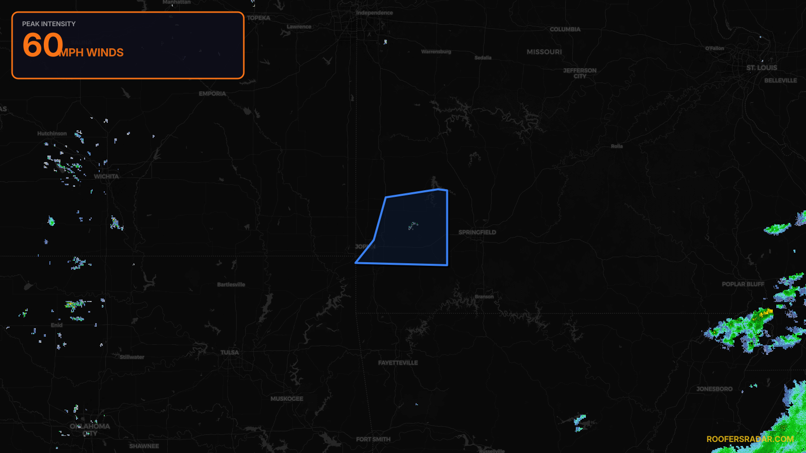
Severe Thunderstorm Warning issued April 17 at 9:43PM CDT until April 17 at 10:45PM CDT by NWS Springfield MO
Missouri
Pull this lead list →Pre-loads ~41,942 residential properties into Step 2 for zone selection.
⚠Counts inside NWS warning area· storm hadn’t entered polygon at capture
Storm Score
9
🏠 Residential
41,942
🏢 Commercial
1,495
Total properties
43,437
NWS intensity
💨 60MPHIntensity Score 9/100
Issued
Apr 18, 2:43 AM UTC
Expires
Apr 18, 3:45 AM UTC
Event type
Severe Thunderstorm Warning
Affected areas (5)
Barton, MODade, MOJasper, MOLawrence, MONewton, MO
ID: urn:oid:2.49.0.1.840.0.90a4d068d0270fd980abd402e752fa5feb25925e.001.1Centroid: 37.257, -94.101