SevereThunderstorm★ Peak frameCaptured 12h ago
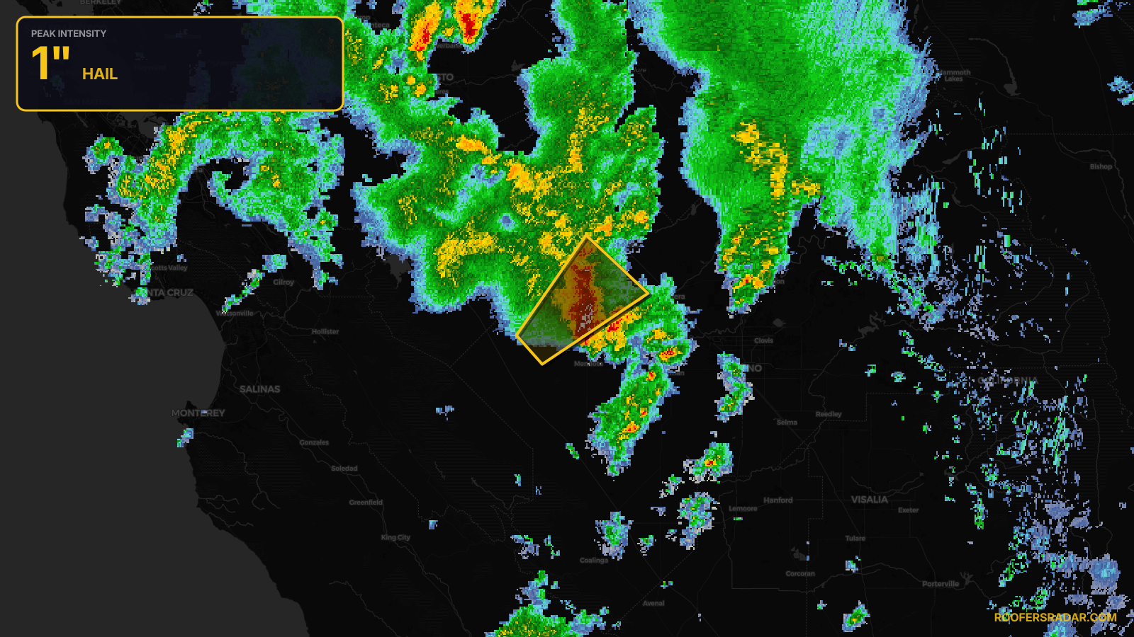
Severe Thunderstorm Warning issued April 21 at 3:19PM PDT until April 21 at 3:45PM PDT by NWS Hanford CA
California
Pull this lead list →Pre-loads ~1,927 residential properties into Step 2 for zone selection.
✓Counts inside actual storm footprint· 8.3% of NWS polygon hit
Storm Score
11
🏠 Residential
1,927
🏢 Commercial
152
Total properties
2,079
Estimated roofing opportunity🔴 Zones 1 & 2
💰 ~$1.0M
Conservative estimate at 10% claim rate, scoped to the damage zone (core + inner — ~40% of the warning polygon): 🏠 ~771 residential · 🏢 ~61 commercial. Industry-low claim values ($10K residential / $40K commercial).
NWS intensity
🧊 1"Hail💨 60MPHRadar indicatedIntensity Score 11/100
Issued
Apr 21, 10:19 PM UTC
Expires
Apr 21, 10:45 PM UTC
Event type
Severe Thunderstorm Warning
Affected areas (3)
Fresno, CAMadera, CAMerced, CA
ID: urn:oid:2.49.0.1.840.0.8ee10324d6fd58757dfdf8aa305351c871ff505b.001.1Centroid: 36.892, -120.464