SevereThunderstorm★ Peak frameCaptured 2d ago
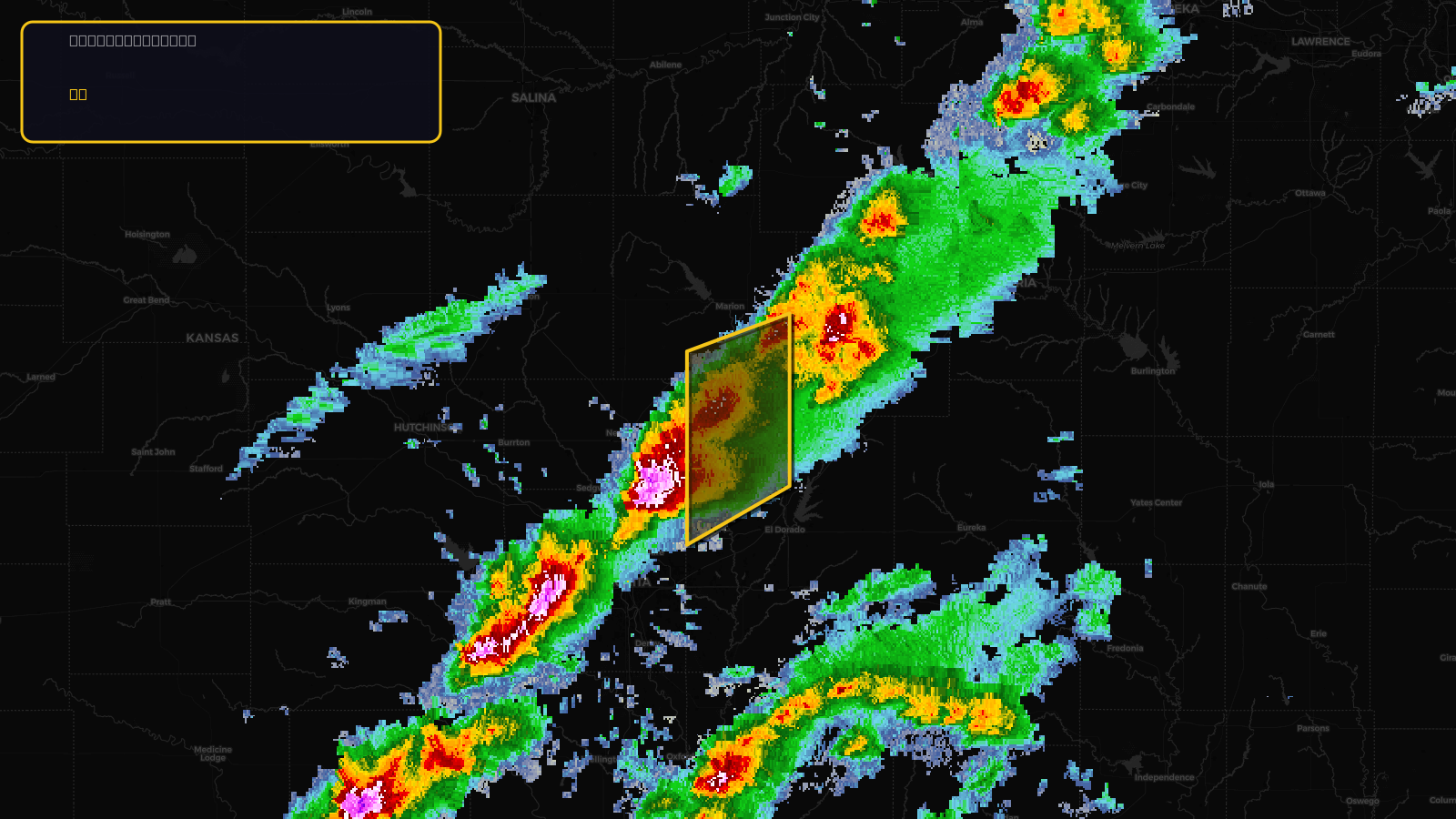
Severe Thunderstorm Warning issued April 17 at 2:09PM CDT until April 17 at 3:00PM CDT by NWS Wichita KS
Kansas
Pull this lead list →Pre-loads ~2,676 residential properties into Step 2 for zone selection.
Storm Score
13
🏠 Residential
2,676
🏢 Commercial
242
Total properties
2,918
Estimated roofing opportunity🔴 Zones 1 & 2
💰 ~$1.5M
Conservative estimate at 10% claim rate, scoped to the damage zone (core + inner — ~40% of the warning polygon): 🏠 ~1,070 residential · 🏢 ~97 commercial. Industry-low claim values ($10K residential / $40K commercial).
NWS intensity
🧊 1"Hail💨 60MPHRadar indicatedIntensity Score 13/100
Issued
Apr 17, 7:09 PM UTC
Expires
Apr 17, 8:00 PM UTC
Event type
Severe Thunderstorm Warning
Affected areas (2)
Butler, KSMarion, KS
ID: urn:oid:2.49.0.1.840.0.8e5e5c4dd568e7375d44eac1a8c6d24464019018.001.1Centroid: 38.102, -97.026